© Gary Salisbury
Isle of Man
Latitude: 54° 6' 16'' N
Longitude: 4° 36' 51'' W
14 January 2011 1442 (Local Time)
Camera direction: towards E
Image P/S code: P.10.6
Image I.D.: 4767
CL = 9, CM = 0, CH = 0
-
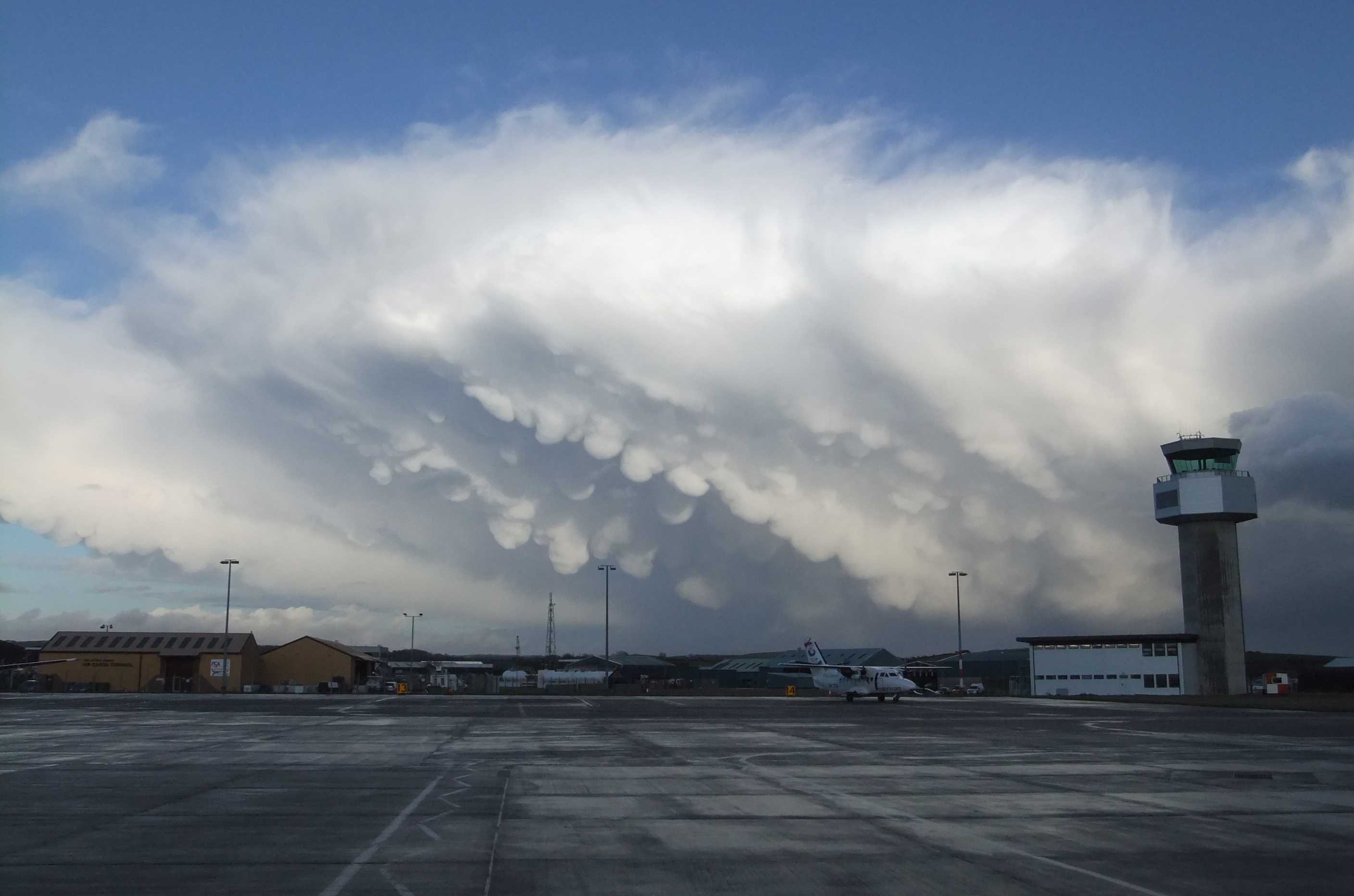
Cumulonimbus capillatus incus mamma
A prominent feature of this wintertime Cumulonimbus capillatus incus is the hanging protuberances akin to udders on the under surface of the cloud. This is the supplementary feature mamma.
Links in the image description will highlight features on the image. Mouse over the features for more detail.
© Gary SalisburyIsle of ManLatitude: 54° 6' 16'' NLongitude: 4° 36' 51'' W14 January 2011 1442 (Local Time)Camera direction: towards ECL = 9, CM = 0, CH = 0Image P/S code: P.10.6Image I.D.: 4767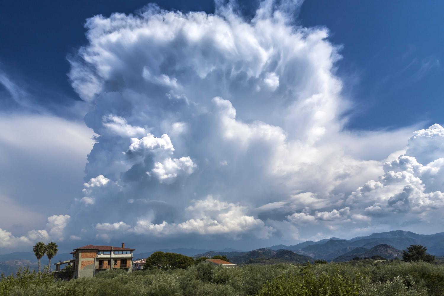
Cumulonimbus capillatus incus with mamma
Cumulonimbus are heavy, dense clouds of considerable or great vertical extent, in the form of a mountain or huge towers. At least part of the upper portion is usually smooth, fibrous or striated and is nearly always flattened. The cloud base is often very dark. In this image, the upper portions have a cirriform appearance, identifying the species as capillatus, and an anvil is in the early stages of development, which is the supplementary feature incus. Also visible are some udder-like protuberances hanging from the under surface of the cloud which are supplementary feature mamma and are caused by powerful downdraughts. Other developing cells can be seen in the image, including Cumulus mediocris and Cumulus congestus. In the background on the left of the image, we see the spread of a developed anvil associated with a different Cumulonimbus cell.
Links in the image description will highlight features on the image. Mouse over the features for more detail.
© Fabrizio MicalizziPace del Mela, Messina, ItalyLatitude: 38° 11' 27'' NLongitude: 15° 18' 34'' E08 August 2015 1430 (Local Time)Camera direction: towards SECL = 9, CM = 0, CH = 0Image P/S code: S.10.6 1Image I.D.: 4736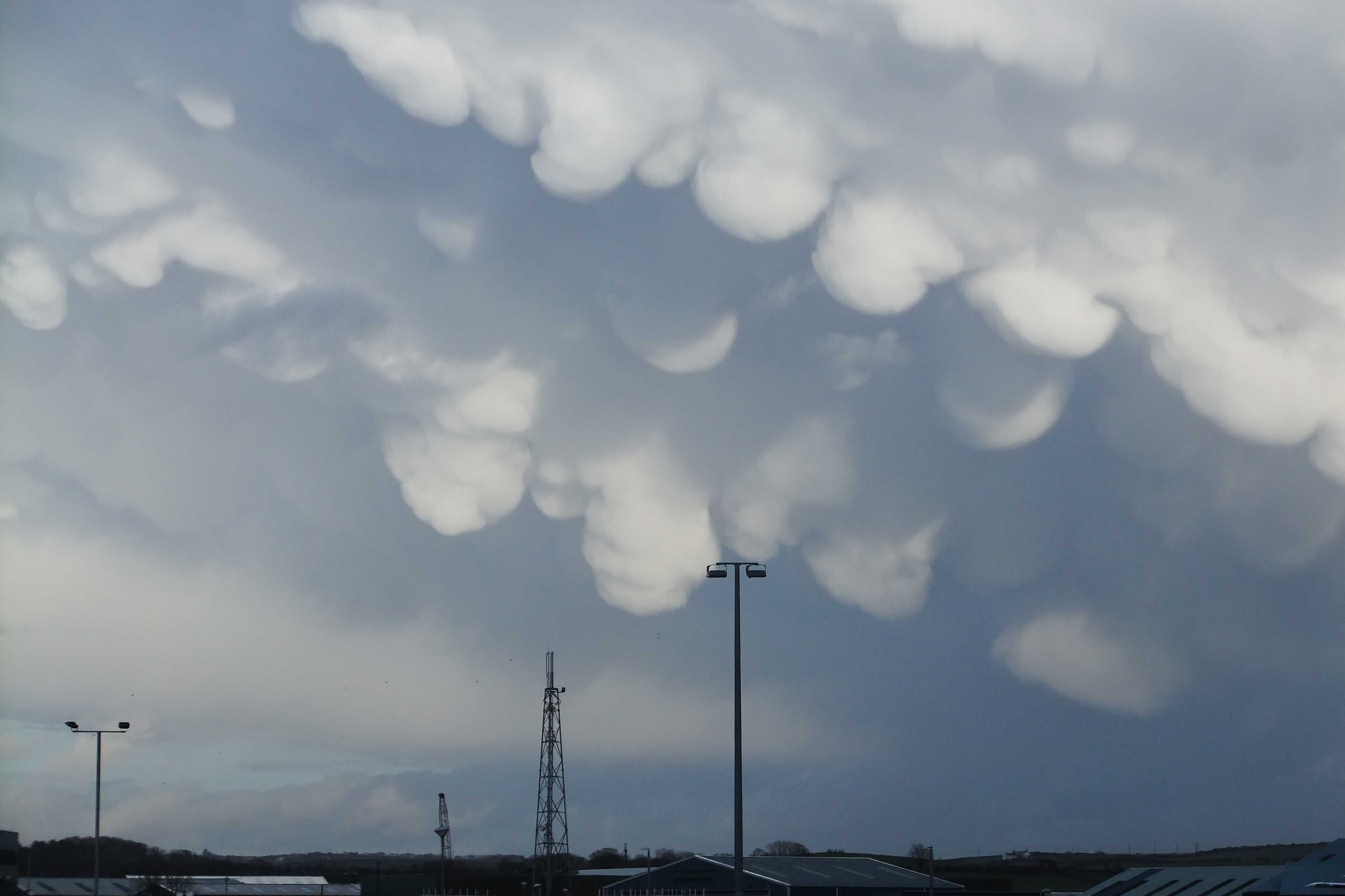
Mamma
This close-up view shows mamma on the underside of a Cumulonimbus capillatus incus. This supplementary feature takes the form of hanging protuberances that are like udders.
Links in the image description will highlight features on the image. Mouse over the features for more detail.
© Gary SalisburyIsle of ManLatitude: 54° 5' 53'' NLongitude: 4° 37' 31'' W14 January 2011 1442 (Local Time)Camera direction: towards ECL = 9, CM = /, CH = /Image P/S code: S.10.6 2Image I.D.: 4768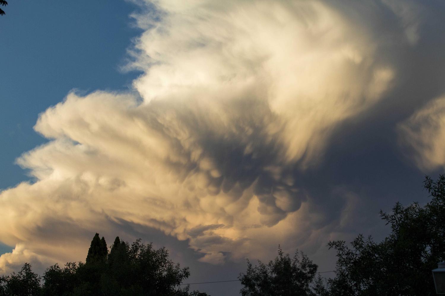
Cumulonimbus capillatus with mamma
Cumulonimbus are heavy, dense clouds of considerable or great vertical extent in the form of a mountain or huge towers. At least part of the upper portion is usually smooth, fibrous or striated and is nearly always flattened. The cloud base is often very dark. In this image of several cells, the upper portions have a cirriform appearance, identifying the species as capillatus. Anvils are developing, which are the supplementary feature incus. Also visible are udder-like protuberances or globules hanging from the under surface of the cloud at 4 and 5; these are the supplementary feature mamma, caused by powerful downdraughts within the cumulonimbus.
Links in the image description will highlight features on the image. Mouse over the features for more detail.
© Anton van NiekerkWitpoort, Midrand, South AfricaLatitude: 25° 59' 23'' SLongitude: 28° 4' 4'' E31 December 2011 1854 (Local Time)Camera direction: towards NECL = 9, CM = 0, CH = 0Image P/S code: S.10.6 3Image I.D.: 5122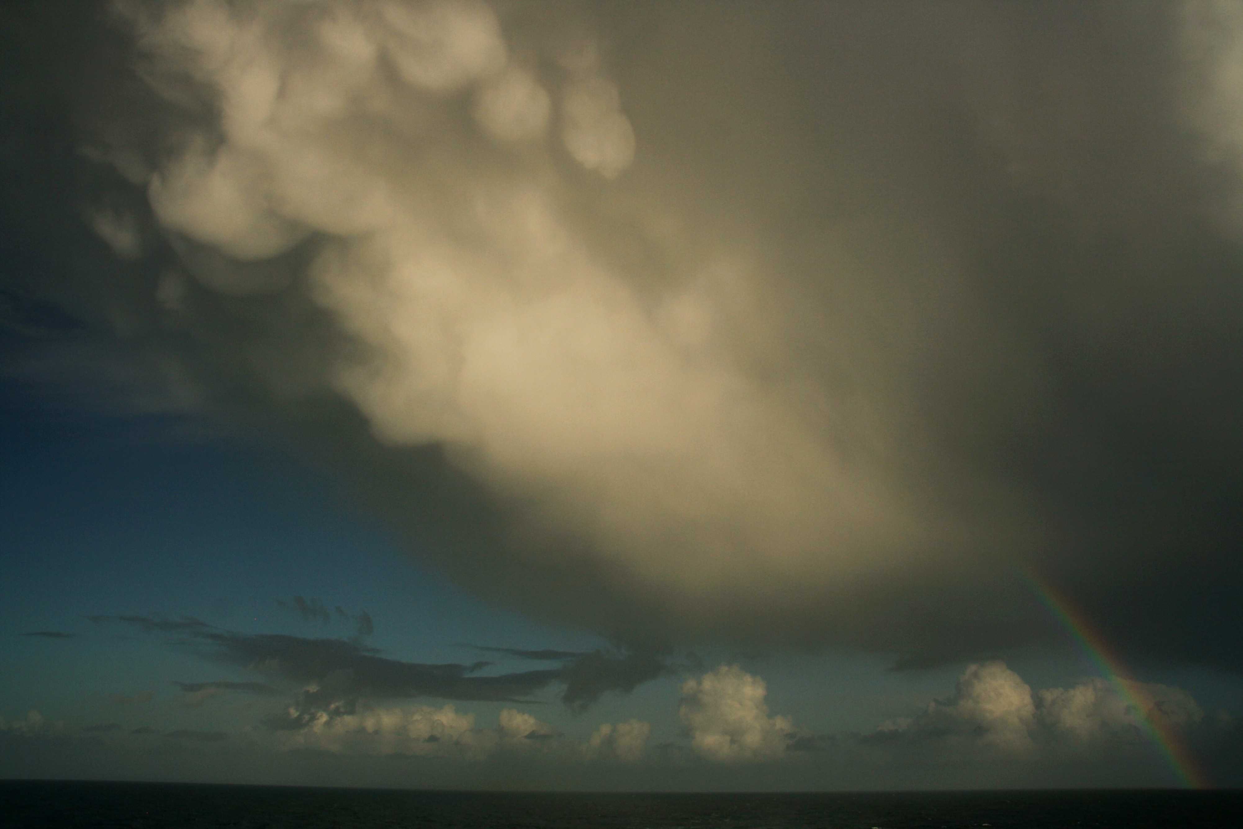
Dissipating Cumulonimbus capillatus praecipitatio incus mamma with rainbow
Here, Cumulonimbus is in a state of decay over the Bay of Biscay. Moderately heavy rain is still reaching the surface, but the cloud has become almost entirely glaciated, with little cumuliform development remaining. An area of mamma is visible near the north-western edge of the anvil, illuminated by the Sun. A rainbow is visible near the bottom right-hand corner of the field of view. Isolated patches of Cumulus fractus are present under the anvil, near the centre and centre-left of the photo. Scattered Cumulus mediocris and Cumulus congestus are visible in the distance and isolated patches of Altocumulus are visible in the middle distance, left of the centre.
A polar maritime air mass with north-westerly winds was affecting the Bay of Biscay. An occlusion was located over western France and was clearing eastwards away from the Bay of Biscay. The polar maritime air mass was characterized by instability due to sea surface temperatures and had scattered showers.
Links in the image description will highlight features on the image. Mouse over the features for more detail.
© Matthew ClarkBay of BiscayLatitude: 47° 25' 15'' NLongitude: 5° 11' 8'' W17 November 2010 1420 (Local Time)Camera direction: towards NECL = 9, CM = 3, CH = 0Image P/S code: S.10.6 4Image I.D.: 5517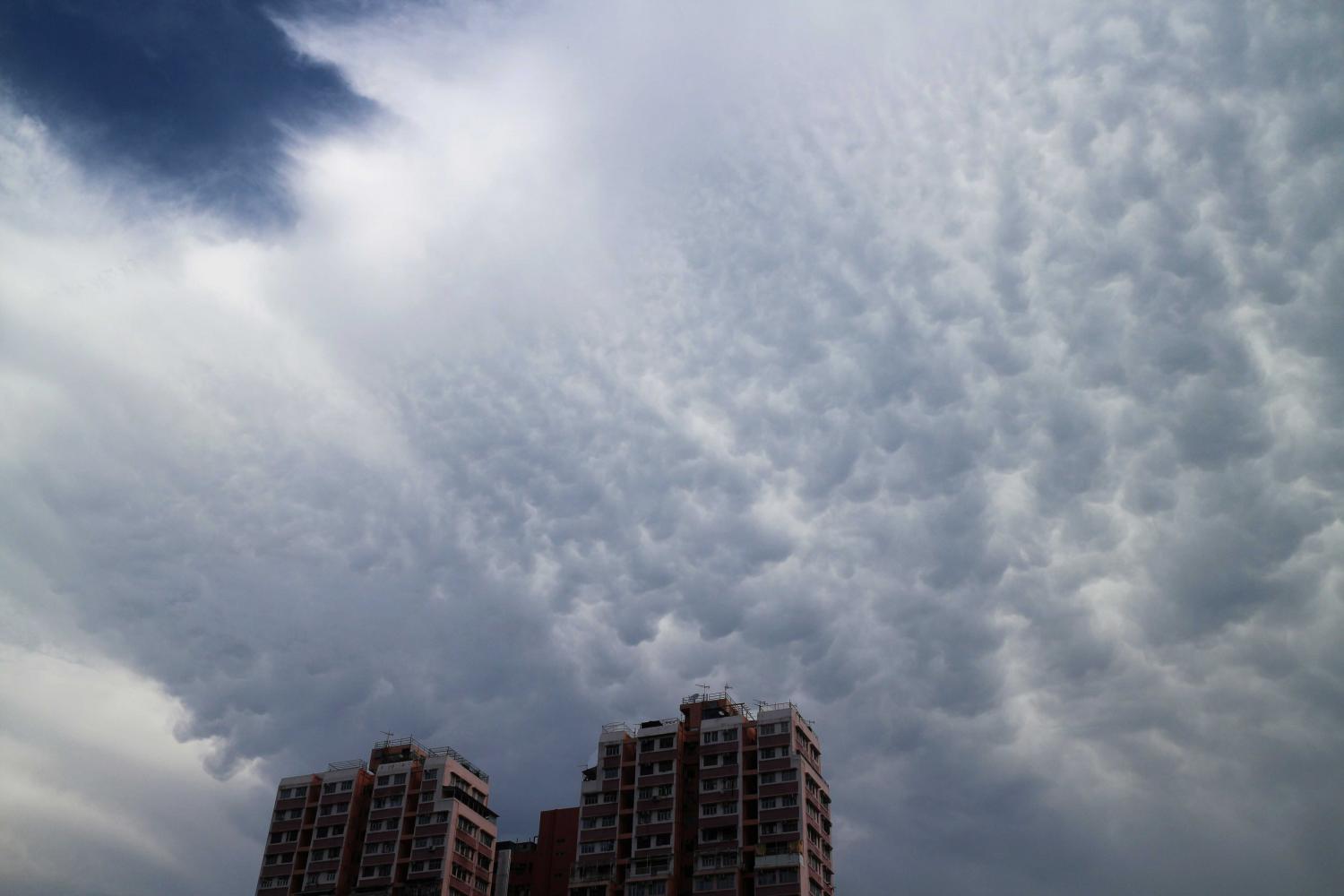
Cumulonimbus capillatus incus mamma
The dominant feature in this image is the hanging protuberances, like udders, on the under surface of the anvil of a Cumulonimbus capillatus incus. This is the supplementary feature mamma.
Links in the image description will highlight features on the image. Mouse over the features for more detail.
© Man Kam HooYuen Long, Hong Kong, ChinaLatitude: 22° 26' 40'' NLongitude: 114° 1' 20'' E08 June 2016 0929 (Local Time)CL = 9, CM = /, CH = /Image P/S code: S.10.6Image I.D.: 6062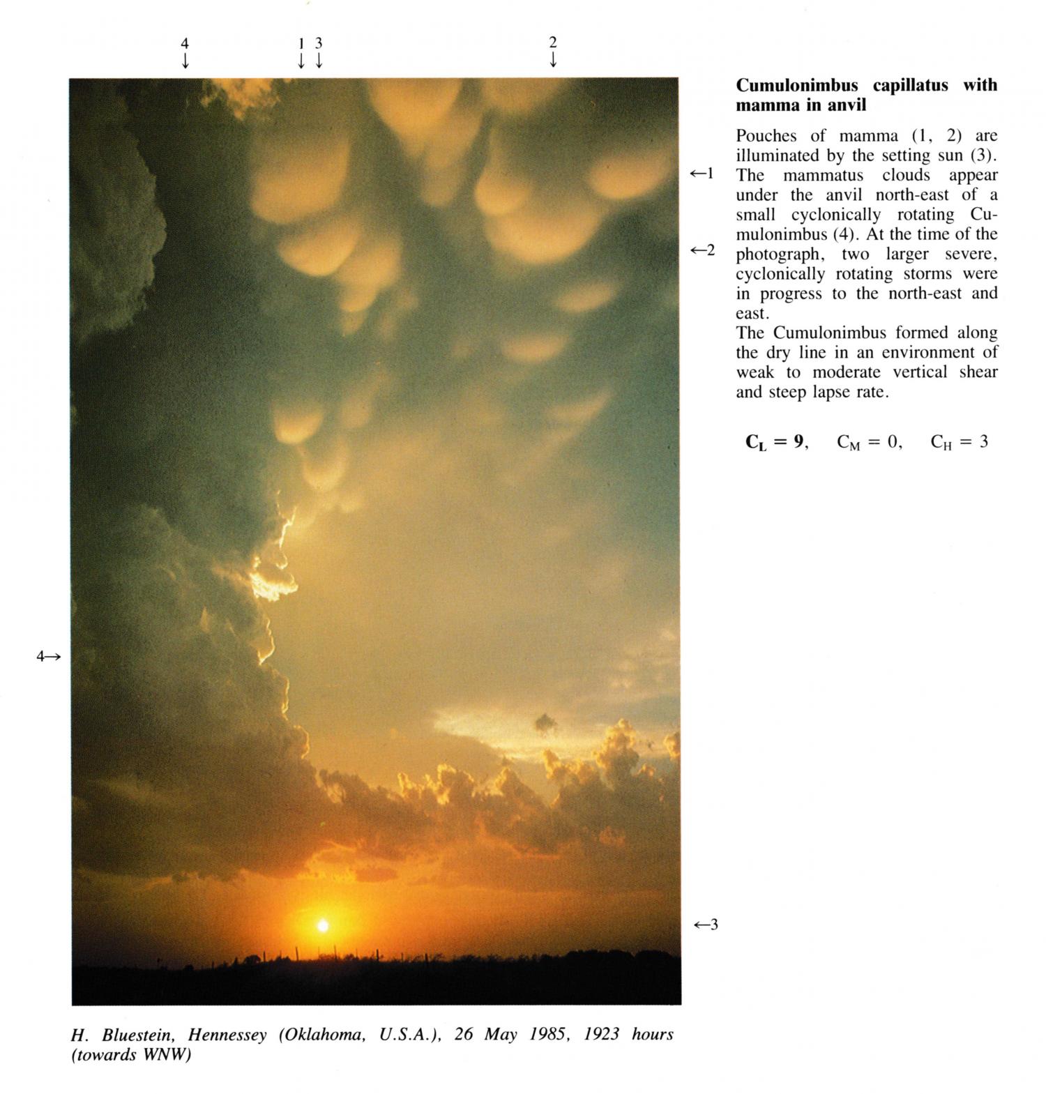
Cumulonimbus capillatus with mamma in anvil
Pouches of mamma at 1, 2 are illuminated by the setting sun. The mammatus clouds appear under the anvil north-east of a small cyclonically rotating Cumulonimbus. At the time of the photograph, two larger severe, cyclonically rotating storms were in progress to the north-east and east. The Cumulonimbus formed along the dry line in an environment of weak to moderate vertical shear and steep lapse rate.
Links in the image description will highlight features on the image. Mouse over the features for more detail.
© H.B. BluesteinHennessey, Oklahoma, United States of AmericaLatitude: 36° 14' 55'' NLongitude: 97° 31' 32'' W26 May 1985 1923 (Local Time)Camera direction: towards WNWCL = 9, CM = 0, CH = 3