© Mustafa Hayri Ayvaz
Istanbul, İstanbul, Turkey
Latitude: 40° 52' 50'' N
Longitude: 29° 12' 39'' E
04 May 2016 1659 (Local Time)
Camera direction: towards SE
Image P/S code: P.10.5
Image I.D.: 4775
CL = 9, CM = 6, CH = 3
-
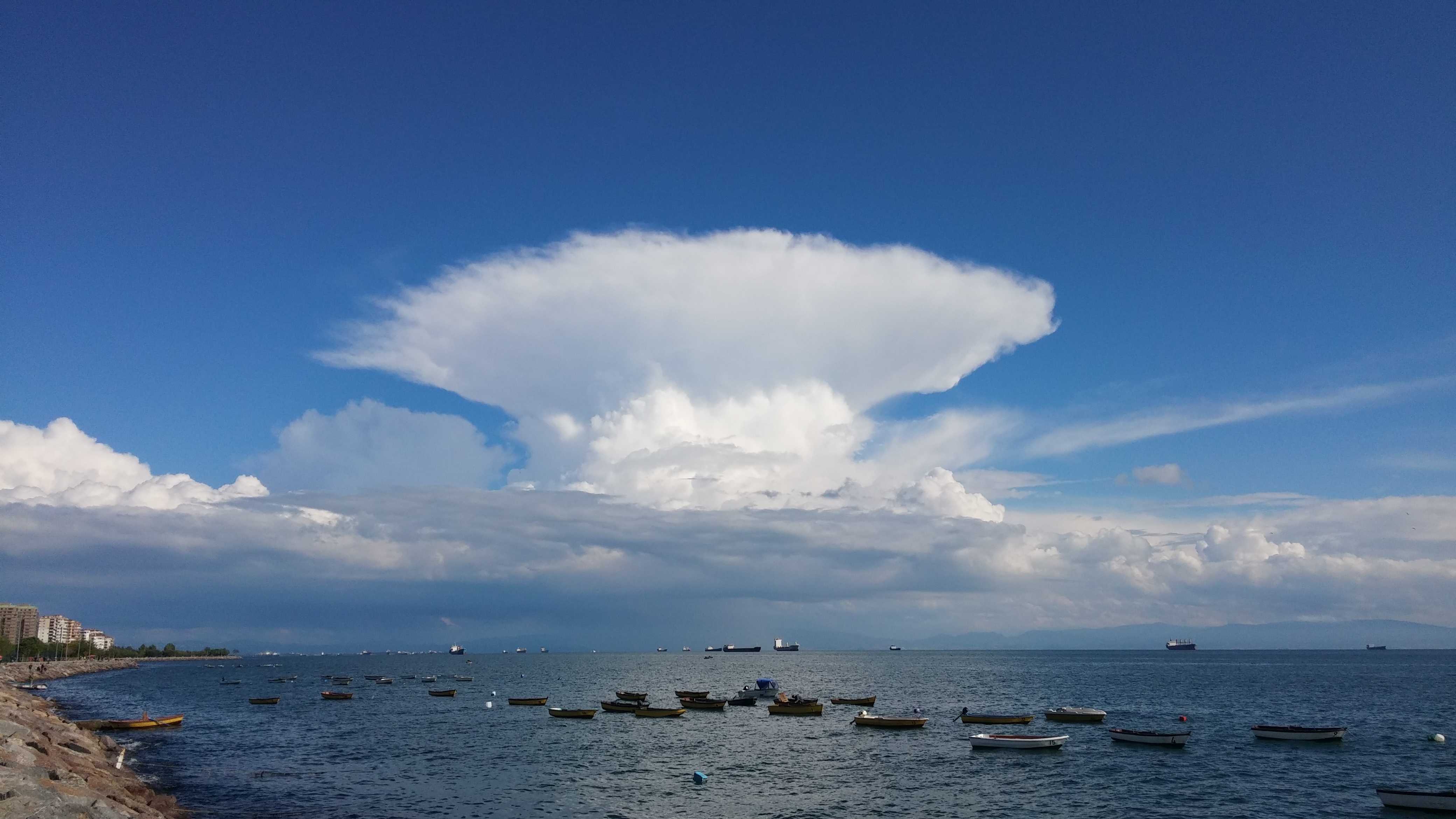
Cumulonimbus capillatus praecipitatio incus mamma praecipitatio
This photo shows a Cumulonimbus capillatus cell with a well-developed symmetrical anvil (supplementary feature incus). The under surface of the incus shows mamma forming. To the left and behind is another, slightly more recent cell. Precipitation is falling from both of these cells at 1 and 2.
On the left edge is another cumuliform cell identified as Cumulus congestus. This cell is just about to transition to Cumulonimbus calvus. More Cumulus in different stages of development can be seen in many areas.
Cumulonimbus are described as "cloud factories" that may produce patches of Cirrrus spissatus, Altocumulus, Altostratus or Stratocumulus.
Links in the image description will highlight features on the image. Mouse over the features for more detail.
© Mustafa Hayri AyvazIstanbul, İstanbul, TurkeyLatitude: 40° 52' 50'' NLongitude: 29° 12' 39'' E04 May 2016 1659 (Local Time)Camera direction: towards SECL = 9, CM = 6, CH = 3Image P/S code: P.10.5Image I.D.: 4775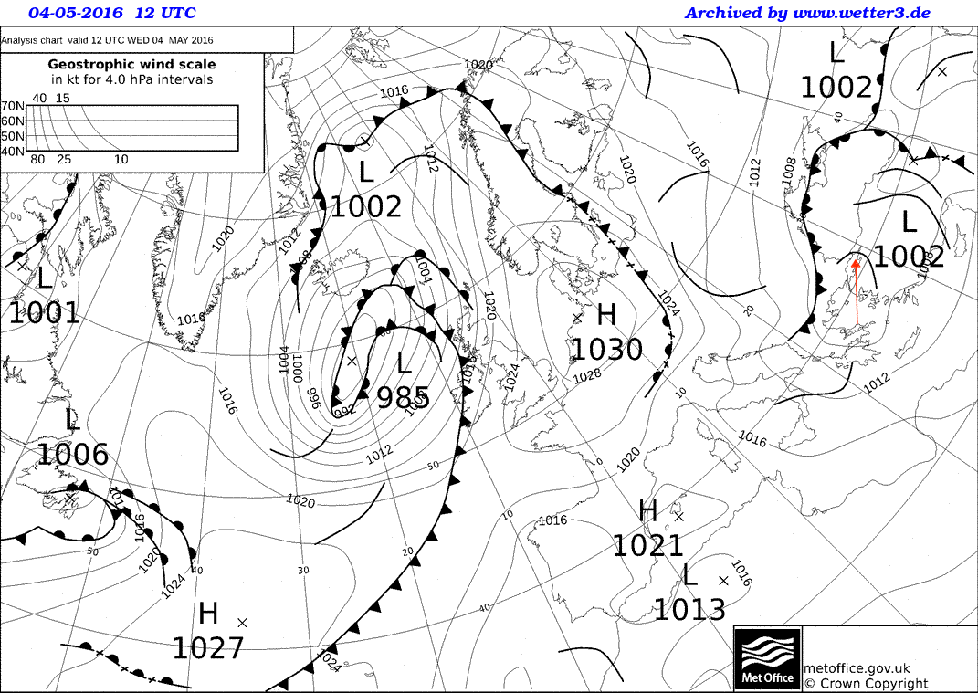
This image shows unstable conditions as a trough passes through the area. An occluded front is approaching from the north-west.
© Crown Copyright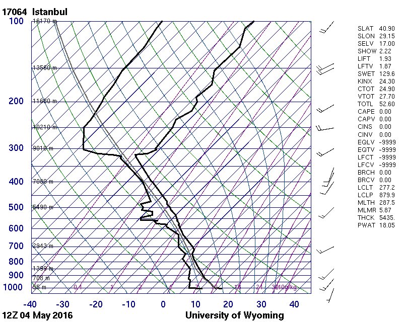
This sounding shows instability and high moisture content in the low levels. The relatively low tropopause at around 315 hPa limited the vertical extent of the Cumulonimbus and 20-kt winds provided minimal shear for downwind spreading of the Cumulonimbus top.
© University of Wyoming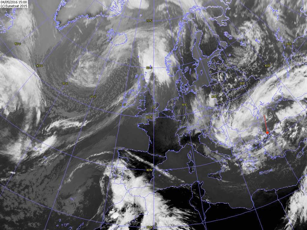
The brilliant white small cloud circles are Cumulonimbus cells developing in the vicinity.
© EUMETSAT, 2015
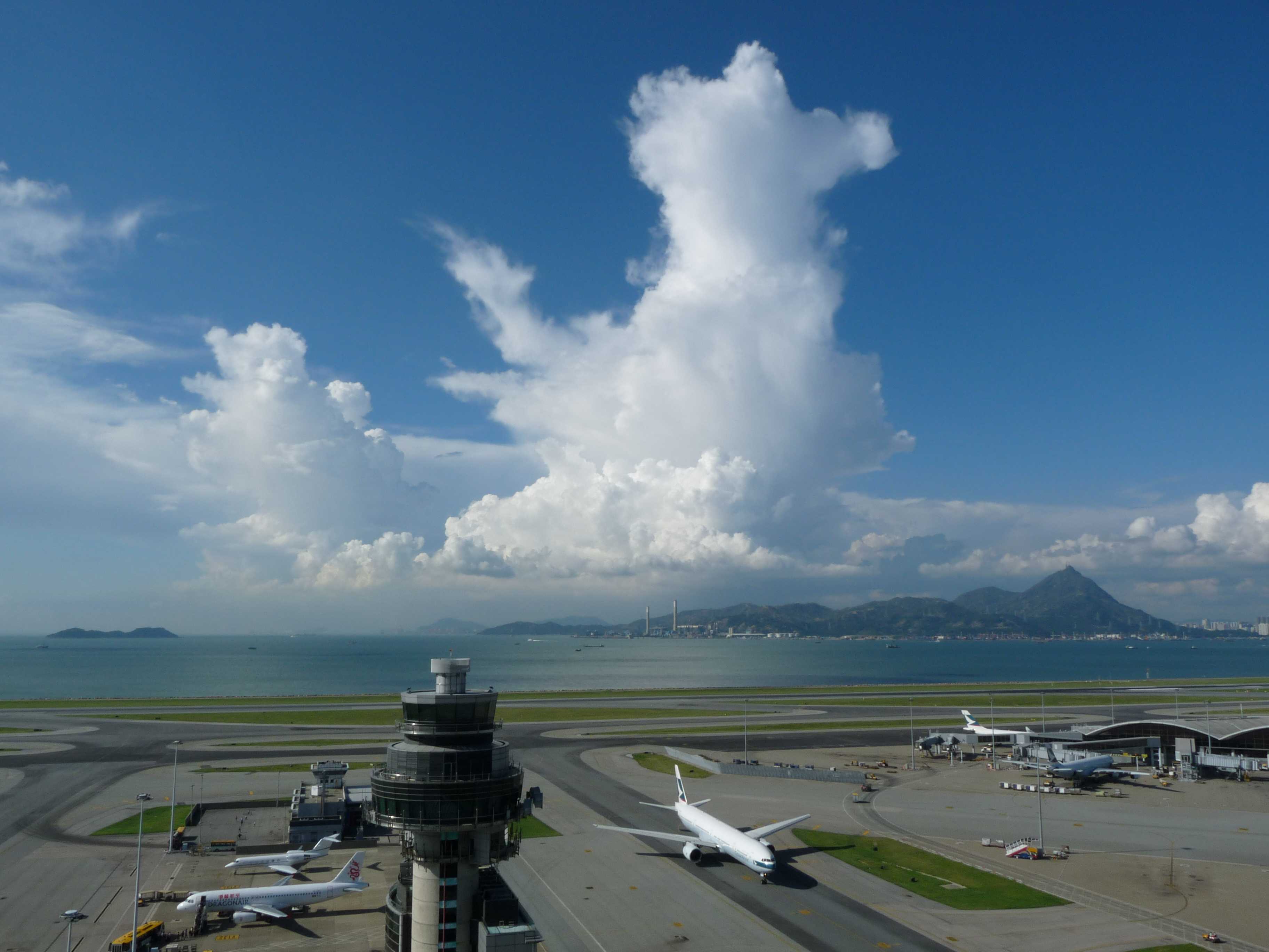
Cumulonimbus capillatus incus praecipitatio and Cirrus fibratus cumulonimbogenitus
This very convective scene shows the genus Cumulonimbus. The vigorous and closer cell on the right shows the typical sproutings of cumuliform clouds and is in the form of a tower. The top is starting to lose its sharp outline as it transitions to Cumulonimbus calvus. A little to the left, the more distant and mature cloud is Cumulonimbus capillatus; the upper portion has cirriform parts with a fibrous structure and it is developing an anvil, which is the supplementary feature incus. Other developing cells can be seen on the left of the photograph. Precipitation, the supplementary feature praecipitatio, visible at 4 and 5, usually occurs with Cumulonimbus cloud and can be seen on the horizon. Towards the top is a patch of Cirrus fibratus cumulonimbogenitus, having developed from a Cumulonimbus cloud top, and in the foreground, various unorganized scraps of cloud with ragged outlines are Cumulus fractus.
Links in the image description will highlight features on the image. Mouse over the features for more detail.
© Tsz Cheung LeeTsim Sha Tsui, Hong Kong, ChinaLatitude: 22° 17' 56'' NLongitude: 114° 10' 20'' E14 June 2015 0925 (Local Time)Camera direction: towards ECL = 9, CM = 0, CH = 1Image P/S code: S.10.5 11Image I.D.: 4747Cumulonimbus capillatus incus and Cirrus cumulonimbogenitus
Narrow, high Cumulonimbus capillatus incus towers are visible at 1 and 2. The upper parts of both towers have smooth or fibrous parts and are starting to spread out in a rather haphazard manner, as seen at 5 and 6.
In the background is a dense, thick and extensive patch of Cirrus spissatus, which is the remains of the upper part of an earlier Cumulonimbus.
A line of Cumulus congestus and mediocris is in the foreground.
Links in the image description will highlight features on the image. Mouse over the features for more detail.
© Wing Choi HoChek Lap Kok, Hong Kong, ChinaLatitude: 22° 18' 56'' NLongitude: 113° 55' 21'' E13 September 2010 1559 (Local Time)Camera direction: towards NCL = 9, CM = 0, CH = 3Image P/S code: S.10.5 7Image I.D.: 4757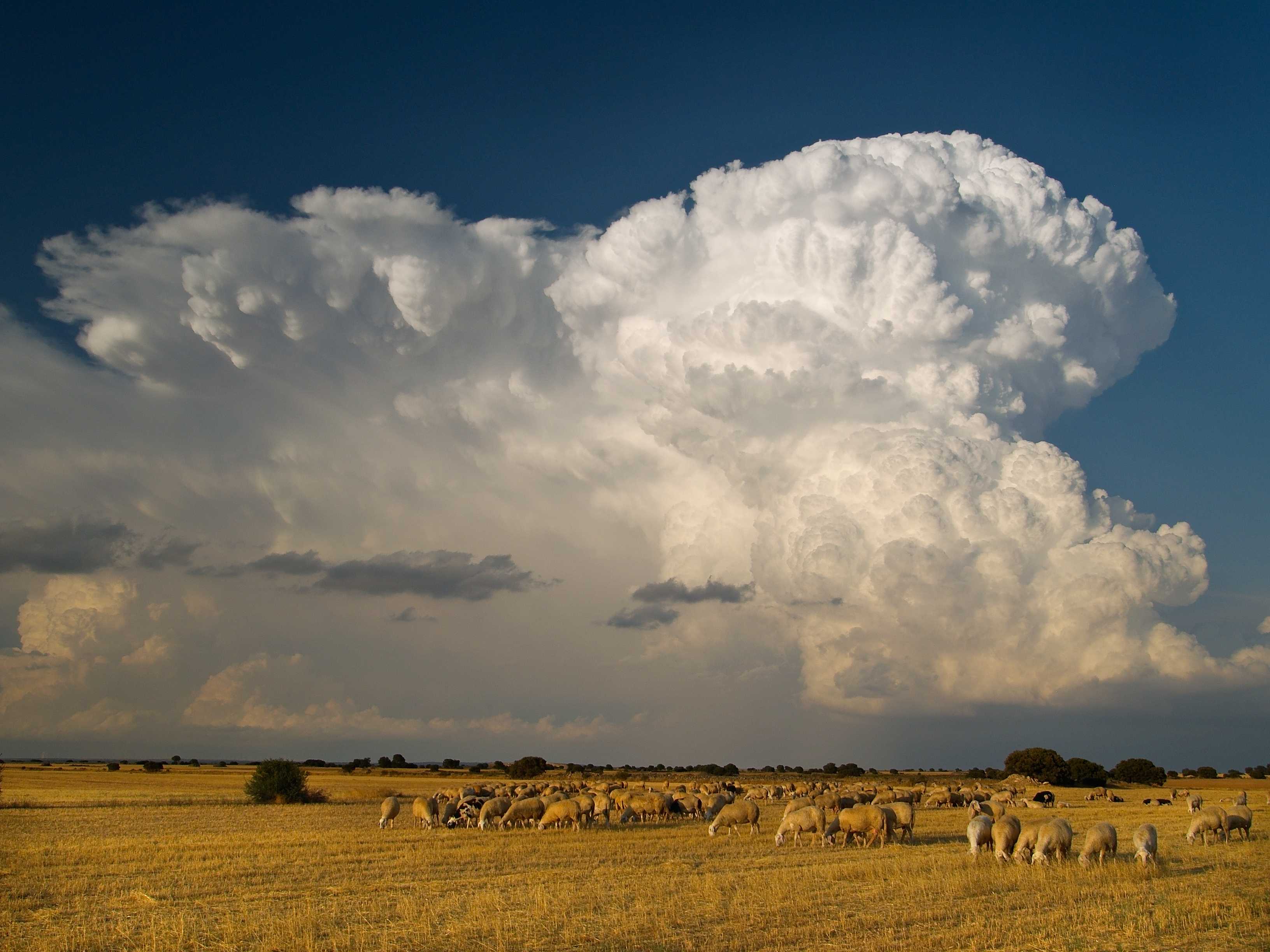
Cumulonimbus capillatus incus with mamma
Cumulonimbus is a heavy and dense cloud of considerable or strong vertical extent, in the form of a mountain or huge towers. At least part of its upper portion is usually smooth, fibrous or striated, and is nearly always flattened. In this powerful image, the Cumulonimbus capillatus was moving west to east (left to right) and gives a cross-sectional view of the squall line in which it developed. It has a fibrous, flattened top on the left, which has become anvil-shaped (supplementary feature incus) with well-developed mamma on the underside (another supplementary feature). On the left is an excellent example of incus as a cumuliform anvil. The supplementary praecipitatio is visible and it should be noted that this squall line produced severe hail. We also see the cauliflower-like appearance of a developing cell (or cells) of Cumulus congestus, while the darker, flattened scraps of cloud nearer the camera are likely to be Stratocumulus cumulonimbogenesis.
Links in the image description will highlight features on the image. Mouse over the features for more detail.
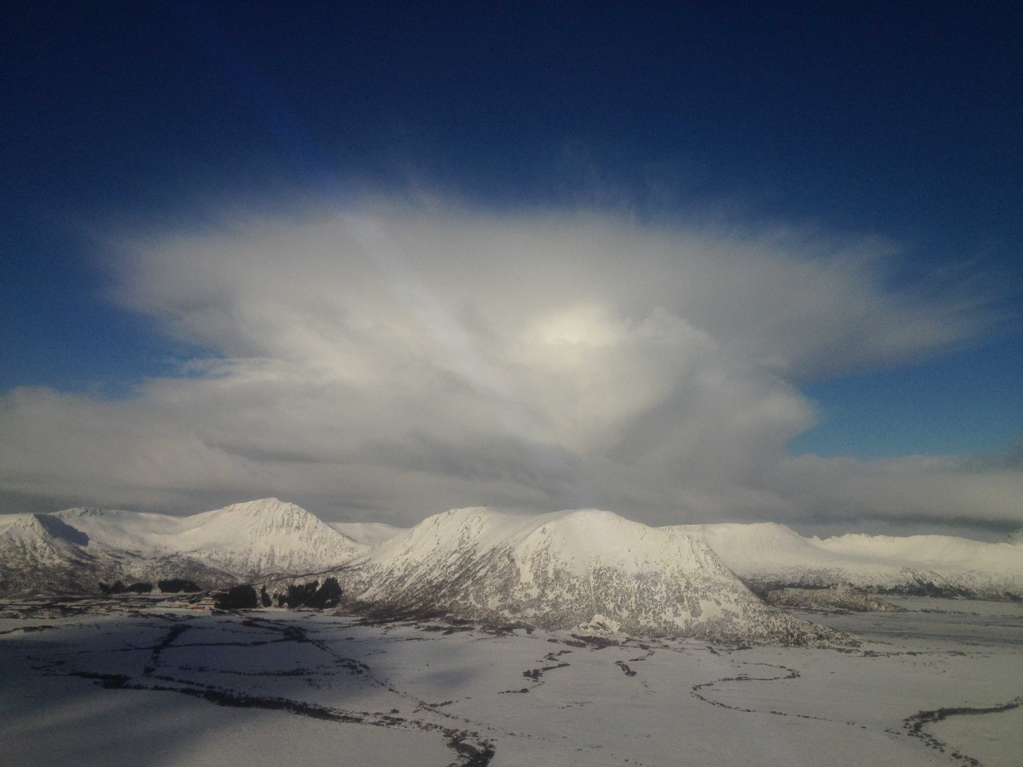
© Antonio J. GalindoMinaya, Albacete, SpainLatitude: 39° 17' 0'' NLongitude: 2° 20' 6'' W09 August 2009 2014 (Local Time)Camera direction: towards NECL = 9, CM = 0, CH = 0Image P/S code: S.10.5 9Image I.D.: 4761Cumulonimbus capillatus incus
This photograph showing a Cumulonimbus was taken from an aircraft at about 1 500 m (5 000 ft). The upper portion of the cloud is cirriform in nature with a fibrous structure, identifying the species as capillatus. The cloud top is spreading out in the form of an anvil at 2, which is the supplementary feature incus. Within the main cloud, the whiter part is a developing cell.
This is a typical winter season Cumulonimbus of polar regions, as it is compact both laterally and vertically. A typical cloud base is 450 to 600 m (1 500 to 2 000 ft), with an anvil top of around 3 000 m (10 000 ft), which is much lower than in the mid-latitudes and the tropics, where Cumulonimbus may reach from 9 000 to 15 000 m (30 000 to 50 000 ft). The precipitation in these winter season clouds consists of snow, snow pellets and small hail.
Links in the image description will highlight features on the image. Mouse over the features for more detail.
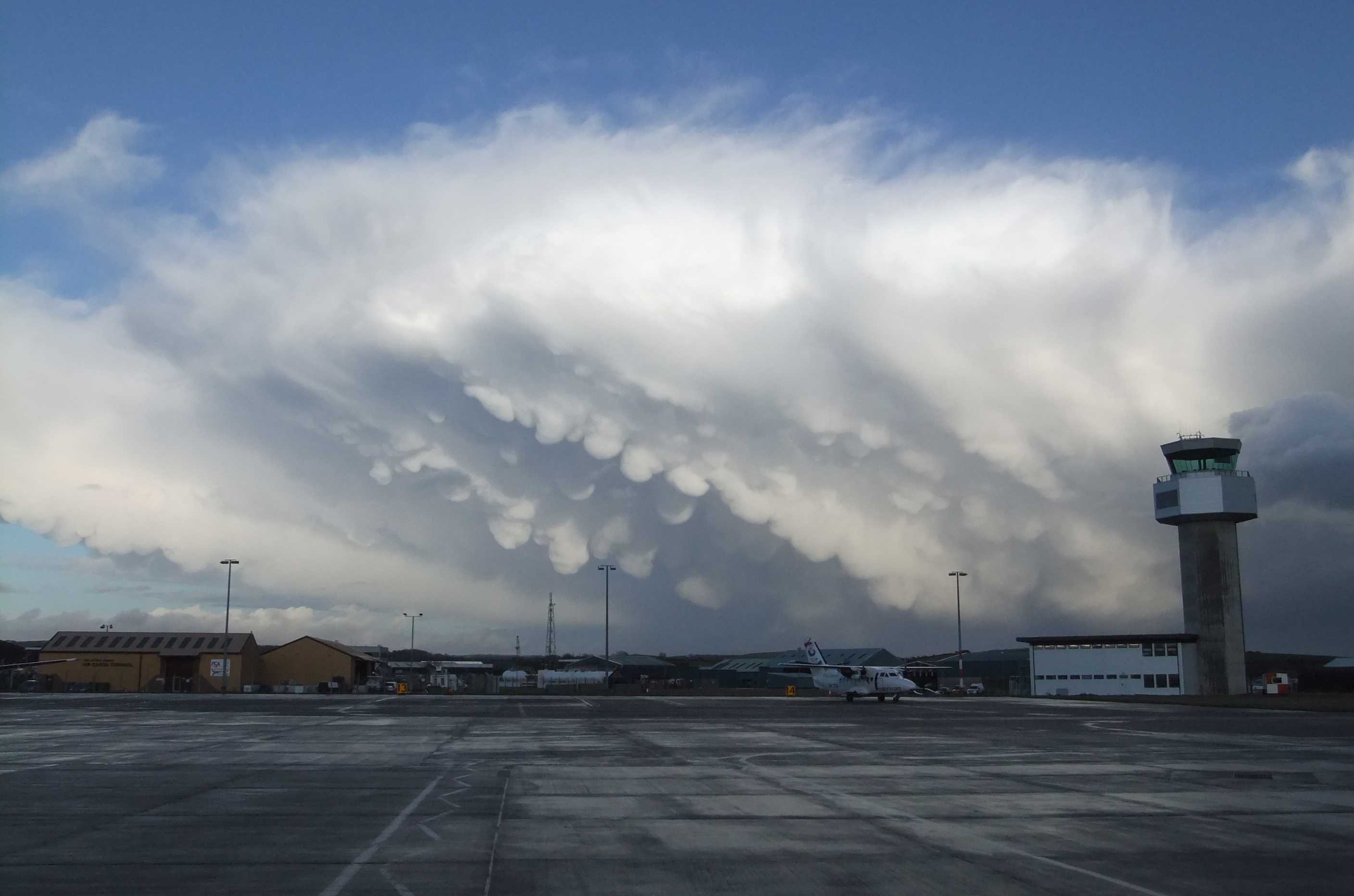
© Henrik WideroeDverberg, NorwayLatitude: 69° 7' 14'' NLongitude: 15° 58' 20'' E04 March 2015 0959 (Local Time)Camera direction: towards NWCL = 9, CM = 0, CH = 0Image P/S code: S.10.5 5Image I.D.: 4763Cumulonimbus capillatus incus mamma
A prominent feature of this wintertime Cumulonimbus capillatus incus is the hanging protuberances akin to udders on the under surface of the cloud. This is the supplementary feature mamma.
Links in the image description will highlight features on the image. Mouse over the features for more detail.
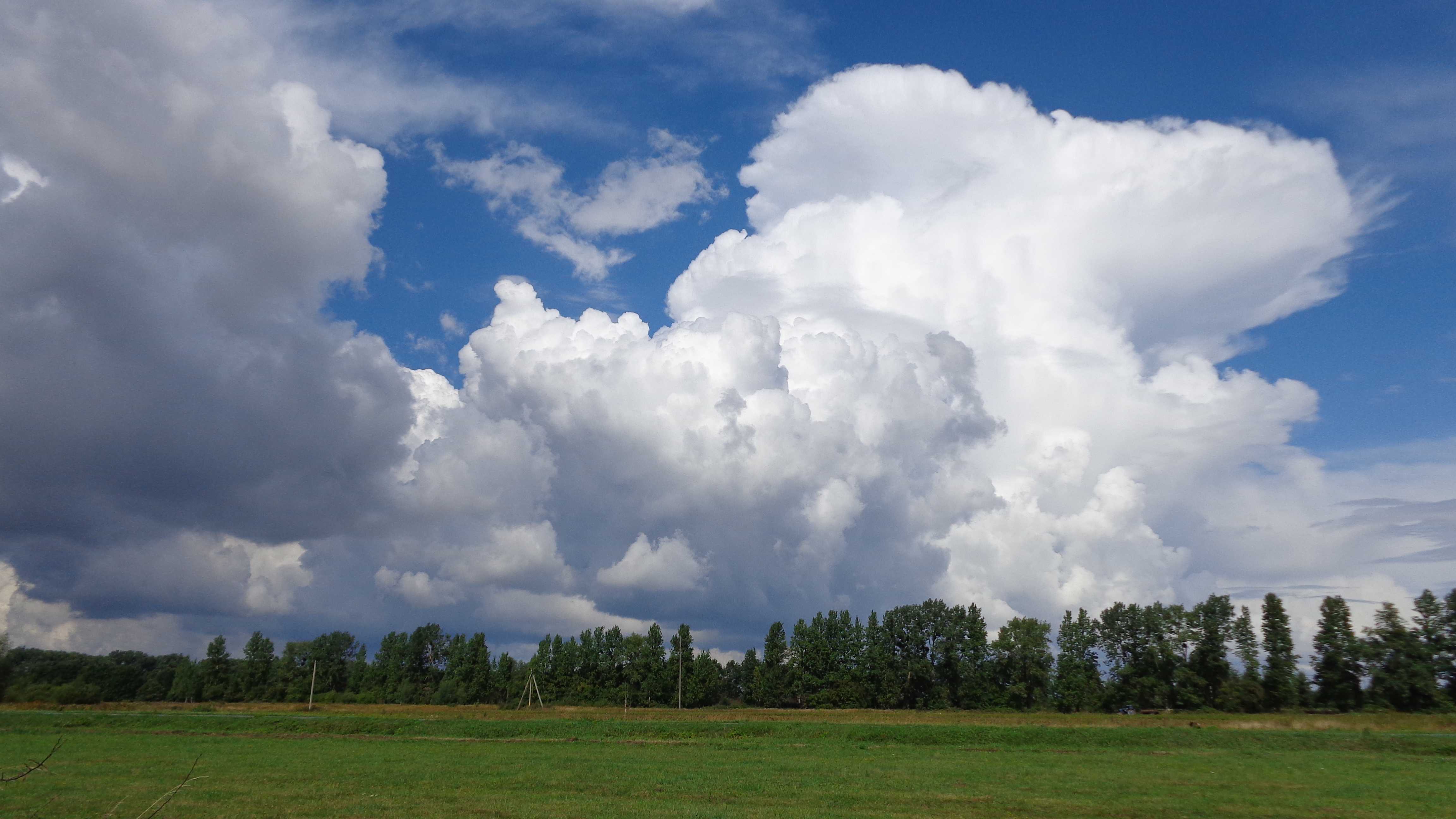
© Gary SalisburyIsle of ManLatitude: 54° 6' 16'' NLongitude: 4° 36' 51'' W14 January 2011 1442 (Local Time)Camera direction: towards ECL = 9, CM = 0, CH = 0Image P/S code: P.10.6Image I.D.: 4767Cumulonimbus capillatus incus
The image shows a range of convective cloud in transition from Cumulus to Cumulonimbus. Of principal interest is the large white Cumulonimbus cloud of moderate to great vertical extent towards the right-hand side. The upper portion of the cloud is flattened with a cirriform appearance and fibrous structure, identifying the species as capillatus. The top is spreading out in the form of an anvil – the supplementary feature incus. Cumulus cloud in various stages of development can be seen, with smaller Cumulus mediocris towards the lower right and Cumulus congestus near the centre, identified by cauliflower sproutings. Small scraps of probable Stratocumulus cumulonimbogenitus and Altocumulus cumulonimbogenitus can also be seen on the right.
Links in the image description will highlight features on the image. Mouse over the features for more detail.
© Sergei MorozovSlavyanskoye, Kaliningrad, Russian Federation.Latitude: 54° 50' 6'' NLongitude: 20° 57' 53'' E16 August 2014 1201 (Local Time)Camera direction: towards NWCL = 9, CM = 6, CH = 1Image P/S code: S.10.5 8Image I.D.: 4771Lightning from Cumulonimbus capillatus incus
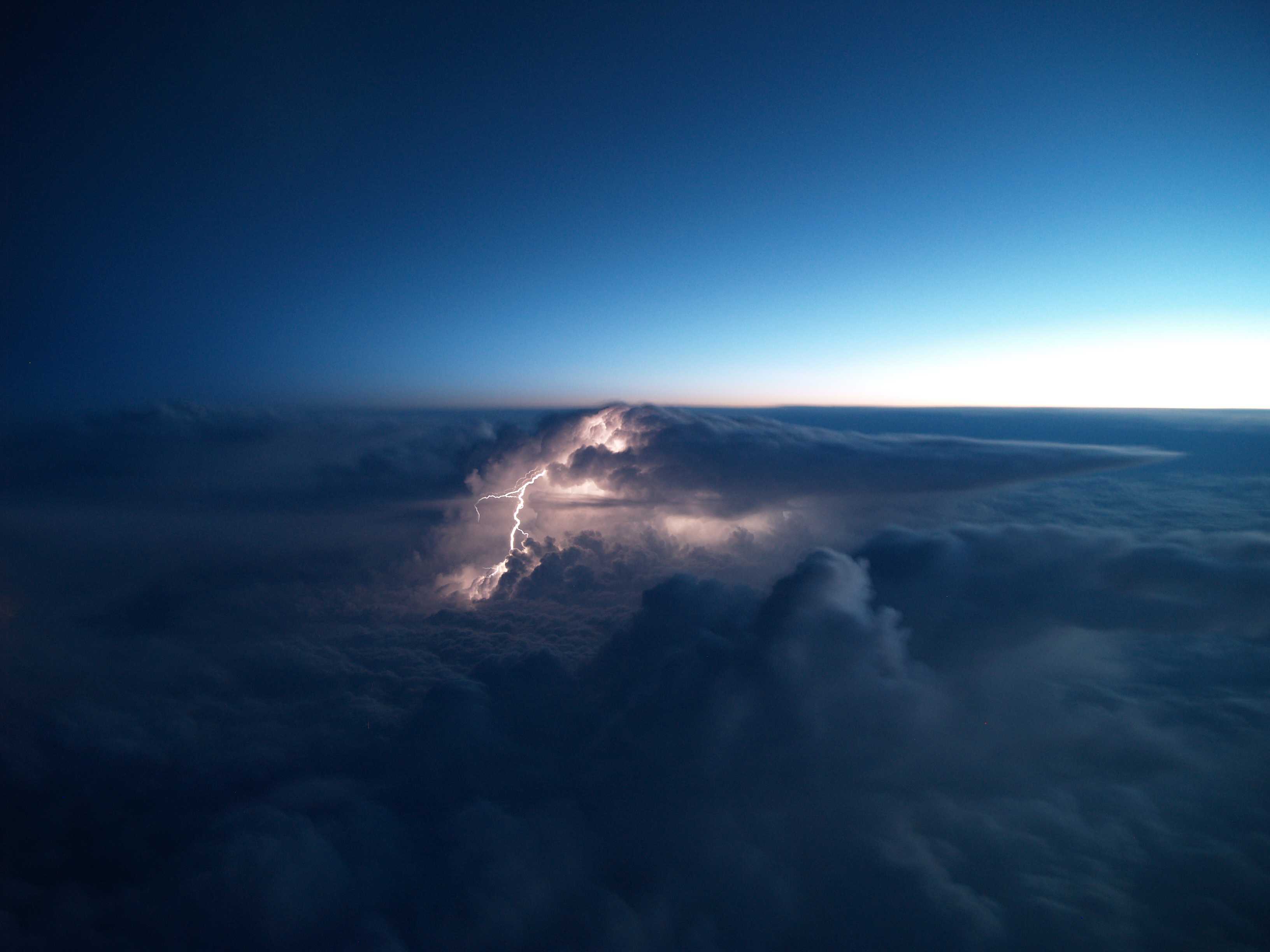
In this view from an aircraft, a lightning discharge is seen originating from near the top of a large Cumulonimbus capillatus incus. The supplementary feature incus is the uppermost portion of the Cumulonimbus spread out in the shape of an anvil.
Links in the image description will highlight features on the image. Mouse over the features for more detail.
© Severin Manuel BaerlocherPunjab, IndiaLatitude: 30° 17' 49'' NLongitude: 74° 26' 36'' E19 December 2010 0213 (Local Time)Camera direction: towards NECL = 9, CM = 6, CH = 1Image P/S code: S.14.1 21Image I.D.: 5569Clouds at different levels viewed from an aircraft
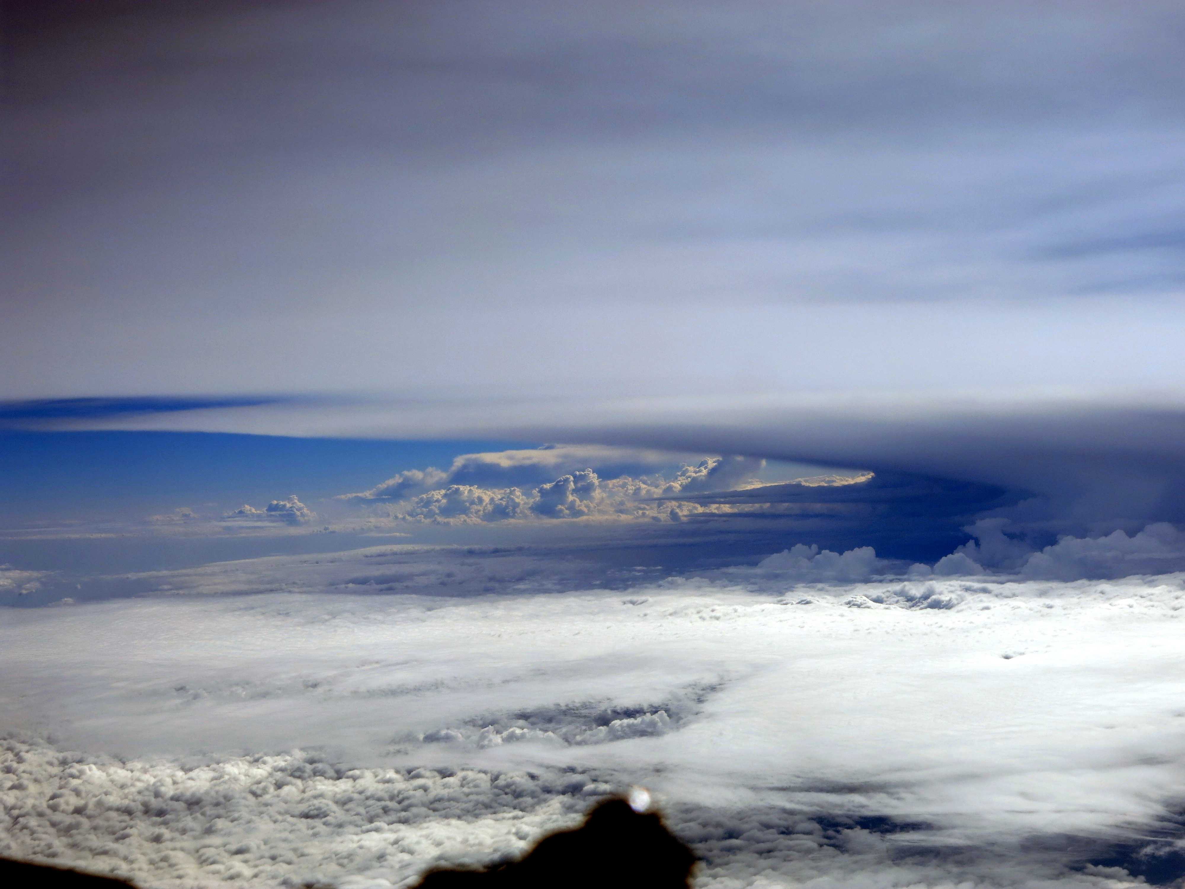
Viewed from an aircraft, the vertical distribution of clouds in the atmosphere can be appreciated. In the upper portion of this image is an extensive sheet of Cirrostratus fibratus (a high-level cloud), while at the lower left is a layer of Stratocumulus stratiformis (a low-level convective cloud). The upper surface of the Stratocumulus layer displays bulges and protuberances. At a level above the Stratocumulus is a thin sheet (variety translucidus) of Altostratus, which most likely formed by the spreading out of part of a Cumulonimbus (cumulonimbogenitus). On the right and in the middle of the picture are towers of Cumulus congestus (5 and 6), possibly having developed from the Altocumulus castellanus in the middle of the image. Finally, the anvil (incus) of a large and tall Cumulonimbus capillatus stretches across the middle of the picture.
Links in the image description will highlight features on the image. Mouse over the features for more detail.
© Marcin KocybikGrand Sud, Aix-en-Provence, FranceLatitude: 43° 29' 5'' NLongitude: 5° 26' 57'' E21 July 2015 1300 (Local Time)Camera direction: towards WCL = 9, CM = 6, CH = 1Image P/S code: P.20.10.5Image I.D.: 5686Cumulonimbus capillatus incus
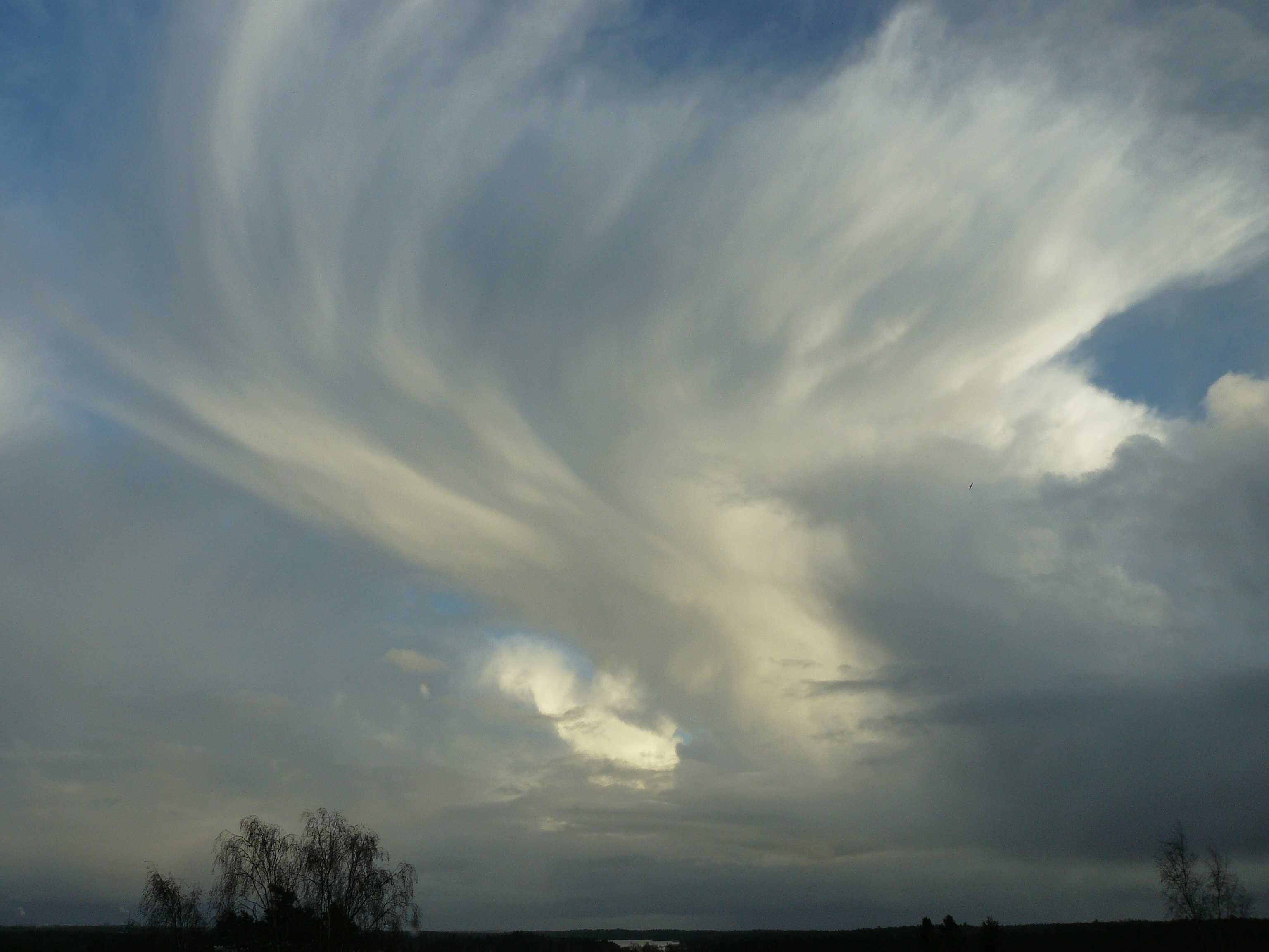
The image shows a winter sky of air mass showers falling from a Cumulonimbus capillatus incus. In this example. the Cumulonimbus has almost entirely frozen, as evidenced by the fibrous structure extending almost to the base of the cloud. The cirriform fibrous upper part of this cloud cannot be identified as Cirrus spissatus cumulonimbogenitus as it still attached to the mother-cloud Cumulonimbus.
A Cumulonimbus capillatus cell can be seen in the left distance as well.
Patches of Stratocumulus formed from the spreading of parts of Cumulonimbus are also present.
Links in the image description will highlight features on the image. Mouse over the features for more detail.
© Jarmo KoistinenEspoo, FinlandLatitude: 60° 0' 0'' NLongitude: 25° 0' 0'' E04 December 2011 1458 (Local Time)Camera direction: towards ECL = 9, CM = 0, CH = 0Image P/S code: S.10.5 6Image I.D.: 5698Cumulonimbus capillatus incus
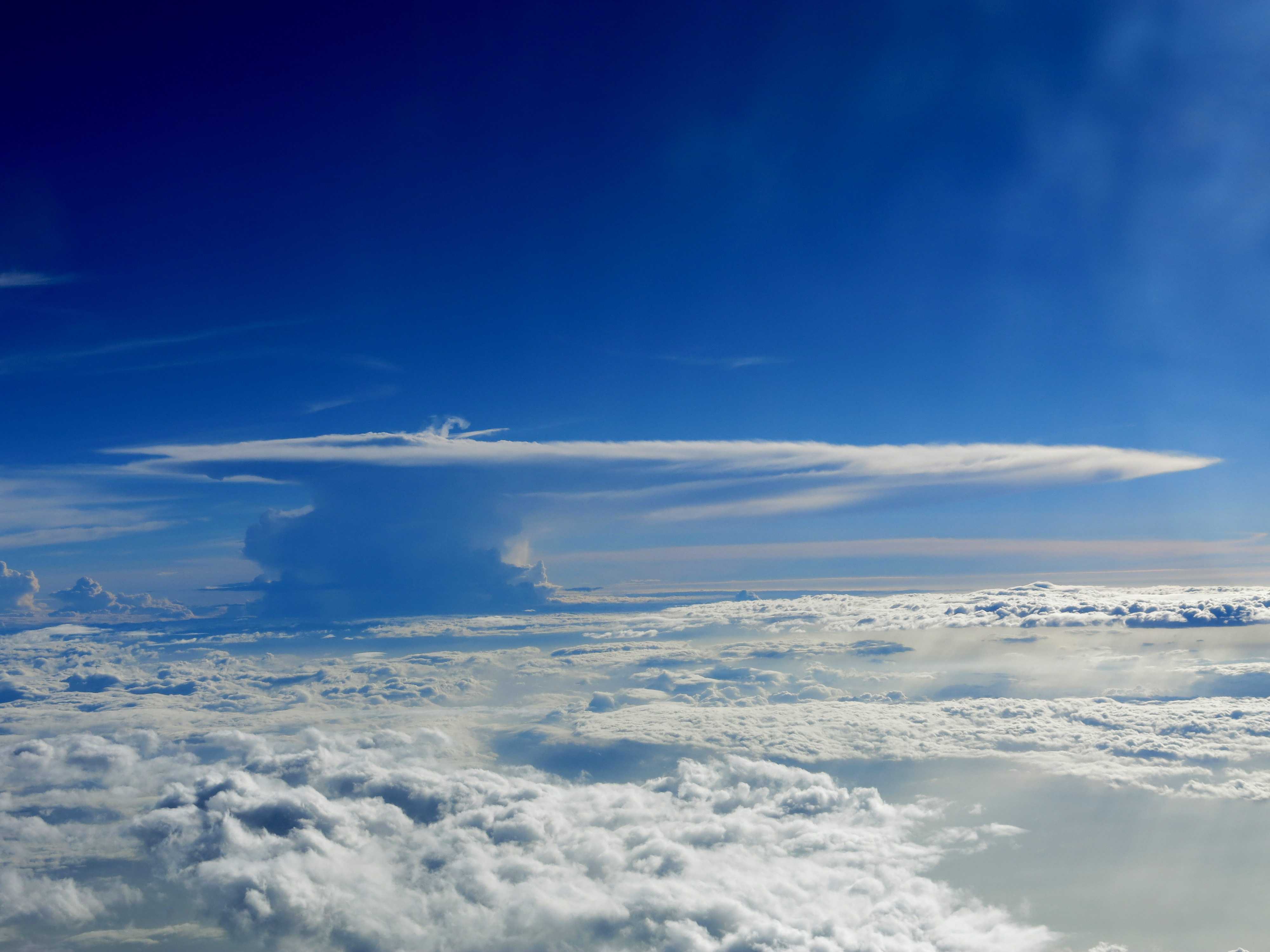
The main feature of this picture, which was taken from an aircraft, is the tall Cumulonimbus capillatus incus that towers above the other tropospheric clouds. Cumulonimbus is a heavy and dense cloud of considerable vertical extent, in the form of a mountain or huge towers. The species capillatus is characterized by the upper portion having cirriform parts of clearly fibrous or striated structure. The supplementary feature incus denotes that the upper portion has spread out in the form of an anvil.
Links in the image description will highlight features on the image. Mouse over the features for more detail.
© Marcin KocybikMaharashtra, IndiaLatitude: 10° 16' 18'' NLongitude: 76° 30' 32'' E04 December 2015 1600 (Local Time)Camera direction: towards SWCL = 9, CM = 0, CH = 0Image P/S code: S.10.5Image I.D.: 5988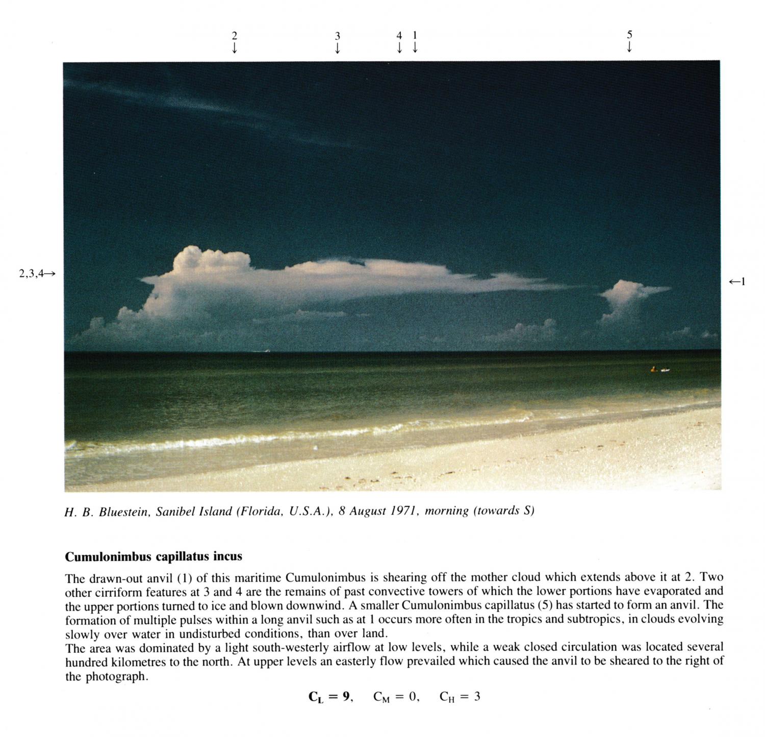
Cumulonimbus capillatus incus
(NB. Hour of morning estimated)
The drawn-out anvil of this maritime Cumulonimbus is shearing off the mother cloud which extends above it at 2. Two other cirriform features at 3 and 4 are the remains of past convective towers of which the lower portions have evaporated and the upper portions turned to ice and blown downwind. A smaller Cumulonimbus capillatus has started to form an anvil. The formation of multiple pulses within a long anvil occurs more often in the tropics and subtropics, in clouds evolving slowly over water in undisturbed conditions, than over land. The area was dominated by a light south-westerly airflow at low levels, while a weak closed circulation was located several hundred kilometres to the north. At upper levels an easterly flow prevailed which caused the anvil to be sheared to the right of the photograph.
CL = 9, CM = 0, CH = 3
Links in the image description will highlight features on the image. Mouse over the features for more detail.
© H.B. BluesteinSanibel Island, Florida, United States of AmericaLatitude: 26° 26' 36'' NLongitude: 82° 6' 41'' W08 August 1971 0900 (Local Time)Camera direction: towards S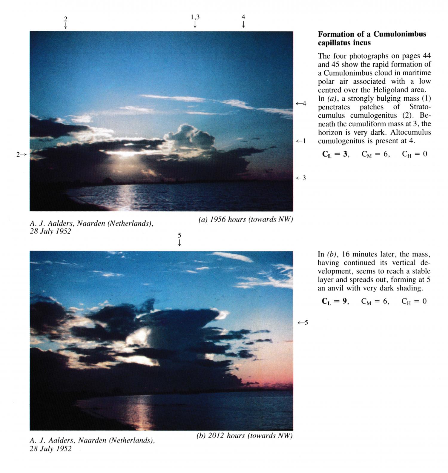
Formation of a Cumulonimbus capillatus incus
The four photographs PR.44 - PR.47 show the rapid formation of a Cumulonimbus cloud in maritime polar air associated with a low centred over the Heligoland area. In (a), a strongly bulging mass penetrates patches of Stratocumulus cumulogenitus. Beneath the cumuliform mass at 3, the horizon is very dark. Altocumulus cumulogenitus is present at 4.
Links in the image description will highlight features on the image. Mouse over the features for more detail.
© A.J. AaldersNaarden, NetherlandsLatitude: 52° 17' 43'' NLongitude: 5° 9' 37'' E28 July 1952 1956 (Local Time)Camera direction: towards NWCL = 3, CM = 6, CH = 0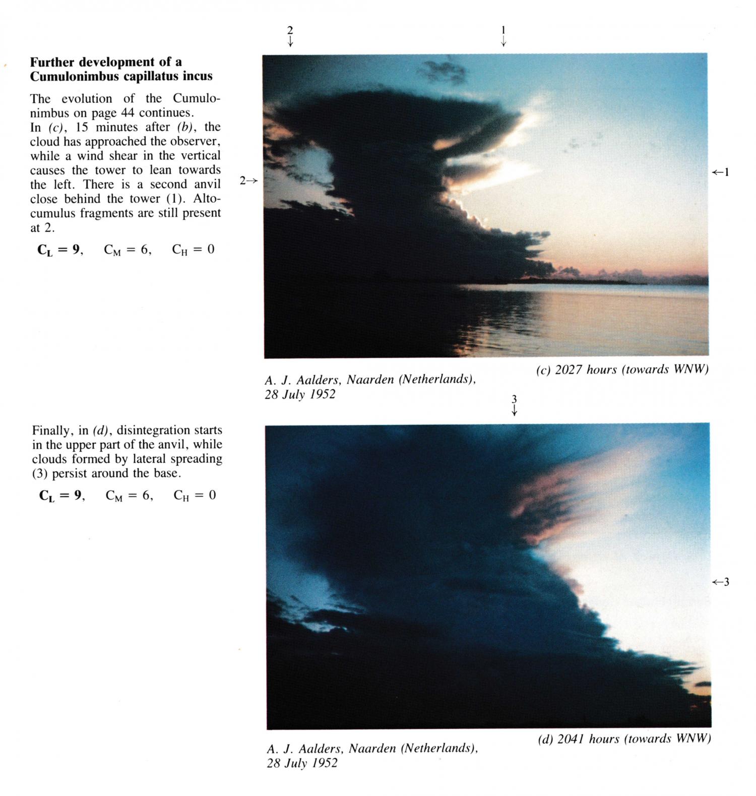
Further development of a Cumulonimbus capillatus incus (4 images)
The evolution of the Cumulonimbus (PR.44 & 45) continues. Here, 15 minutes after image PR.45, the cloud has approached the observer, while a wind shear in the vertical causes the tower to lean towards the left. There is a second anvil close behind the tower. Altocumulus fragments are still present at 2.
Links in the image description will highlight features on the image. Mouse over the features for more detail.
© A.J. AaldersNaarden, NetherlandsLatitude: 52° 17' 43'' NLongitude: 5° 9' 37'' E28 July 1952 2027 (Local Time)Camera direction: towards WNWCL = 9, CM = 6, CH = 0
