© Frank Le Blancq
Noirmont Common, St Brelade, Jersey
Latitude: 49° 10' 13'' N
Longitude: 2° 10' 12'' W
30 March 2016 1555 (Local Time)
Camera direction: towards SW
Image P/S code: P.5.0
Image I.D.: 4785
CL = 0, CM = 1, CH = /
-
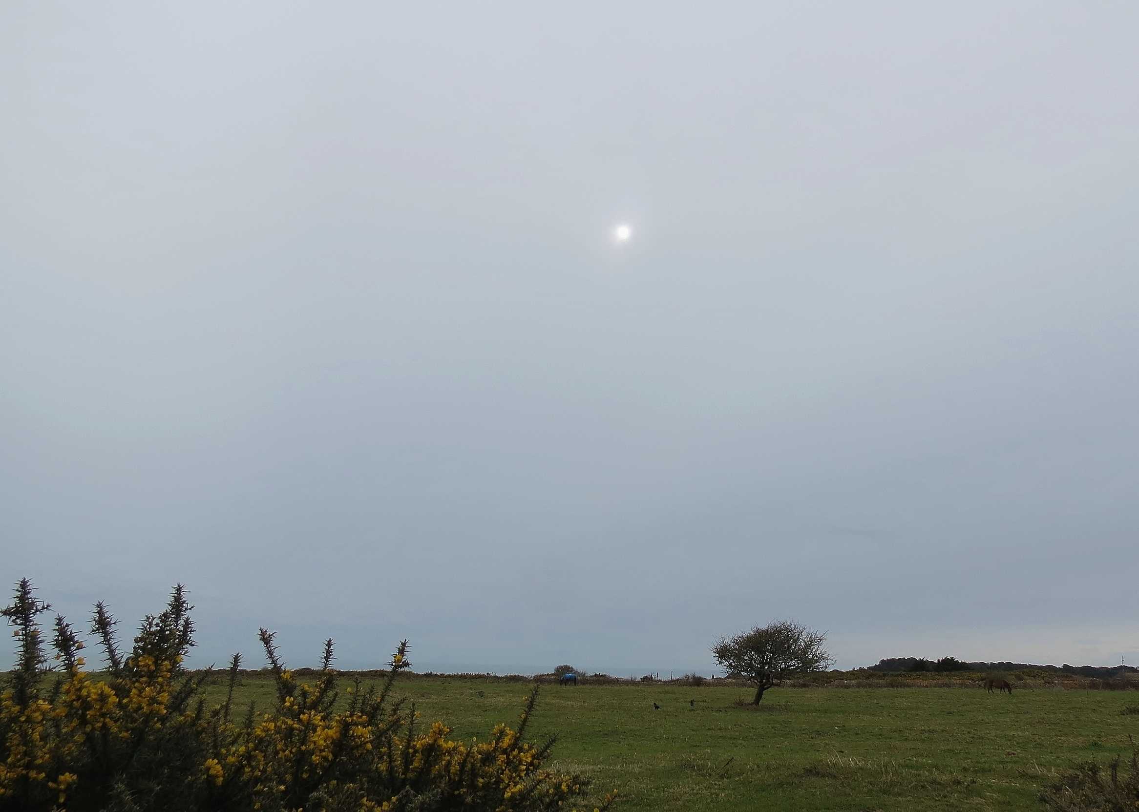
Altostratus translucidus
The photograph is a classic example of Altostratus translucidus: a grey featureless layer of great horizontal extent covering almost the whole sky. The cloud layer is sufficiently thin that the sun is visible through the cloud, known as the “ground glass effect”, but it was thick enough not to cast shadows. Within 30 minutes, the layer had thickened to obscure the Sun, becoming Altostratus opacus. The cloud was associated with a front to the south.
Links in the image description will highlight features on the image. Mouse over the features for more detail.
© Frank Le BlancqNoirmont Common, St Brelade, JerseyLatitude: 49° 10' 13'' NLongitude: 2° 10' 12'' W30 March 2016 1555 (Local Time)Camera direction: towards SWCL = 0, CM = 1, CH = /Image P/S code: P.5.0Image I.D.: 4785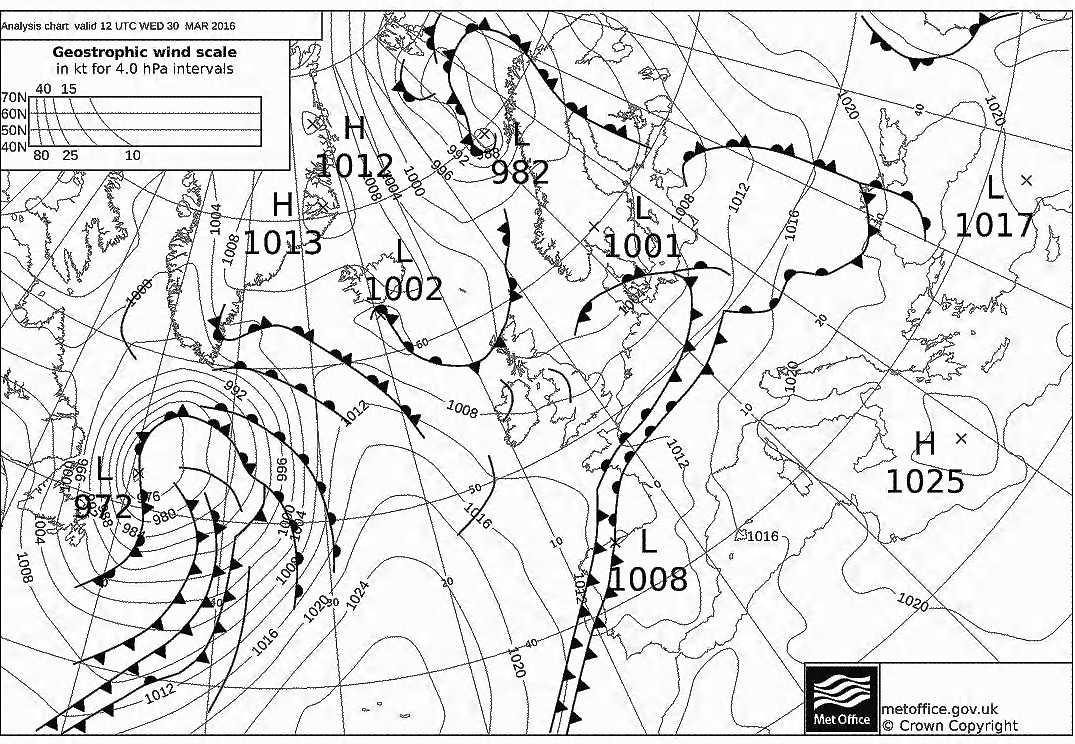
At 1200 UTC, shallow low pressure covered the North Sea. A cold front extended from north-western Poland to northern France and on to north-western Spain and the Canary Islands, Spain. A weak wave was present over the northern part of the Bay of Biscay and a shallow low was present over northern Spain.
© Crown Copyright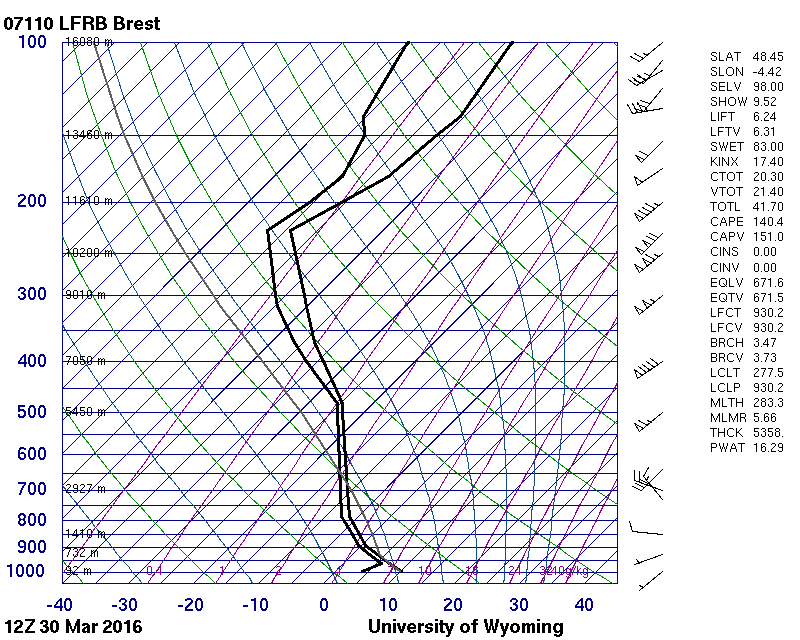
This sounding is from Brest, France, 190 km upstream, and shows near saturation from the surface to the tropopause.
© University of Wyoming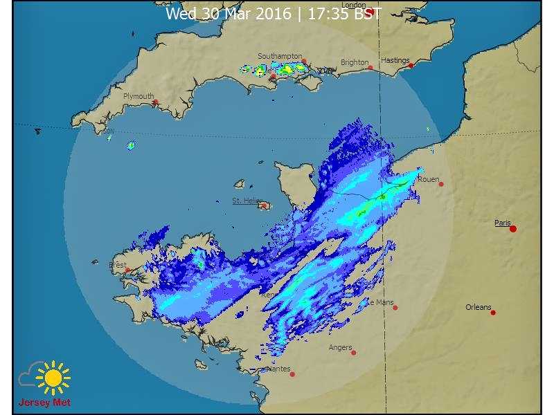
The radar image from the radar in Jersey at 1635 UTC (1 hour and 40 minutes after the time of the photograph) shows rain associated with the surface front over northern France.
© States of Jersey 2016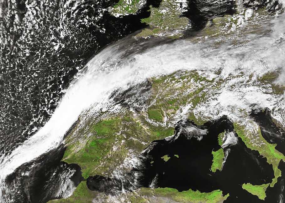
The NOAA visual image taken at 1408 UTC and Meteosat visual image taken at 1615 UTC clearly show a classic frontal band of cloud that is associated with the surface front extending from northern France to north-west Spain.
© Credit NOAA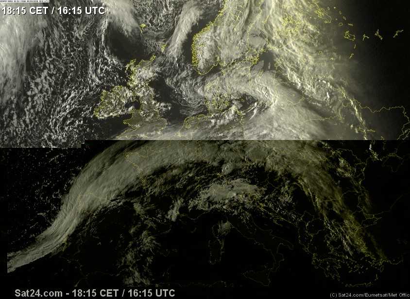
An alternative (Meteosat) visual image of the frontal cloud band at 1500 UTC, extending from south-west Iberia to north-west Spain and then on to northern France and into central Europe.
© Crown Copyright