© Mike Baker
Camp Bastion, near Nad-e Ali, Helmand Province, Afghanistan
Latitude: 31° 51' 11'' N
Longitude: 64° 13' 12'' E
16 May 2014 1345 (Local Time)
Image P/S code: P.12.2.2
Image I.D.: 4838
-
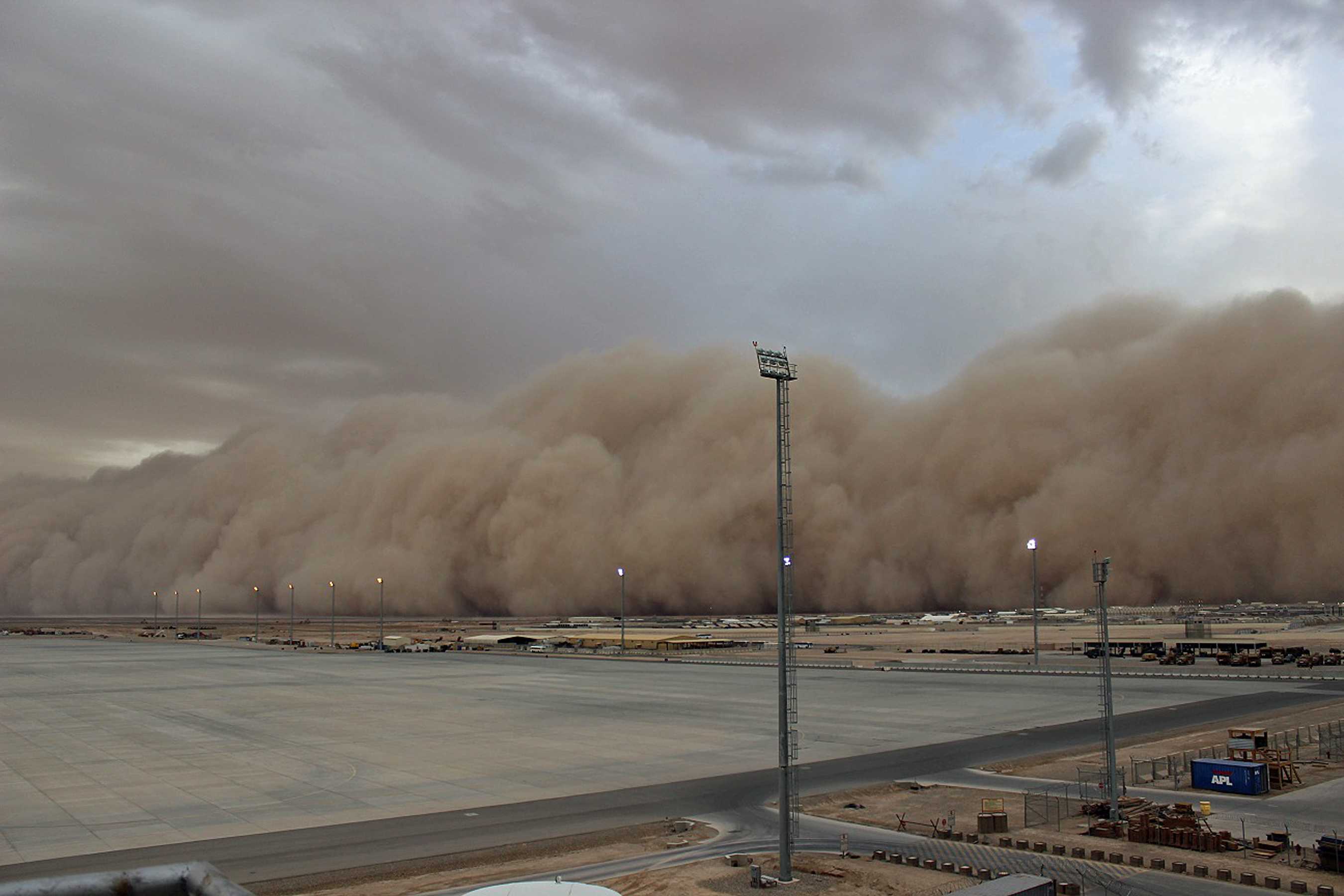
Dust storm
A dust storm or sandstorm (commonly known as a haboob) is an ensemble of dust or sand energetically lifted to great height by a strong and turbulent wind.
This picture shows a dust storm in Helmand Province, Afghanistan. The dust was raised by the downdraft from a high-based thunderstorm.
The forward portion of a dust storm often has the appearance of a wide and high wall that advances fairly rapidly, as in this picture. The leading edge of the “wall of dust” marks the location of the advancing gust front. This dust storm reduced visibility to about 10 m and a maximum wind gust of over 50 kt was recorded. Conditions improved after about an hour.
Links in the image description will highlight features on the image. Mouse over the features for more detail.
© Mike BakerCamp Bastion, near Nad-e Ali, Helmand Province, AfghanistanLatitude: 31° 51' 11'' NLongitude: 64° 13' 12'' E16 May 2014 1345 (Local Time)Image P/S code: P.12.2.2Image I.D.: 4838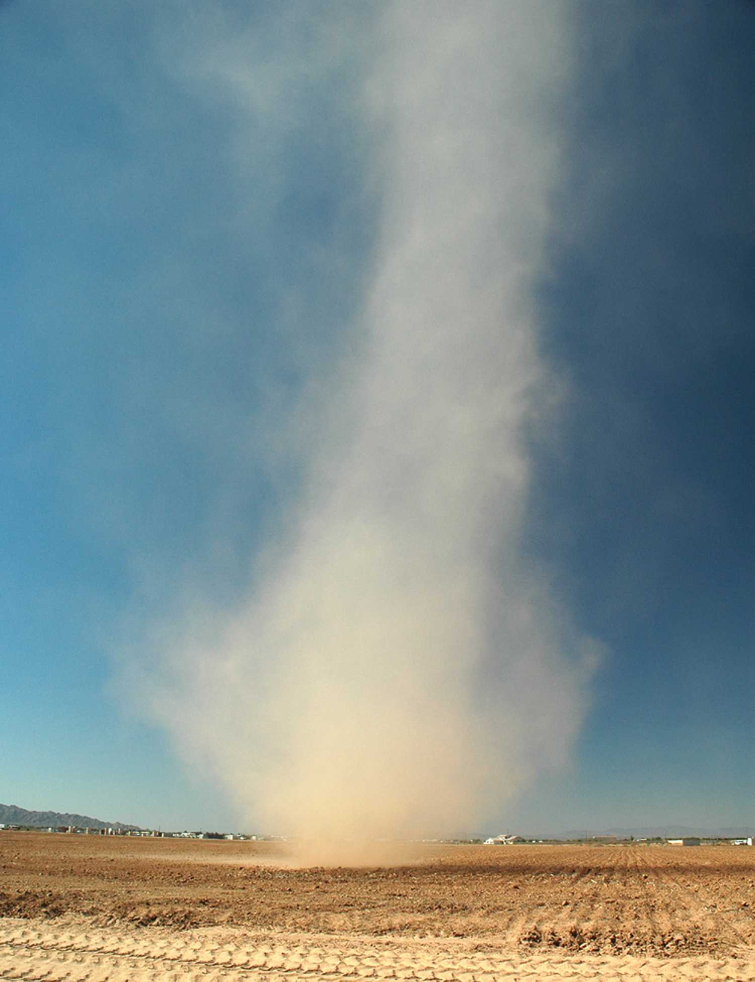
Dust whirl (dust devil)
A dust devil (dust whirl or sand whirl) is an ensemble of particles of dust or sand, sometimes accompanied by small litter, raised from the ground in the form of a whirling column about an approximately vertical axis. Dust devils occur when the air near the ground is very unstable, such as when the soil is strongly heated by the Sun.
Links in the image description will highlight features on the image. Mouse over the features for more detail.
© Stan Celestiannear Glendale, Arizona, United States of AmericaLatitude: 33° 33' 34'' NLongitude: 112° 22' 44'' W04 July 2004 1550 (Local Time)Image P/S code: P.12.2.3Image I.D.: 5434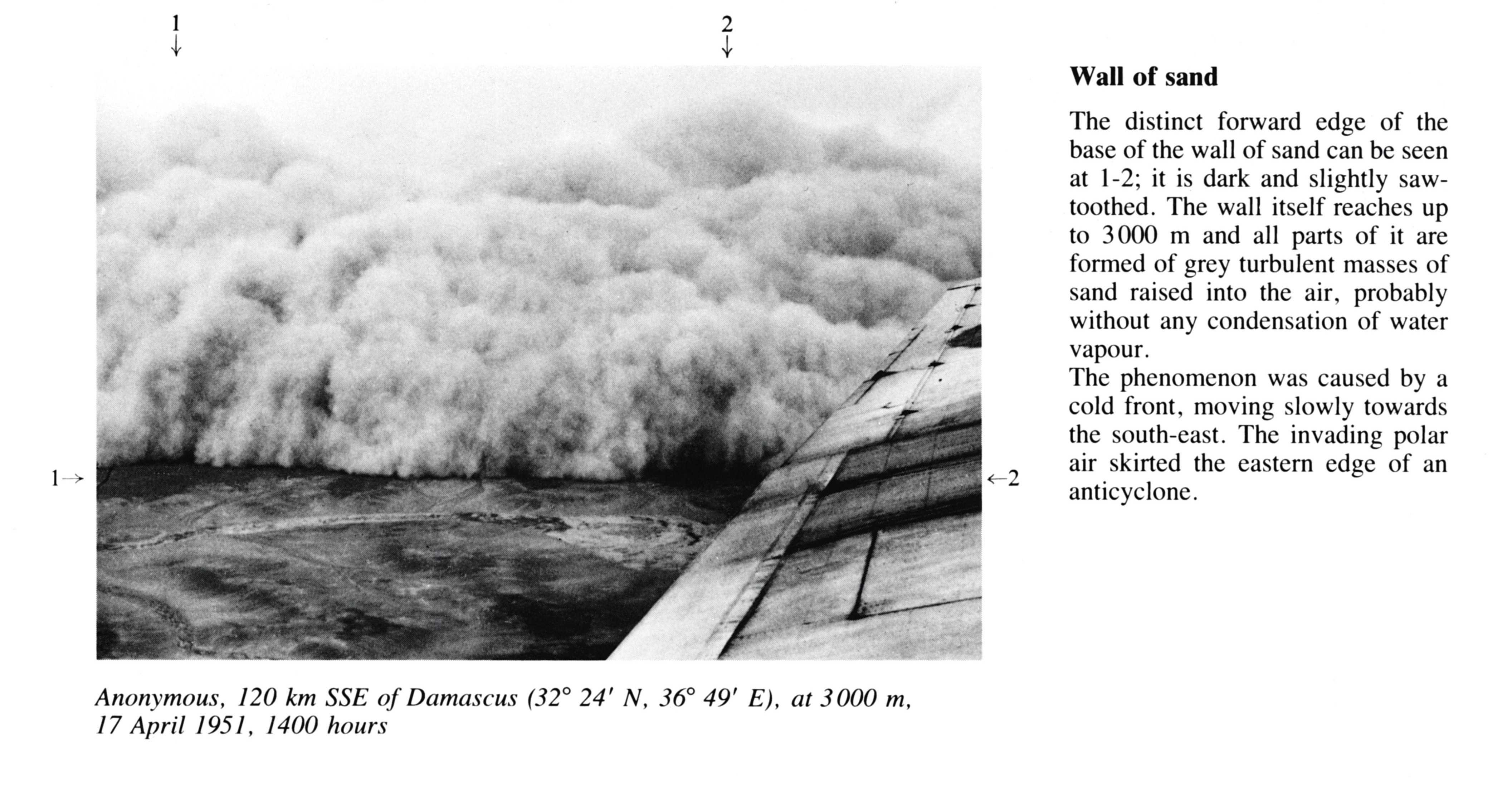
Wall of sand
The distinct forward edge of the base of the wall of sand can be seen at 1 - 2; it is dark and slightly saw-toothed. The wall itself reaches up to 3000 m and all parts of it are formed of grey turbulent masses of sand raised into the air, probably without any condensation of water vapour.
The phenomenon was caused by a cold front, moving slowly towards the south-east. The invading polar air skirted the eastern edge of an anticyclone.
Links in the image description will highlight features on the image. Mouse over the features for more detail.
© WMO (unknown photographer)120 km SSE of Damascus, Syria, at 3000 mLatitude: 32° 24' 0'' NLongitude: 36° 49' 0'' E17 April 1951 1400 (Local Time)CL = /, CM = /, CH = /