© Stephen Burt
Tregavethan, Truro, Cornwall TR4 9EL, United Kingdom of Great Britain and Northern Ireland
Latitude: 50° 16' 54'' N
Longitude: 5° 6' 59'' W
06 August 2009 1919 (Local Time)
Camera direction: towards NE
Image P/S code: P.1.9
Image I.D.: 4846
CL = 0, CM = 0, CH = 2
-

Cirrus spissatus radiatus, Cirrus uncinus radiatus, Cirrus floccus and Cirrocumulus floccus
This image shows Cirrocumulus floccus developing into Cirrus uncinus, which is, in parts, merging into Cirrus spissatus. There are also a few elements of Cirrus floccus present. The Cirrus uncinus and spissatus are of the variety radiatus as strong south-south-west winds have arranged the Cirrus into parallel bands that appear to be converging at a point on the horizon.
Links in the image description will highlight features on the image. Mouse over the features for more detail.
© Stephen BurtTregavethan, Truro, Cornwall TR4 9EL, United Kingdom of Great Britain and Northern IrelandLatitude: 50° 16' 54'' NLongitude: 5° 6' 59'' W06 August 2009 1919 (Local Time)Camera direction: towards NECL = 0, CM = 0, CH = 2Image P/S code: P.1.9Image I.D.: 4846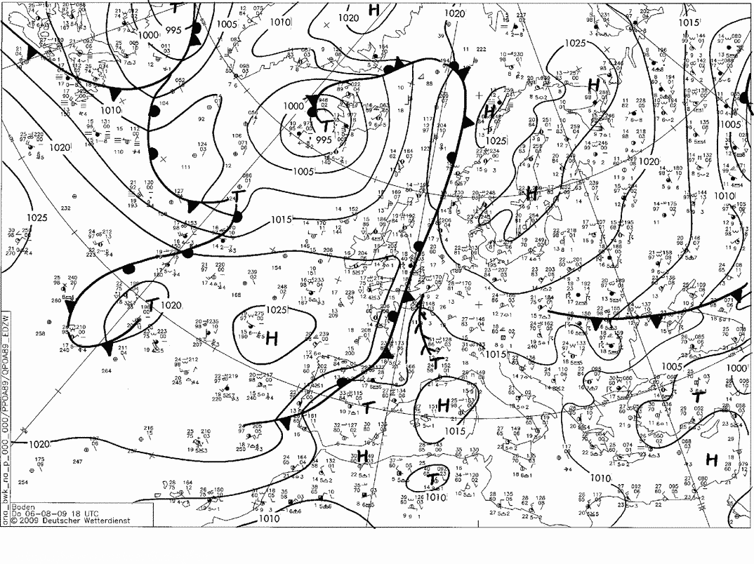
South-west England, UK lay under a ridge from the Azores anticyclone, while a fairly active waving front lay over southern England. Extensive high cloud associated with the frontal system persisted throughout the day to the east and north-east of Cornwall, UK.
© Deutscher Wetterdienst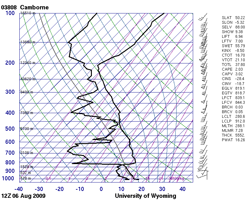
The ascent from nearby Camborne, England, UK (15 km south-west of the site where the photograph was taken) from 1200 UTC shows very moist conditions at Cirrus levels, above a strong anticyclonic inversion at about 825 hPa. The winds at Cirrus levels were very strong south-south-west winds at close to 100 kt – very high for midsummer.
© University of Wyoming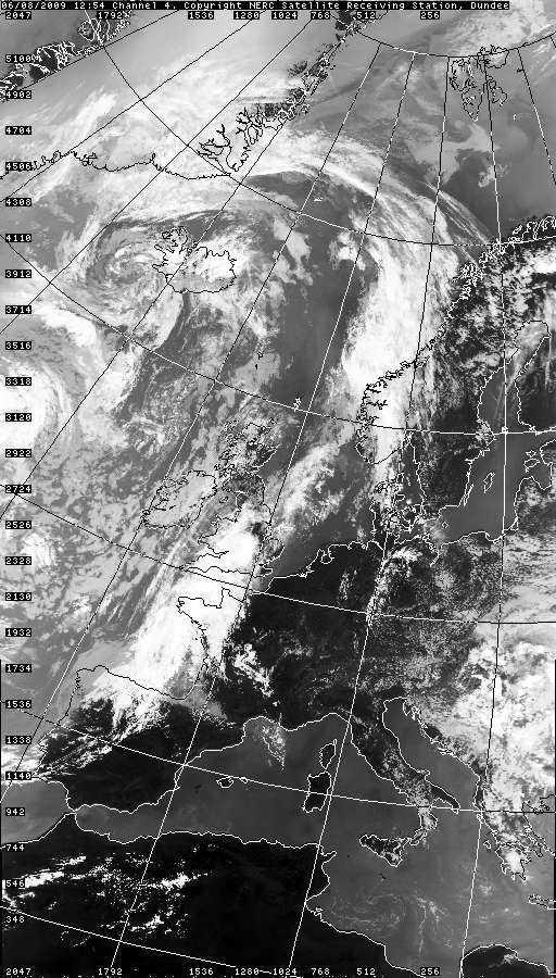
The satellite image from six hours earlier shows the thicker frontal cloud over Cornwall, UK (where a few spots of rain fell late that morning), with the bands of Cirrus spissatus lying at that time to the west of Cornwall.
© NEODAAS/University of Dundee
Cirrus fibratus radiatus
The photograph shows a fine display of Cirrus that includes species fibratus and uncinus, both of the variety radiatus where, due to perspective, parallel bands appear to converge towards one point. Altocumulus in thin patches and Cumulus humilis (5 and 6) are also present.
Links in the image description will highlight features on the image. Mouse over the features for more detail.
© Tsz Cheung LeeBiei, Hokkaido, JapanLatitude: 43° 36' 58'' NLongitude: 142° 27' 15'' E21 July 2006 1330 (Local Time)CL = 5, CM = 3, CH = 4Image P/S code: S.1.9 1Image I.D.: 4799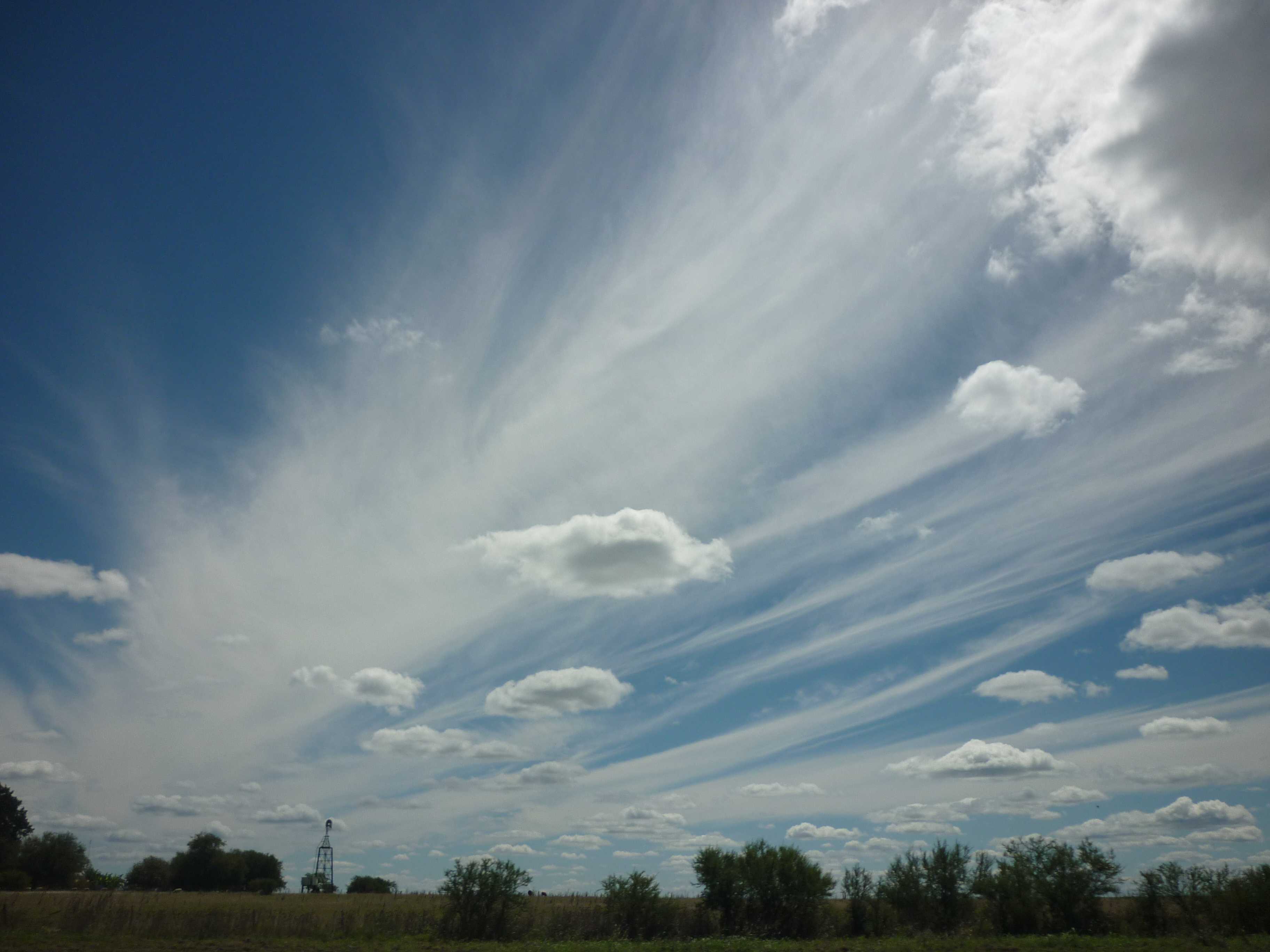
Cirrus fibratus radiatus and Cumulus humilis
Cirrus fibratus radiatus and Cumulis humilis
Links in the image description will highlight features on the image. Mouse over the features for more detail.
© Victor OviedoConcordia, Entre Rios, ArgentinaLatitude: 31° 23' 29'' SLongitude: 58° 1' 3'' W15 March 2013 1649 (Local Time)Camera direction: towards WNWCL = 1, CM = 0, CH = 1Image P/S code: S.1.9 2Image I.D.: 5816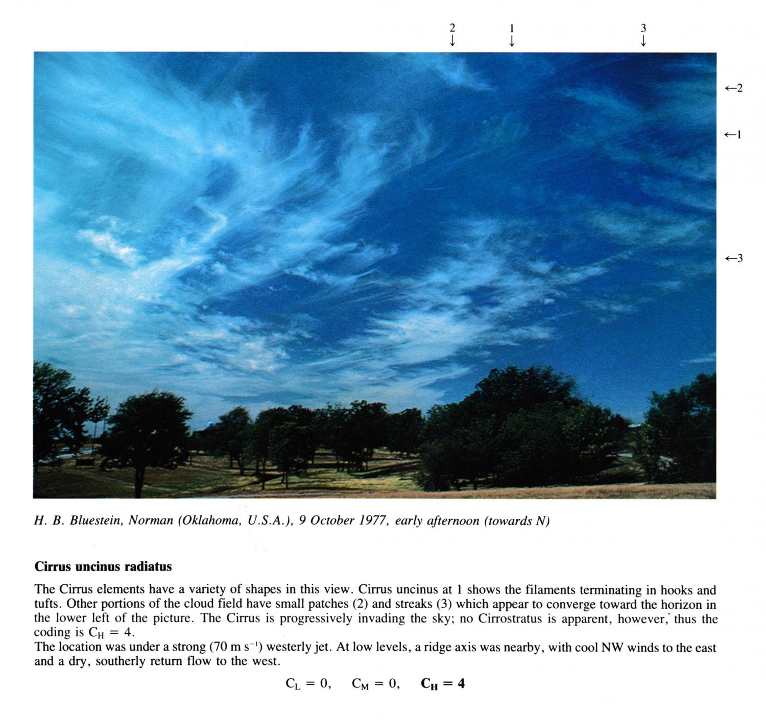
Cirrus uncinus radiatus
(NB. Time of day estimated; early afternoon)
The Cirrus elements have a variety of shapes in this view. Cirrus uncinus at 1 shows the filaments terminating in hooks and tufts. Other portions of the cloud field have small patches and streaks which appear to converge toward the horizon in the lower left of the picture. The Cirrus is progressively invading the sky; no Cirrostratus is apparent, however; thus the coding is CH = 4. The location was under a strong (70 m S-1) westerly jet. At low levels, a ridge axis was nearby, with cool NW winds to the east and a dry, southerly return flow to the west.
Links in the image description will highlight features on the image. Mouse over the features for more detail.
© H.B. BluesteinNorman, Oklahoma, United States of AmericaLatitude: 35° 13' 21'' NLongitude: 97° 26' 22'' W09 October 1977 1400 (Local Time)Camera direction: towards NCL = 0, CM = 0, CH = 4