© Stefan Kämpfe
Erfurt, Germany
Latitude: 51° 0' 0'' N
Longitude: 11° 0' 0'' E
28 September 2015 1145 (Local Time)
Camera direction: towards NE
Image P/S code: P.9.2
Image I.D.: 4993
CL = 2, CM = 0, CH = 0
-
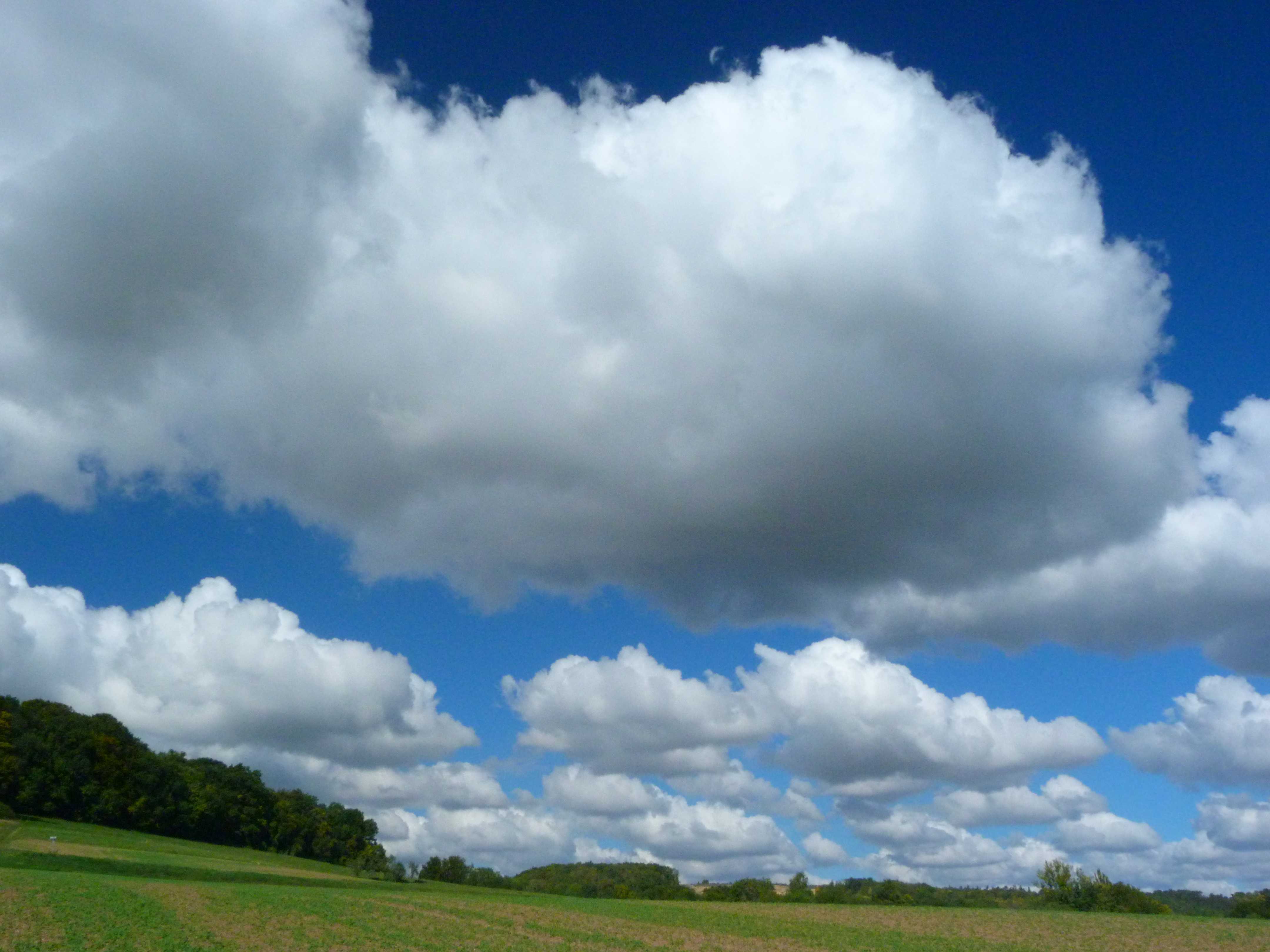
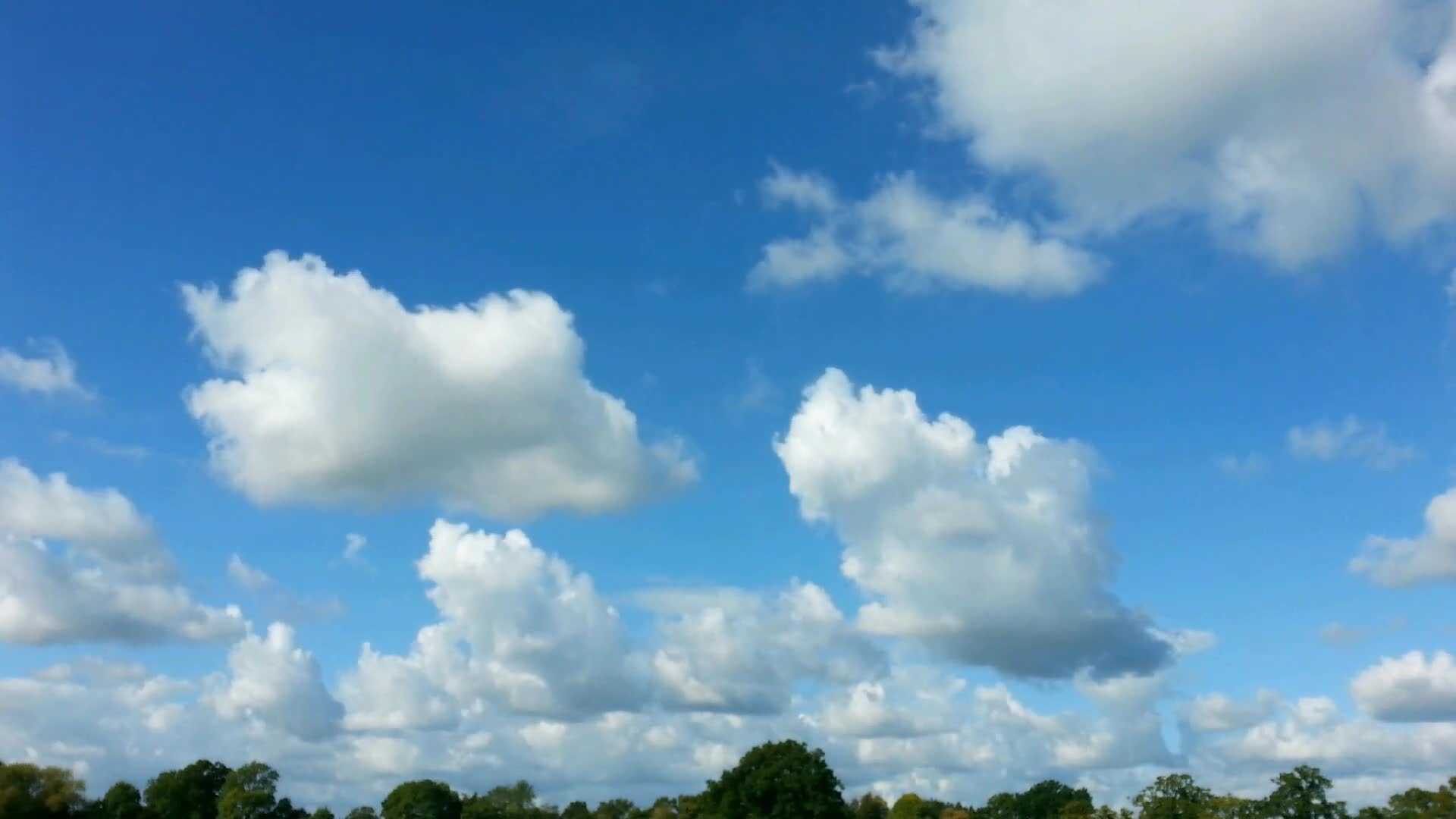
Cumulus mediocris
The photograph shows Cumulus mediocris, a series of detached clouds with sharp outlines; the bases are relatively dark and nearly horizontal, while the tops are sunlit and show up as being bright white. The clouds show moderate vertical development with small protuberances and sproutings at their tops, typical of the species mediocris. There is no precipitation.
Links in the image description will highlight features on the image. Mouse over the features for more detail.
© Stefan KämpfeErfurt, GermanyLatitude: 51° 0' 0'' NLongitude: 11° 0' 0'' E28 September 2015 1145 (Local Time)Camera direction: towards NECL = 2, CM = 0, CH = 0Image P/S code: P.9.2Image I.D.: 4993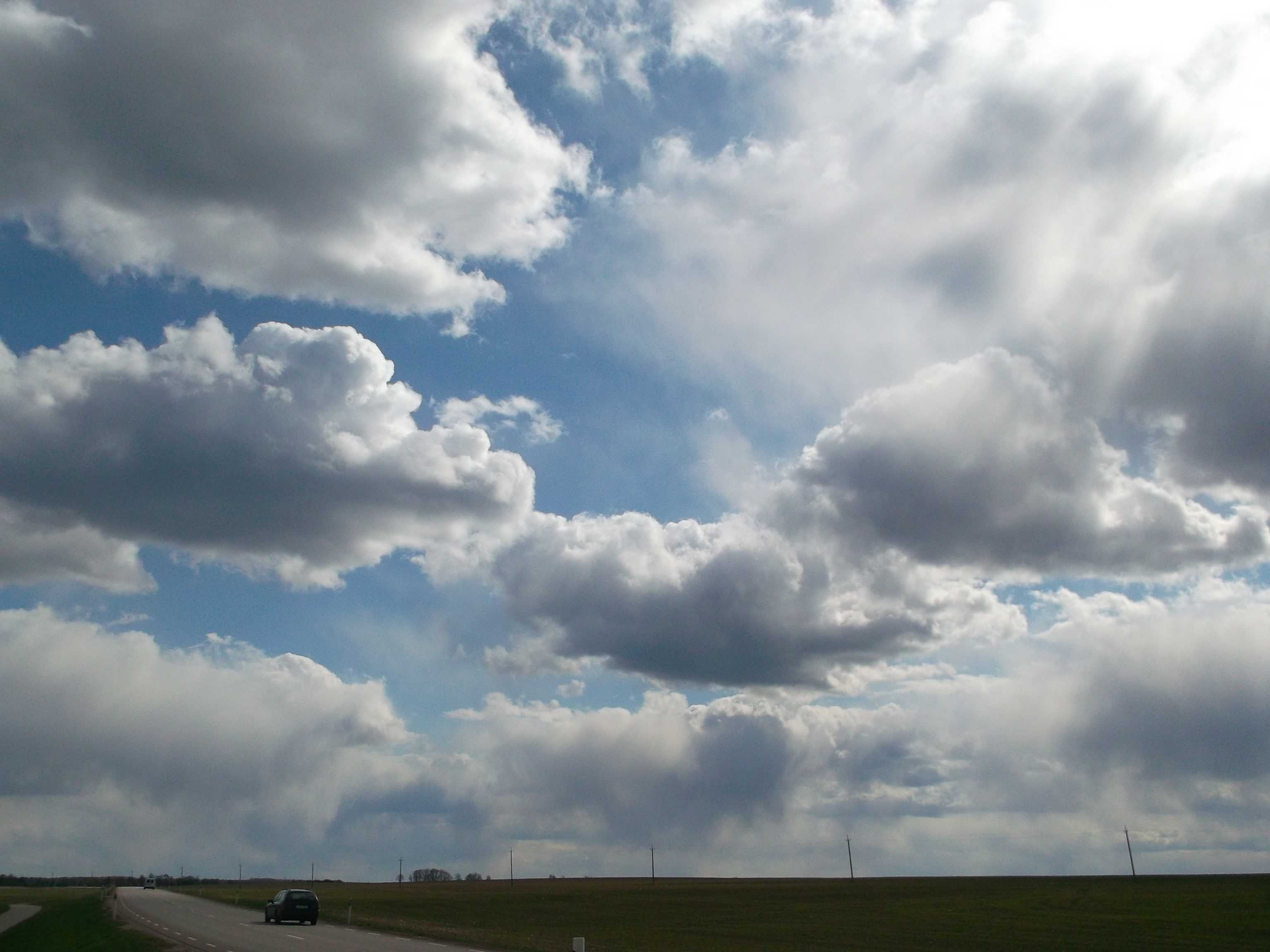
Cumulus mediocris with precipitation
The image shows detached clouds with dark bases and bright white sunlit upper parts (genus Cumulus). They show vertical development with sproutings at the top, indicative of species mediocris. Unlike Cumulus mediocris in general, some clouds here are producing showers with trails of precipitation visible (virga can be seen at 3 and 4). Most are evaporating before reaching the ground in the very dry surface layer (34 %RH), but a few light showers reach the surface (supplementary feature praecipitatio).
Links in the image description will highlight features on the image. Mouse over the features for more detail.
© Kairo KiitsakJõgeva, EstoniaLatitude: 58° 44' 47'' NLongitude: 26° 23' 50'' E06 May 2014 1526 (Local Time)Camera direction: towards SCL = 2, CM = 0, CH = 0Image P/S code: S.9.2 3Image I.D.: 4998
Stratus/sea fog and Cumulus
A low Stratus cloud, possibly as sea fog at the sea surface, laps onto the western shores of Lismore Island near Oban in the west of Scotland, UK. Cumulus mediocris can also be seen building in the far distance over the mountains of the Scottish mainland to the north. A little Cirrus is also in the sky.
Links in the image description will highlight features on the image. Mouse over the features for more detail.
© Ian SimpsonOban, Scotland, United Kingdom of Great Britain and Northern IrelandLatitude: 56° 28' 60'' NLongitude: 5° 33' 0'' W03 August 2011 1000 (Local Time)Camera direction: towards NECL = 2, CM = 0, CH = 0Image P/S code: S.8.0Image I.D.: 5031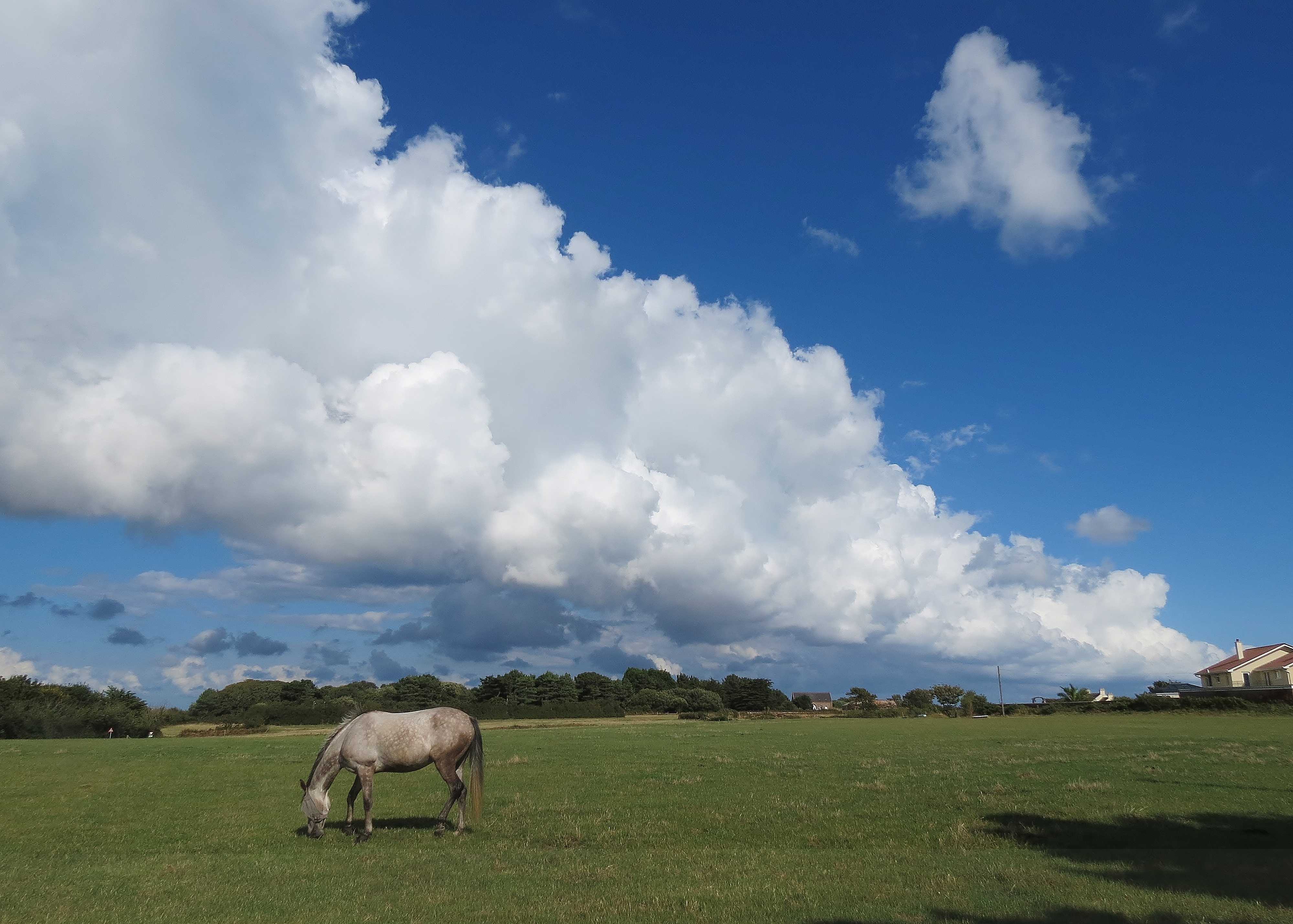
Cumulus mediocris cloud street
The cloud shows a moderate vertical extent of about 1 500 m (5 000 ft), which is typical of Cumulus mediocris but does not reach the great vertical extent required for the species congestus. Small protuberances are visible in the cloud tops and in developing cells above the horse at 2 and 3. The cloud is of the variety radiatus, being in a line (a cloud street) lying parallel to the wind direction. No precipitation or supplementary features are visible. Cumulus fractus can be seen at the upper right and lower left of the image (where it is grey due to its being in the shadow of the cloud street) at 4 and 5.
Links in the image description will highlight features on the image. Mouse over the features for more detail.
© Frank Le BlancqSt. Brelade, JerseyLatitude: 49° 10' 29'' NLongitude: 2° 10' 38'' W15 August 2014 1634 (Local Time)Camera direction: towards ECL = 2, CM = 0, CH = 0Image P/S code: S.9.2 2Image I.D.: 5043
Cumulus mediocris
This is a time-lapse video showing Cumulus development with fractus, humilis and mediocris. Each second on the time lapse equates to 1 minute in real time. The Cumulus bases are around 3 000 ft (estimated from observations at nearby synoptic stations) with tops around 7 000 ft (2 200 m, estimated from the Larkhill, England, UK radiosonde sounding). Some thermals can be seen to rise and dissipate due to the entrainment of the surrounding drier air. Cumulus mediocris bases start to darken.
Links in the image description will highlight features on the image. Mouse over the features for more detail.
© George AndersonWokingham, England, United Kingdom of Great Britain and Northern IrelandLatitude: 51° 25' 18'' NLongitude: 0° 50' 12'' W08 October 2015 1241 (Local Time)Camera direction: towards NWCL = 2, CM = 0, CH = 0Image P/S code: S.9.2 4Image I.D.: Array
Cumulus mediocris and Cumulus fractus
Cumulus is the only genus present. Some of the clouds are in the form of tufts of cotton-wool (species fractus); others are better developed and exhibit the beginning of bulging growth, already appreciable in places in spite of the early hour (species mediocris). Wind and turbulence cause asymmetry of form and raggedness of outline. The picture is typical for maritime polar air behind a cold front; winds at lower levels were WSW, fairly strong (8 to 12 m s-1 at the surface) and gusty. Thunderstorms with hail were observed in the same air mass.
Links in the image description will highlight features on the image. Mouse over the features for more detail.
© M. MézinParis, FranceLatitude: 48° 51' 24'' NLongitude: 2° 21' 8'' E03 April 1948 1901 (Local Time)Camera direction: towards SECL = 2, CM = 0, CH = 0