© Jarmo Koistinen
Espoo, Finland
Latitude: 60° 12' 22'' N
Longitude: 24° 39' 21'' E
31 July 2014 2135 (Local Time)
Camera direction: towards E
Image P/S code: P.2.7
Image I.D.: 5110
CL = 0, CM = 3, CH = 9
-
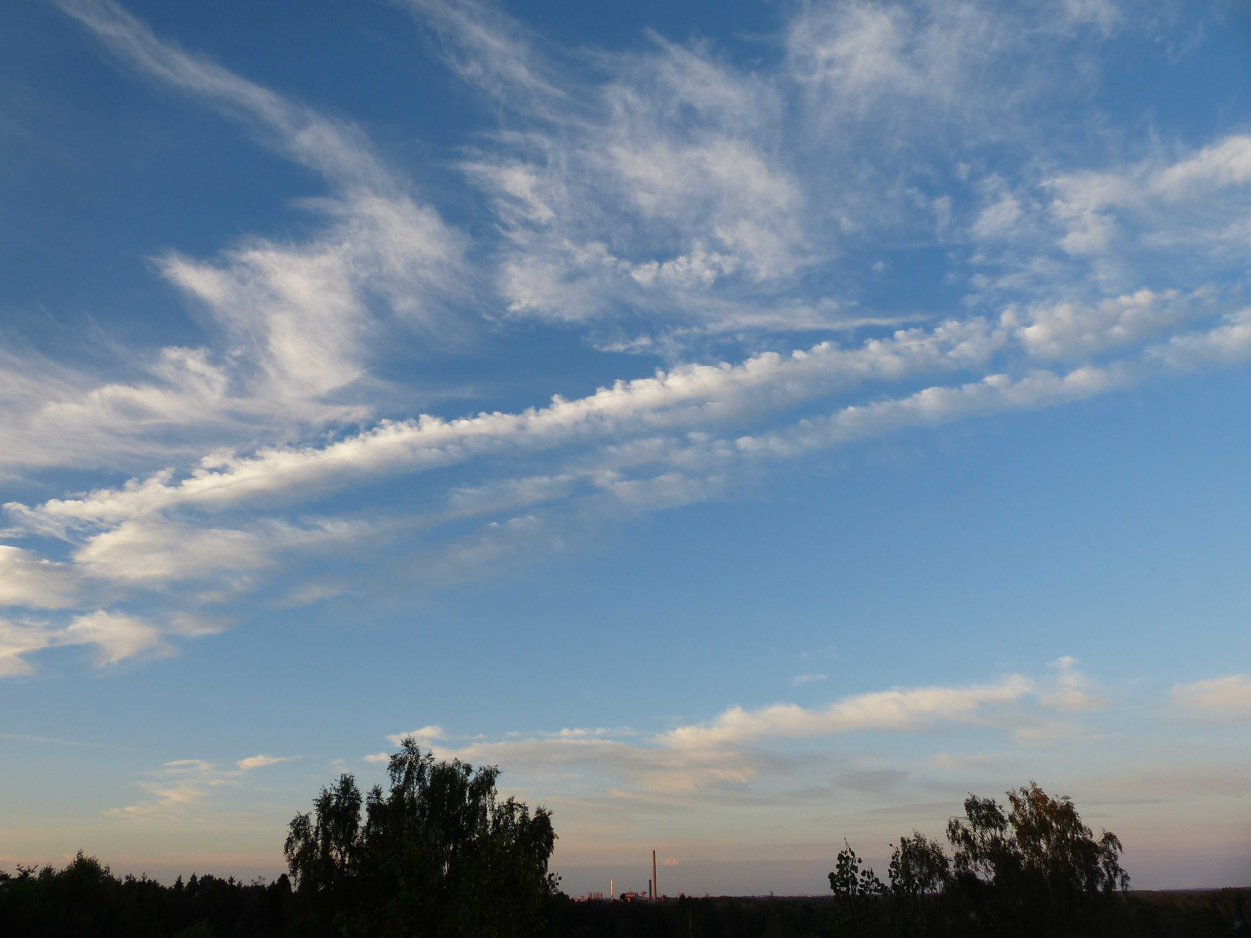
Cirrocumulus castellanus with virga
This photograph shows a patch and two lines of Cirrocumulus composed of small cloud elements. Cirrocumulus is normally white, but here some light grey is visible due to a low Sun angle. In the upper line particularly, elements are vertically developed as cumuliform protuberances in the form of turrets or towers (crenelations) connected by a common base; they are most evident when viewed from the side and are of the species castellanus. The apparent width of the turrets is always less than 1° when observed at an angle of more than 30° above the horizon. Close inspection shows subtle areas of thin virga below the cloud lines and at the bases (seen at 3 and 4), making them somewhat diffuse. On the left, the lines have glaciated and transformed into dense Cirrus spissatus; on the right, some of the elements resemble floccus; and near the top, we see thin Cirrus. These high-level clouds are post-frontal, following the frontal cloud on the horizon. In the distance some darker grey Altocumulus is visible.
Links in the image description will highlight features on the image. Mouse over the features for more detail.
© Jarmo KoistinenEspoo, FinlandLatitude: 60° 12' 22'' NLongitude: 24° 39' 21'' E31 July 2014 2135 (Local Time)Camera direction: towards ECL = 0, CM = 3, CH = 9Image P/S code: P.2.7Image I.D.: 5110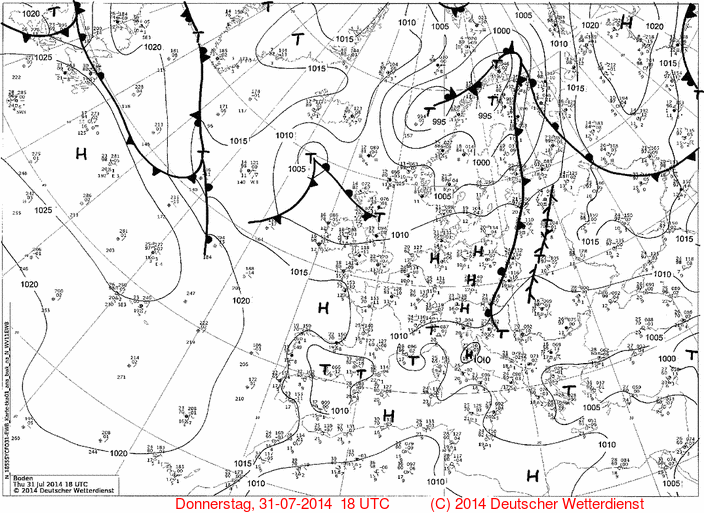
The 1800 UTC pressure chart shows how a complex area of low pressure with three centres extended from south of Iceland to northern Finland. A cold front associated with the low over northern Finland was moving east over the country. At the time of the photograph, the front was about 100 km to the east.
© Deutscher Wetterdienst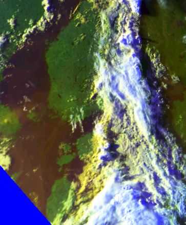
The METOP satellite image (combining channels 1, 2 and 4) was captured an hour before the cloud image. The bright-coloured cloud band of the cold front can be seen east of the photo location in the centre of the image. The small post-frontal cloud patches and lines over southern Finland, extending into the Gulf of Finland, confirm the presence of the cloud in the photograph.
© Finnish Meteorological Institute