© Jüri Kamenik
Pääsküla, Tallinn, Estonia
Latitude: 59° 21' 37'' N
Longitude: 24° 37' 56'' E
15 July 2012 1815 (Local Time)
Camera direction: towards E
Image P/S code: P.6.7
Image I.D.: 5144
CL = 7, CM = 2, CH = /
-
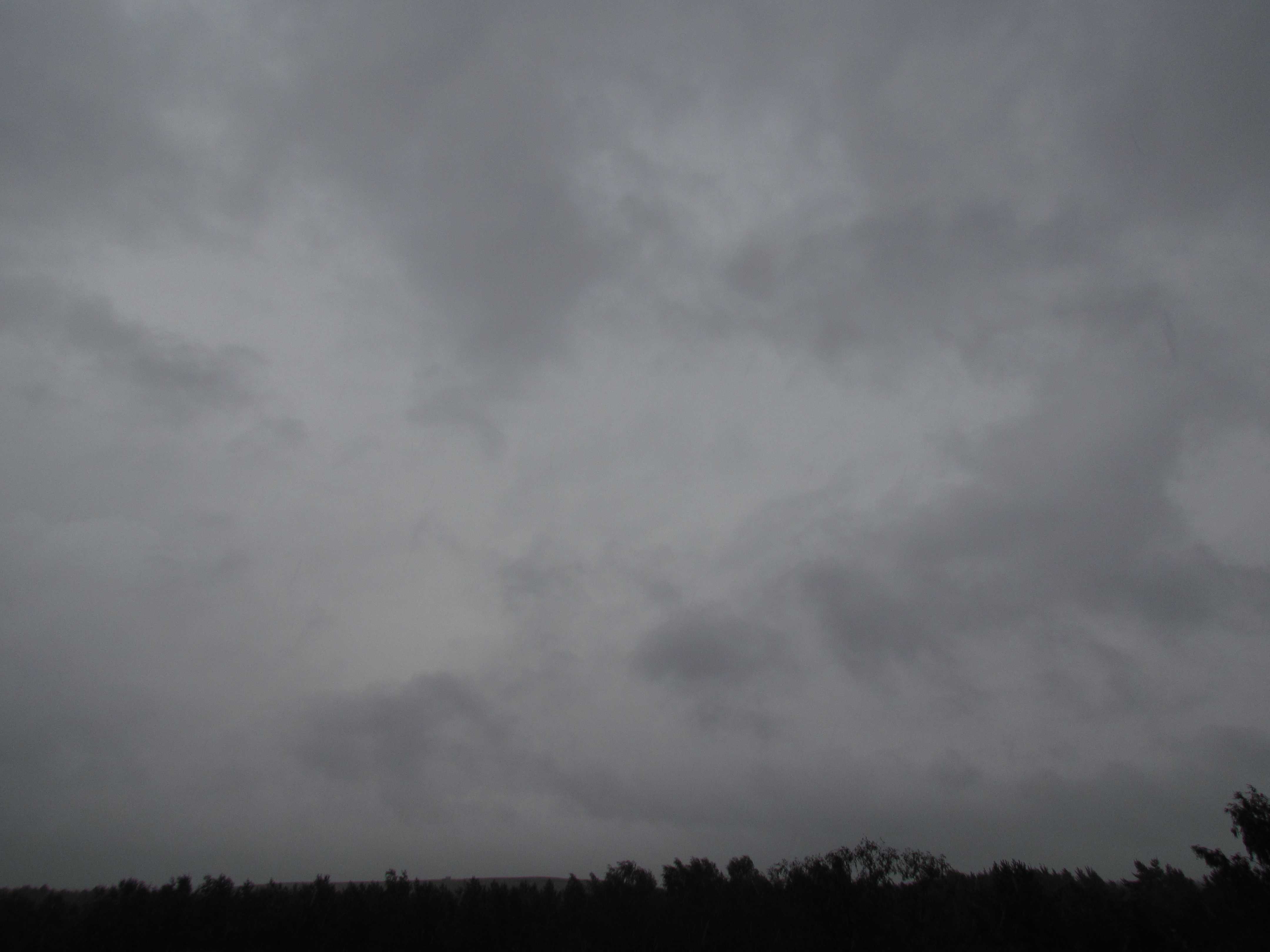
Nimbostratus praecipitatio cumulonimbogenitus with Stratus fractus of wet weather
Nimbostratus is a grey layer of cloud, often dark, with a diffuse appearance caused by more or less continuously falling rain or snow that in most cases reaches the ground. It is thick enough throughout to obscure the Sun. In this photograph, Nimbostratus is the lighter grey background cloud. The darker, ragged, fragmented cloud in the foreground is Stratus fractus, which quickly and continually changes outlines. As it formed due to an increasingly moist layer beneath the Nimbostratus, caused by the partial evaporation of the precipitation, it is Stratus fractus of wet weather. Earlier in the day, Cumulonimbus cloud with heavy rain showers was experienced, but then this changed to the cloud genus Nimbostratus with continuous rain (supplementary feature praecipitatio), which was heavy at times. This is therefore an example of Nimbostratus cumulonimbogenitus.
Links in the image description will highlight features on the image. Mouse over the features for more detail.
© Jüri KamenikPääsküla, Tallinn, EstoniaLatitude: 59° 21' 37'' NLongitude: 24° 37' 56'' E15 July 2012 1815 (Local Time)Camera direction: towards ECL = 7, CM = 2, CH = /Image P/S code: P.6.7Image I.D.: 5144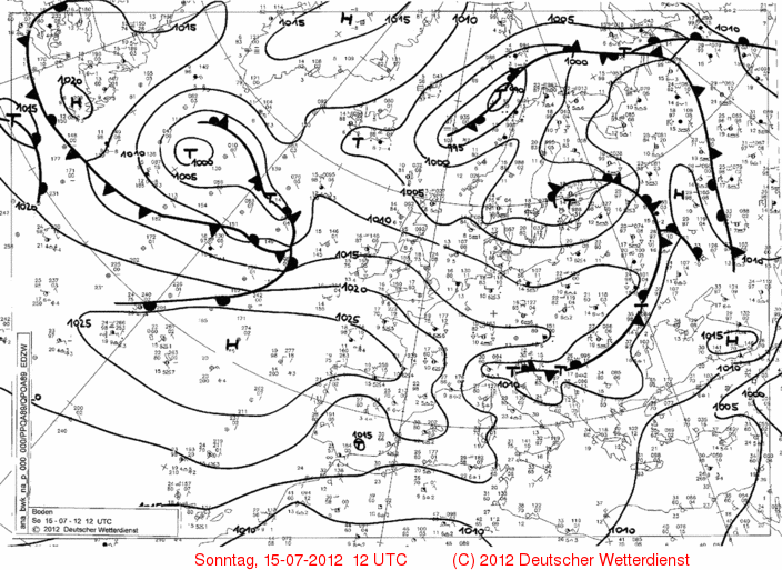
At 1200 UTC, a secondary low of about 1 000 hPa was centred over Estonia. It caused heavy rain showers earlier in the day, which later turned into continuous rain in the vicinity of the image location near Tallinn.
© Deutscher Wetterdienst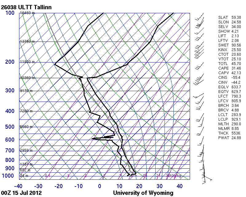
The Tallinn, Estonia (WMO 26038) sounding, taken much earlier in the day, shows a mostly stable but moist air mass. There is instability between 800 and 650 hPa. Winds are southerly at low and medium levels and south-westerly at high levels.
© University of Wyoming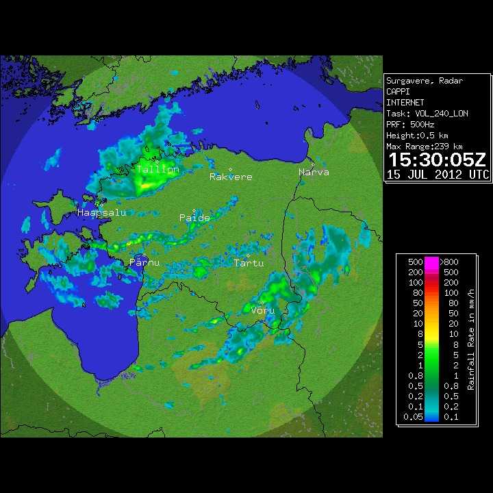
The weather radar image shows lines of showers over the centre and south-east of Estonia. In the north-west over Tallinn (the photo image area), a larger area of precipitation is visible. The intensity in this area is relatively uniform, confirming the likely presence of Nimbostratus.
© Estonian Weather Service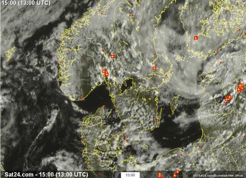
In this 1300 UTC visual satellite image, spiral bands of cloud indicate the centre of low pressure over northern Estonia. The whiter cloud with thunderstorms, near the south of Estonia, confirms the presence of a nearby Cumulonimbus earlier in the day. Over most of Estonia the cloud is more or less continuous; this includes the image site near Tallinn, where the mottled effect indicates a probable mixture of cloud genera.
© Sat24.com/Eumetsat/Met Office