© Matthew Clark
Burley in Wharfedale, West Yorkshire, United Kingdom of Great Britain and Northern Ireland
Latitude: 53° 54' 42'' N
Longitude: 1° 45' 30'' W
22 December 2011 1415 (Local Time)
Camera direction: towards N
Image P/S code: P.4.3
Image I.D.: 5149
CL = 8, CM = 4, CH = 0
-
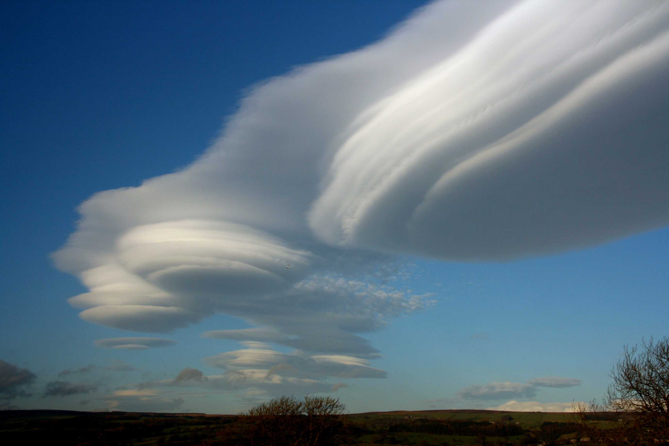
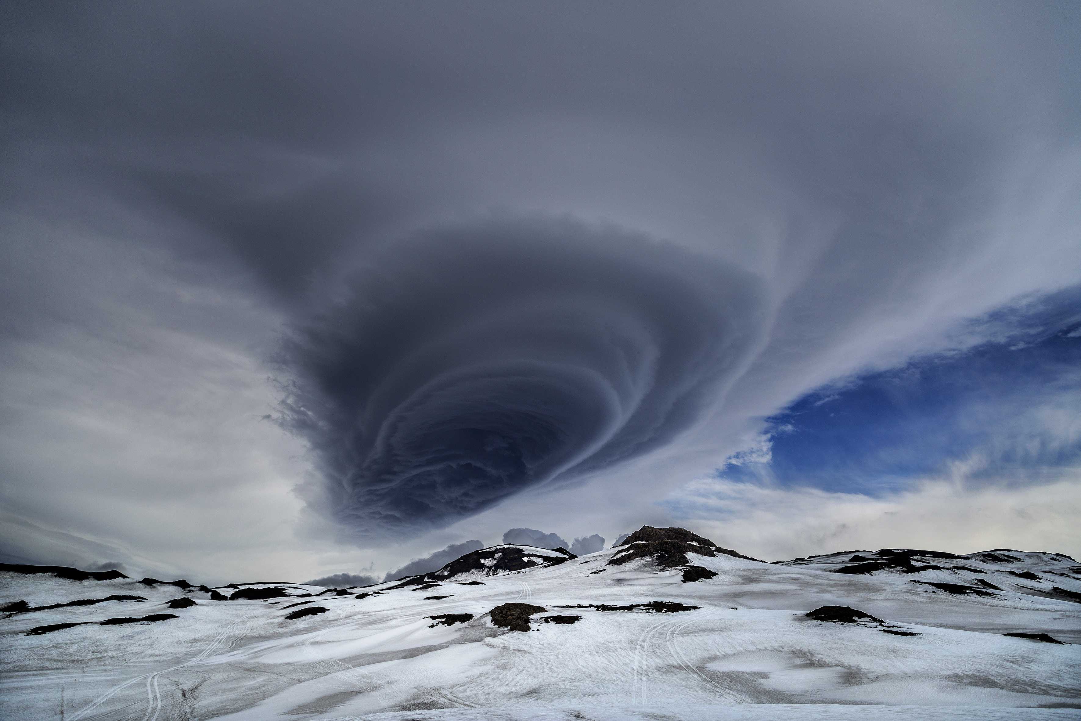
Altocumulus lenticularis to the lee of the Pennines, England, UK
These Altocumulus lenticularis clouds formed over and immediately to the lee of the Yorkshire Pennines, England, UK, within the broad warm sector of a depression centred near 60°N 26°W. The warm sector was characterized by a stable west to south-westerly flow, with anticyclonic curvature around the northern flank of a 1 034-hPa anticyclone centred over the Bay of Biscay.
The clouds persisted for several hours between 1100 and 1530 hours local time, but were best formed between 1400 and 1530 hours. During this period, the largest cloud formed a near-stationary, north-south orientated band whose axis was displaced some 20–30 km east of the highest Pennine hills in the Yorkshire Dales. Satellite imagery indicated cloud top heights in the range from 6 000 m (20 000 ft) to more than 7 500 m (25 000 ft). UK Met Office laser cloud base recorders at Dishforth and Linton-on-Ouse detected cloud base heights in the range of 5 200 to 5 500 m (17 000 to 18 000 ft). The clouds were visible over a large part of northern England, following the dissipation of a lower layer of Stratocumulus clouds during the morning.
Small regions of fluctus (Kelvin-Helmholtz billows) can be seen on the western (upwind) flank of the main cloud, towards the top, right-hand corner of the photo.
Cumulus fractus of fine weather, frayed by strong and turbulent winds, and a patch of residual Stratocumulus can be seen near the horizon.
Links in the image description will highlight features on the image. Mouse over the features for more detail.
© Matthew ClarkBurley in Wharfedale, West Yorkshire, United Kingdom of Great Britain and Northern IrelandLatitude: 53° 54' 42'' NLongitude: 1° 45' 30'' W22 December 2011 1415 (Local Time)Camera direction: towards NCL = 8, CM = 4, CH = 0Image P/S code: P.4.3Image I.D.: 5149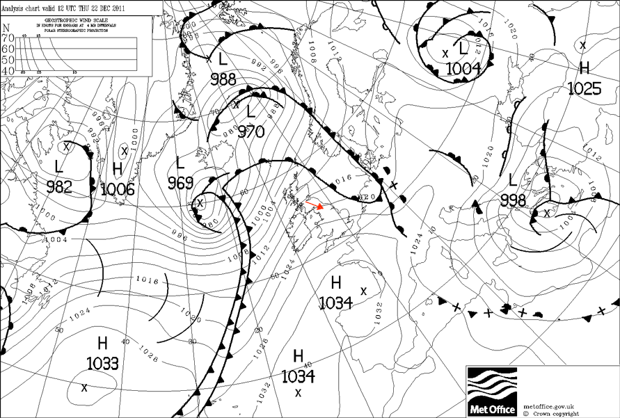
Tight pressure gradient between a deep low pressure system in the North Atlantic Ocean and a large high pressure system in the Bay of Biscay
© Crown Copyright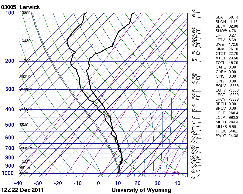
The sounding is from Lerwick, Scotland, UK at 1200 UTC. Unfortunately, no 1200 UTC soundings appear to have been made at the stations of Albemarle or Nottingham, Watnall in England, UK, or at Castor Bay, Northern Ireland, UK, which were all closer to where the photo was taken.
© University of Wyoming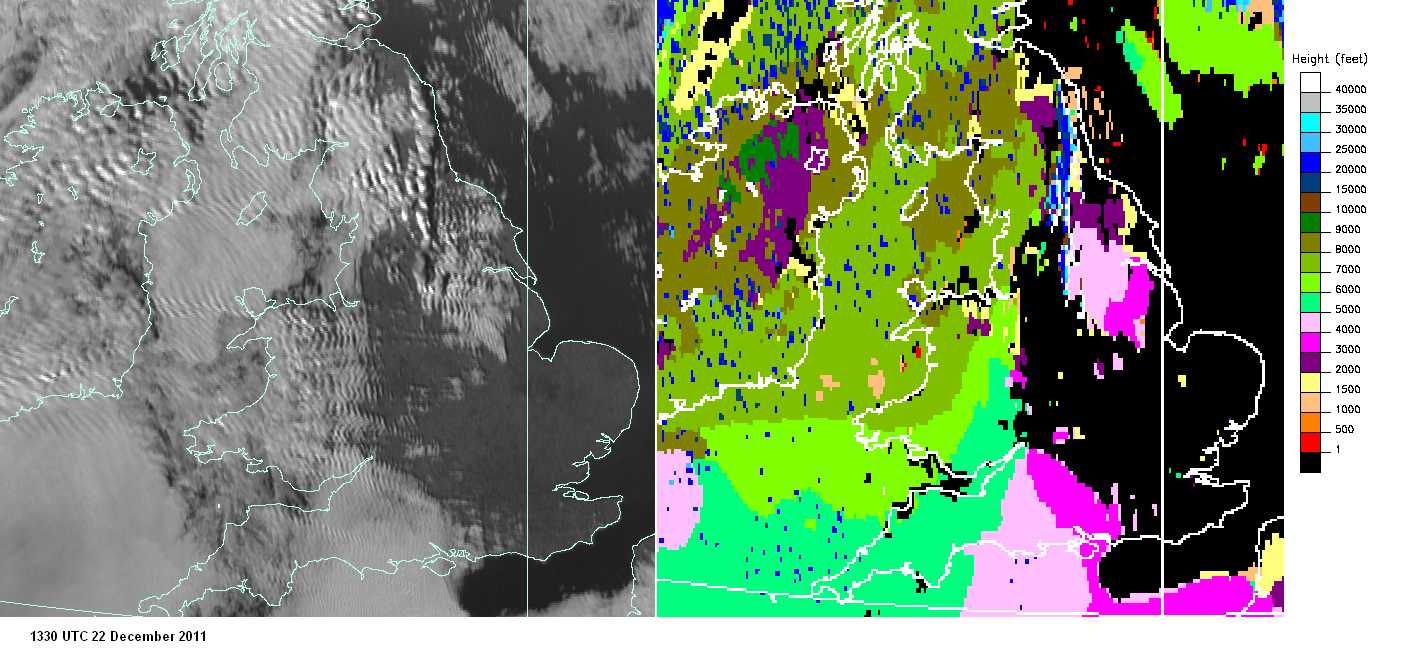
Visible satellite imagery (left) and satellite-derived cloud top heights (right) at 1330 UTC on 22 December 2011. In the visible imagery, the Altocumulus lenticularis is not easily distinguishable from the surrounding Stratocumulus, but their location is revealed by the distinct shadow cast to the east of the clouds, which stands out as a narrow, north-south orientated dark band extending from Northumberland to North Yorkshire, UK. The Altocumulus is easily distinguishable in the cloud top height imagery by its much higher cloud top heights of over 6 000 m (20 000 ft), compared to the approximately 7 000-ft (2 100 m) tops associated with the Stratocumulus to the west over Cumbria, and the approximately 2 000 to 4 000-ft (600 to 1 200 m) tops of Stratus and Stratocumulus to the east over other parts of Yorkshire.
© EUMETSAT, 2011 / Met Office
Altocumulus lenticularis duplicatus and Cumulus
This is a spectacular example of Altocumulus lenticularis duplicatus. There are multiple stacked lens- or almond-shaped patches; these patches are increasing in size with height. The mountain waves responsible for this cloud are also reflected in the extensive layer of undulating Altostratus above the lenticularis. Some Cumulus mediocris and fractus are behind the ridge.
Links in the image description will highlight features on the image. Mouse over the features for more detail.
© Gréta S. GuðjónsdóttirSouth, IcelandLatitude: 63° 37' 52'' NLongitude: 19° 27' 30'' W27 June 2015 2000 (Local Time)Camera direction: towards NCL = 2, CM = 4, CH = /Image P/S code: S.4.3 7Image I.D.: 4719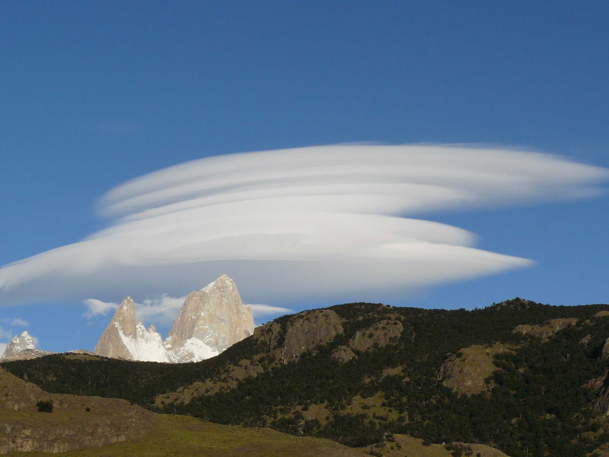
Altocumulus lenticularis duplicatus over Monte Fitz Roy
Classic Altocumulus lenticularis consists of very elongated patches in the shape of a lens or almond. In this example there are multiple stacked patches, making it the variety duplicatus.
There is what appears to be Cumulus fractus of good weather behind the Monte, Argentina.
Links in the image description will highlight features on the image. Mouse over the features for more detail.
© Fabien GilletEl Chaltén, Santa Cruz Province, ArgentinaLatitude: 49° 19' 53'' SLongitude: 72° 53' 11'' W05 January 2008 1333 (Local Time)Camera direction: towards NWCL = 1, CM = 4, CH = 0Image P/S code: S.4.3 6Image I.D.: 4720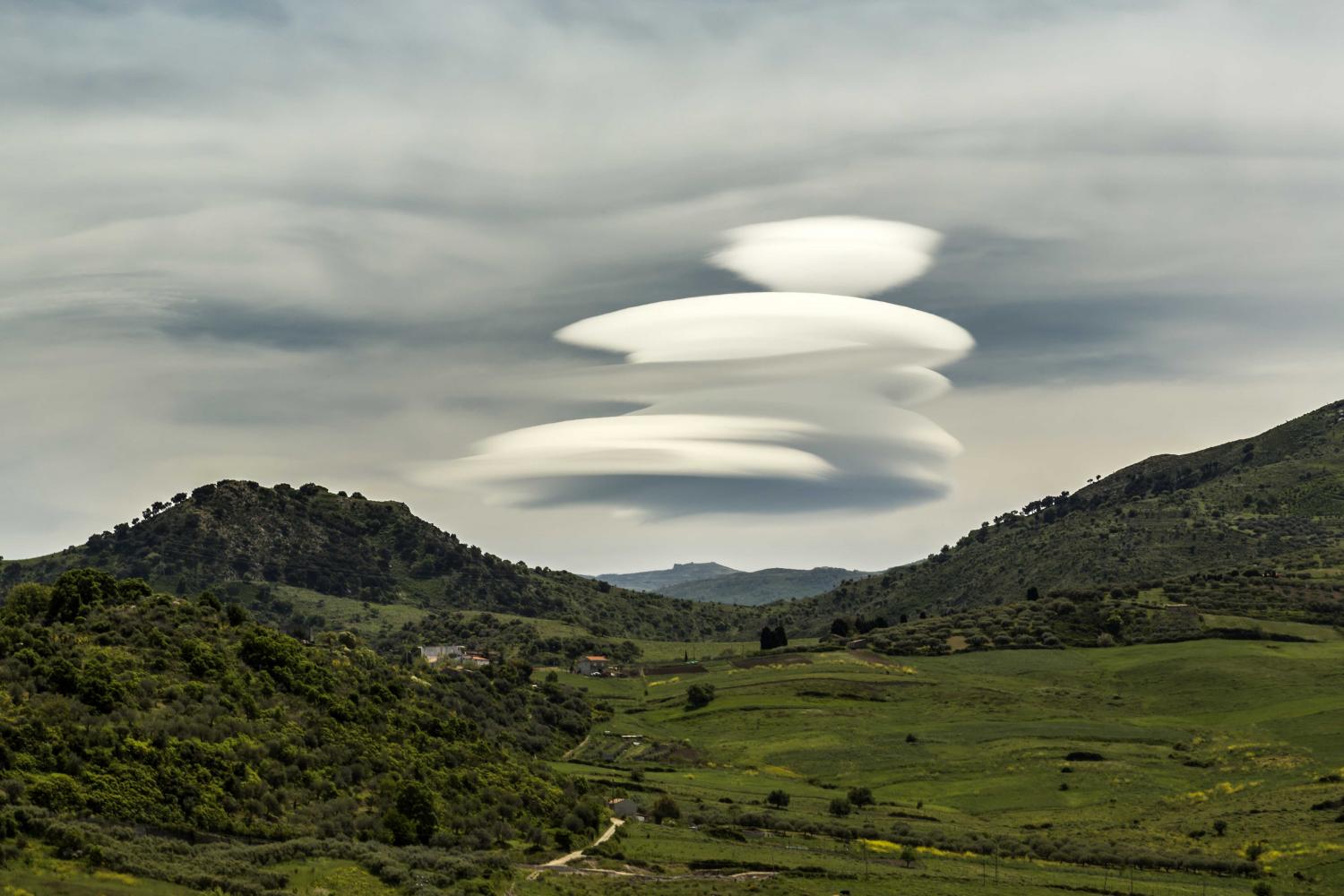
Altocumulus lenticularis duplicatus
Altostratus translucidus undulatus duplicatus. A mountain wave is reflected in the overcast thick Cirrostratus, part of which has thickened sufficiently to be identified as Altostratus.
Links in the image description will highlight features on the image. Mouse over the features for more detail.
© Fabrizio Micalizzi98066 Patti, Province of Messina, ItalyLatitude: 38° 4' 30'' NLongitude: 15° 0' 33'' E02 May 2015 1219 (Local Time)Camera direction: towards SECL = 0, CM = 7, CH = 7Image P/S code: S.4.3 8Image I.D.: 4734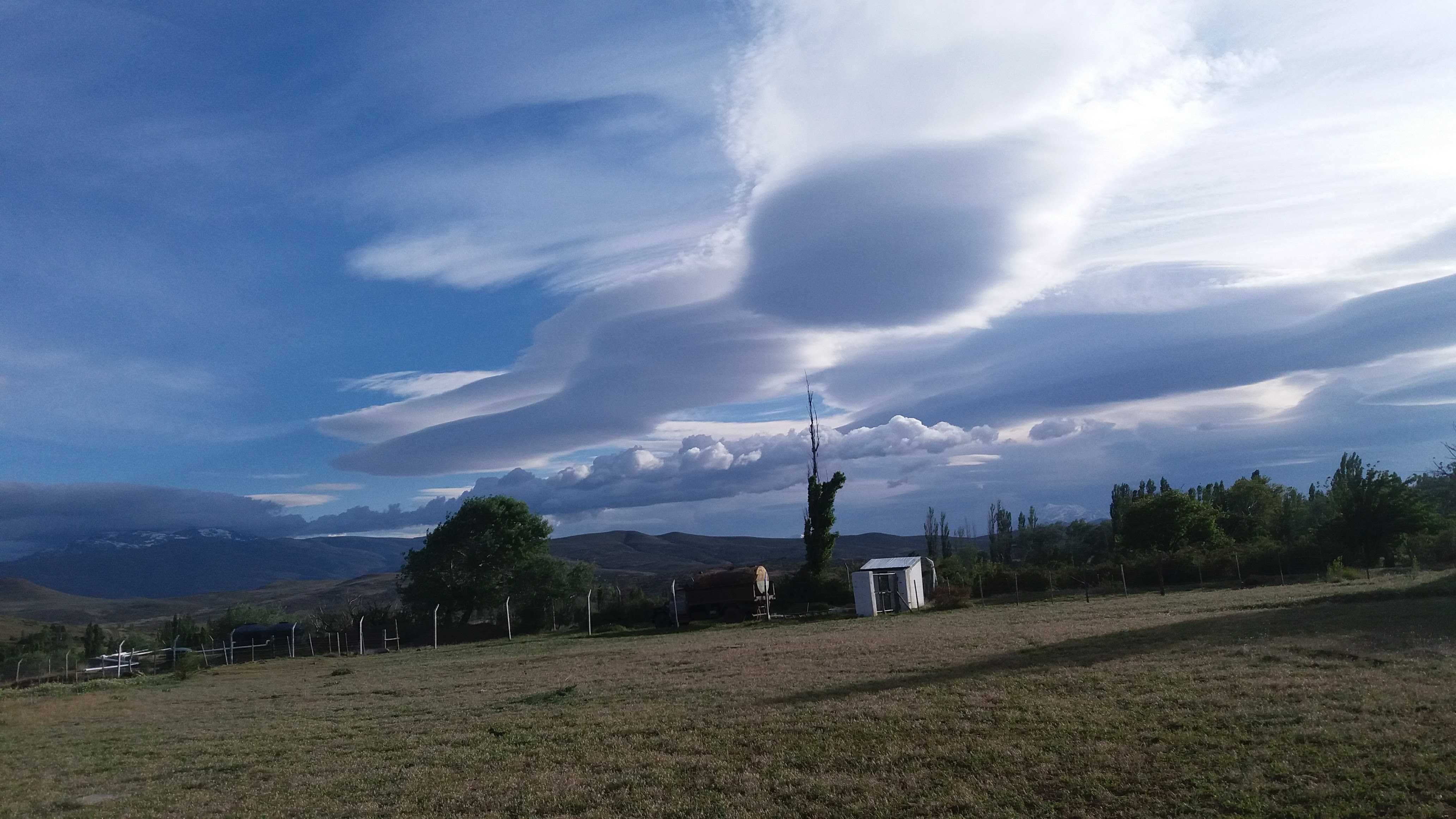
Altocumulus lenticularis and rotor clouds
This picture shows orographic clouds in the lee of the Andes mountains during a foehn wind event. Prominent in the centre and on the right are Altocumulus lenticularis wave clouds. More than one wave layer is visible, indicating the variety duplicatus. Orographic Cirrus has formed above. The line of Cumulus has likely formed on a rotor, which is an eddy of air rotating along a horizontal axis. On the left of the image is a bank of Stratocumulus.
Links in the image description will highlight features on the image. Mouse over the features for more detail.
© Maximiliano VialeEl Cholar, Neuquén, ArgentinaLatitude: 37° 26' 35'' SLongitude: 70° 38' 31'' W31 October 2016 0514 (Local Time)Camera direction: towards NWCL = 8, CM = 4, CH = 1Image P/S code: S.4.3Image I.D.: 6083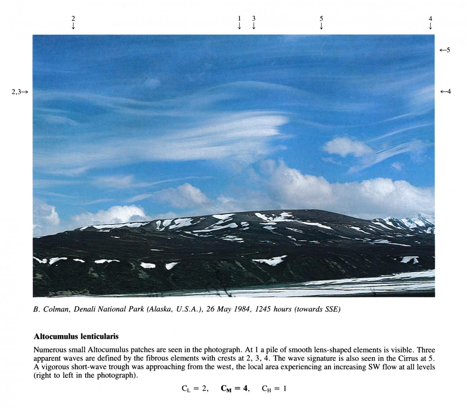
Altocumulus lentcularis
Numerous small Altocumulus patches are seen in the photograph. At 1 a pile of smooth lens-shaped elements is visible. Three apparent waves are defined by the fibrous elements with crests at 2, 3, 4. The wave signature is also seen in the Cirrus at 5. A vigorous short-wave trough was approaching from the west, the local area experiencing an increasing SW flow at all levels (right to left in the photograph).
Links in the image description will highlight features on the image. Mouse over the features for more detail.
© B. ColmanDenali National Park, Alaska, United States of AmericaLatitude: 63° 6' 53'' NLongitude: 151° 11' 33'' W26 May 1984 1245 (Local Time)Camera direction: towards SSECL = 2, CM = 4, CH = 1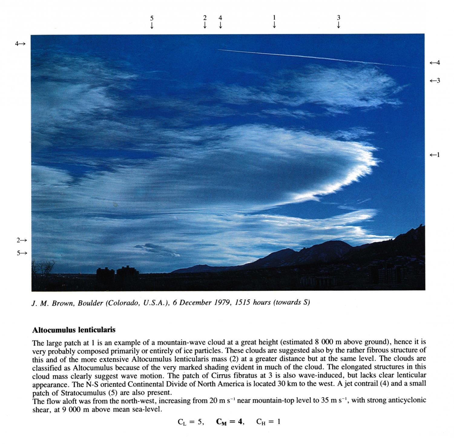
Altocumulus lenticularis
The large patch at 1 is an example of a mountain-wave cloud at a great height (estimated 8 000 m above ground), hence it is very probably composed primarily or entirely of ice particles. These clouds are suggested also by the rather fibrous structure of this and of the more extensive Altocumulus lenticularis mass at a greater distance but at the same level. The clouds are classified as Altocumulus because of the very marked shading evident in much of the cloud. The elongated structures in this cloud mass clearly suggest wave motion. The patch of Cirrus fibratus at 3 is also wave-induced, but lacks clear lenticular appearance. The N-S oriented Continental Divide of North America is located 30 km to the west. A jet contrail and a small patch of Stratocumulus are also present. The flow aloft was from the north-west, increasing from 20 m s-1 near mountain-top level to 35 m s-1, with strong anticyclonic shear, at 9 000 m above mean sea-level.
CL = 5, CM = 4, CH = 1
Links in the image description will highlight features on the image. Mouse over the features for more detail.
© J.M. BrownBoulder, Colorado, United States of AmericaLatitude: 40° 0' 54'' NLongitude: 105° 16' 14'' W06 December 1979 1515 (Local Time)Camera direction: towards SCL = 2, CM = 4, CH = 1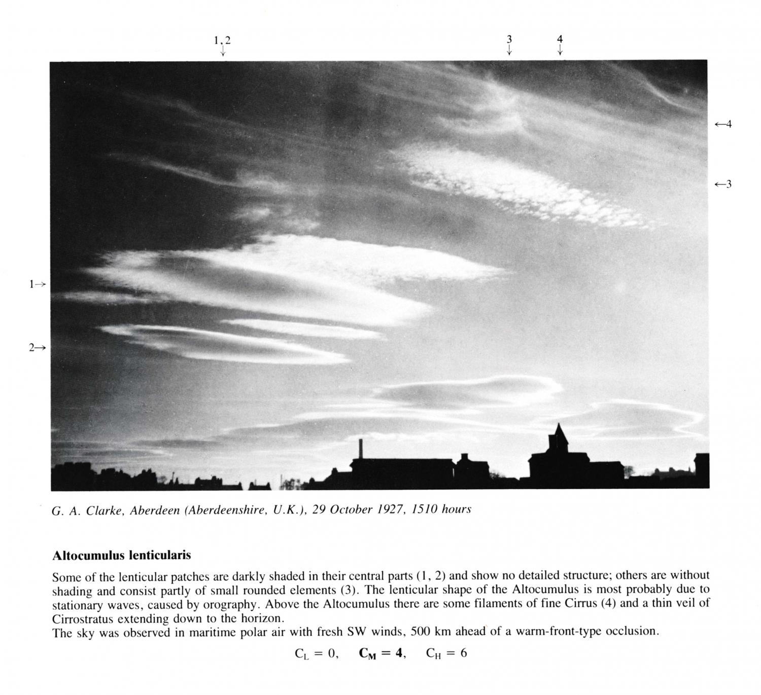
Altocumulus lenticularis
Some of the lenticular patches arc darkly shaded in their central parts at 1, 2 and show no detailed structure; others are without shading and consist partly of small rounded elements. The lenticular shape of the Altocumulus is most probably due to stationary waves, caused by orography. Above the Altocumulus there are some filaments of fine Cirrus and a thin veil of Cirrostratus extending down to the horizon. The sky was observed in maritime polar air with fresh SW winds, 500 km ahead of a warm-front-type occlusion.
Links in the image description will highlight features on the image. Mouse over the features for more detail.
© G.A. ClarkeAberdeen, Aberdeenshire, United Kingdom of Great Britain and Northern IrelandLatitude: 57° 13' 4'' NLongitude: 2° 10' 56'' W29 October 1927 1510 (Local Time)CL = 0, CM = 4, CH = 6