© Imre Dér
Doha International Airport, Doha, Qatar
Latitude: 25° 15' 38'' N
Longitude: 51° 36' 50'' E
23 May 2012 0851 (Local Time)
Image P/S code: P.12.1.2
Image I.D.: 5439
-
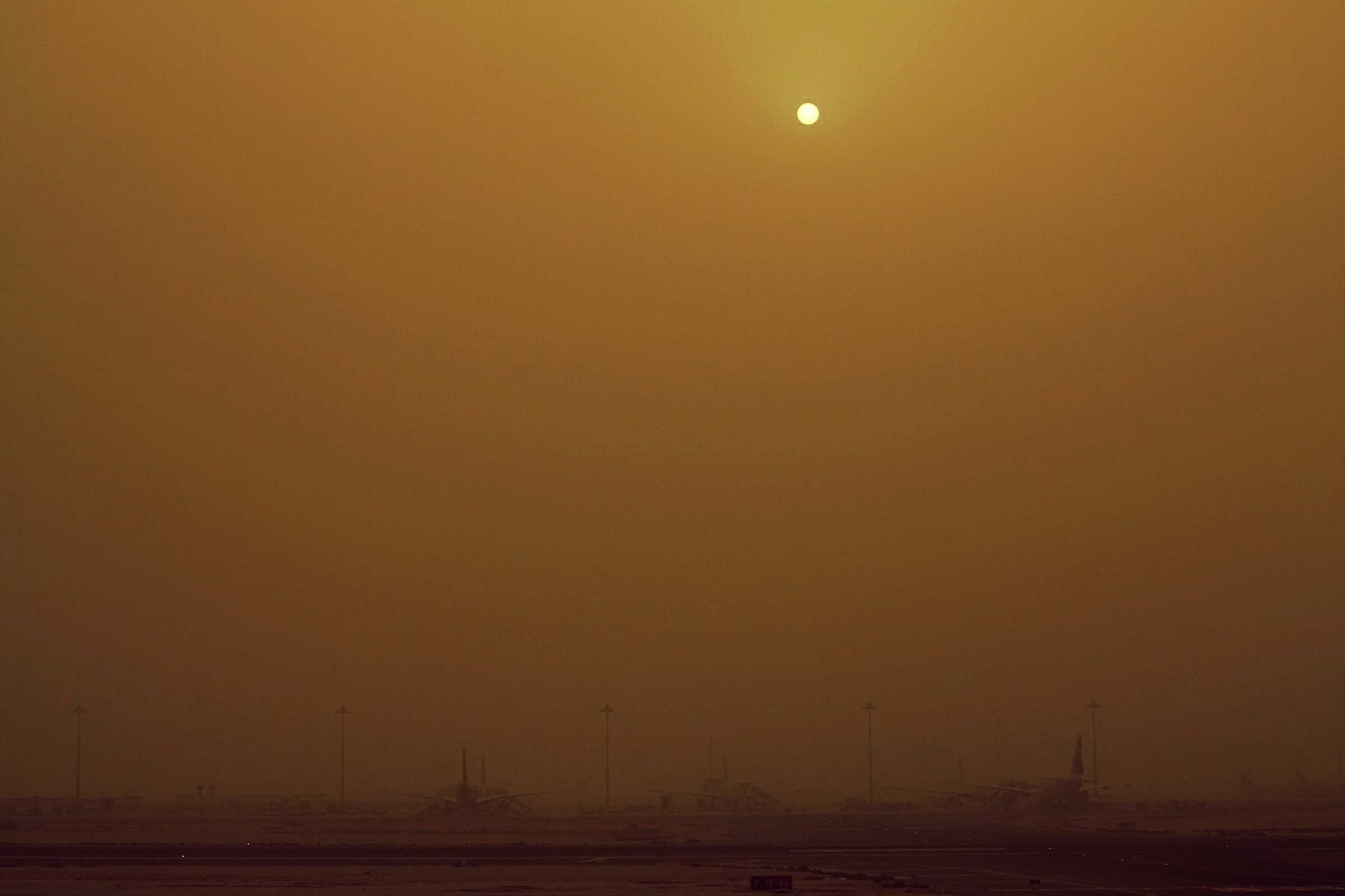
Dust haze
Dust haze is a suspension in the air of dust or small sand particles, raised from the ground prior to the time of the observation by a dust storm or sandstorm that occurred either at or near the location, or far away from it.
In this picture from Doha Airport in Qatar, the visibility is significantly reduced to about 1 200 m by a large amount of dust in the atmosphere that has been blown from afar on a strong shamal wind. The surface wind was from the north-north-west at 19 kt.
Links in the image description will highlight features on the image. Mouse over the features for more detail.
© Imre DérDoha International Airport, Doha, QatarLatitude: 25° 15' 38'' NLongitude: 51° 36' 50'' E23 May 2012 0851 (Local Time)Image P/S code: P.12.1.2Image I.D.: 5439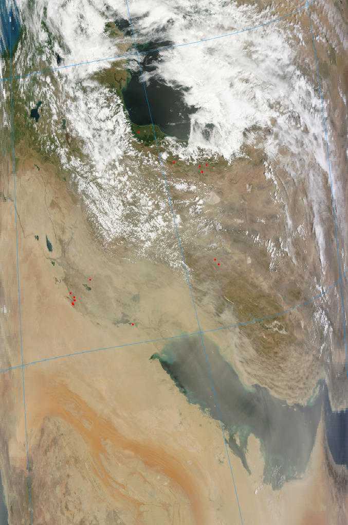
This satellite image (Terra MODIS bands 1-4-3 (true colour)) at 0730 UTC shows dust over the Persian Gulf.
© Credit NASA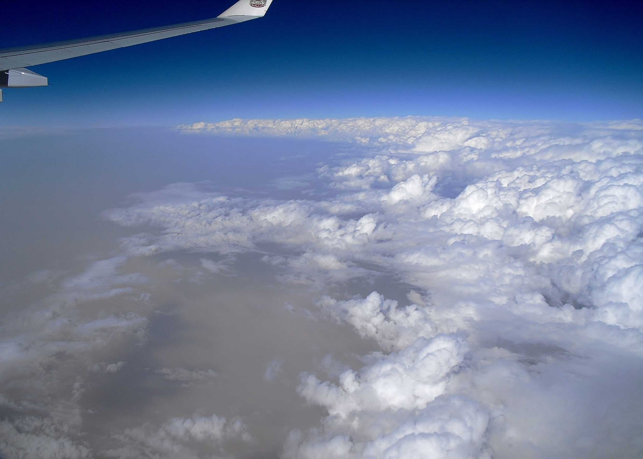
Cumulus congestus and dust
The image shows an area of convection from about 10 400 m (34 000 ft) over southern Iraq. The cloud is mainly Cumulus congestus, indicated by sharp outlines and a lumpy cauliflower appearance. Small amounts of Cumulonimbus (upper centre) and Altocumulus (centre left) can be seen. To the left, the sky is cloudless and ground shadows (lower left) are diffuse due to thick dust haze in the lower atmosphere, resulting from strong surface winds. Nasiriya, Iraq (WMO 40676) reported 200 m visibility in a dust storm and sharply falling pressure at 1500 hours and 5 km in dust haze at 1800 hours.
Links in the image description will highlight features on the image. Mouse over the features for more detail.
© Frank Le BlancqSouthern IraqLatitude: 31° 24' 36'' NLongitude: 47° 19' 24'' E20 February 2011 1526 (Local Time)Camera direction: towards ENEImage P/S code: S.9.3 2Image I.D.: 5127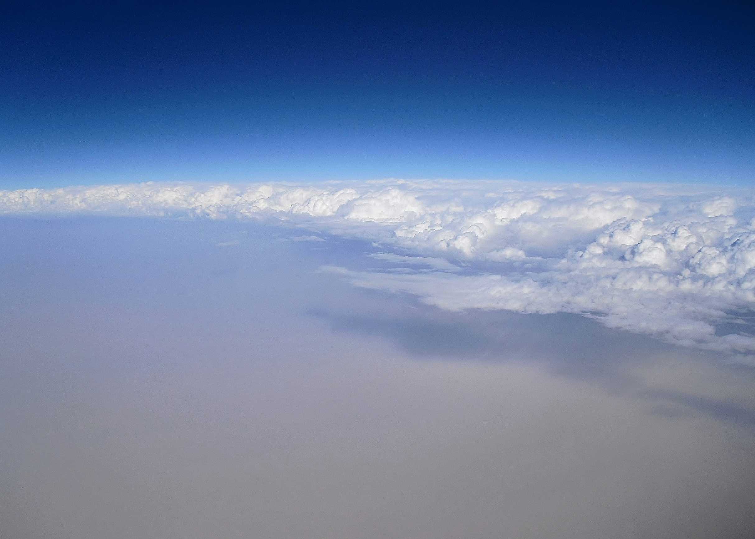
Cumulus congestus and dust
The image shows the clearance of an area of convection seen from 10 400 m (34 000 ft) over southern Iraq. The cloud is mainly Cumulus congestus, identified by sharp outlines and a lumpy cauliflower appearance. Some Cumulonimbus can also be seen at 2 and 3, while Altocumulus (centre right) is trailing behind the main cloud clearance. Behind the front the sky is cloudless, but there is widespread thick dust haze in the lower atmosphere. Nasiriya, Iraq (WMO 40676) reported 200 m visibility in a dust storm at 1500 hours and 5 km in dust haze at 1800 hours.
Links in the image description will highlight features on the image. Mouse over the features for more detail.
© Frank Le BlancqSouthern IraqLatitude: 31° 43' 30'' NLongitude: 47° 10' 19'' E20 February 2011 1529 (Local Time)Camera direction: towards ESEImage P/S code: S.9.3 1Image I.D.: 5128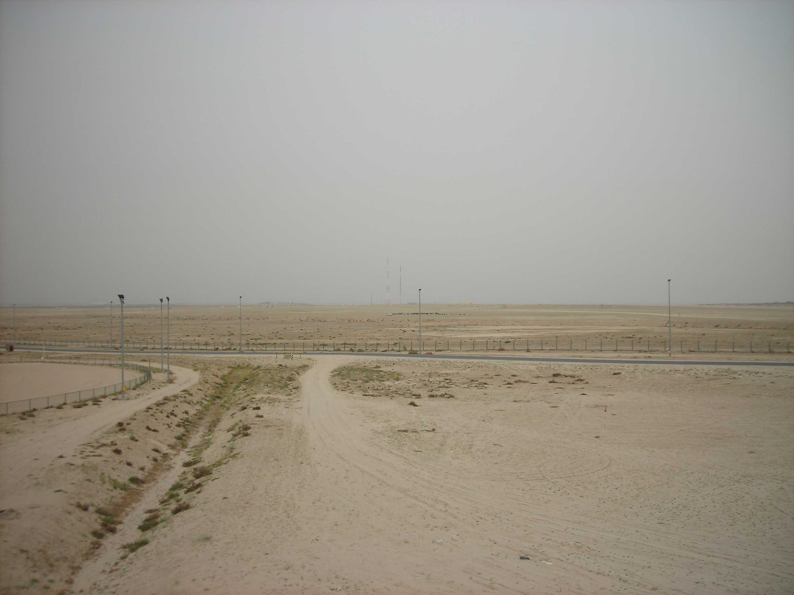
Arrival of a dust storm/sandstorm
In this second picture in the series, the visibility is similar to the previous image; however, note that the sky colour has changed. There is now a suspension in the air of dust or small sand particles (dust haze), raised from the ground as a result of strong winds some distance away from the location.
Links in the image description will highlight features on the image. Mouse over the features for more detail.
© Peter SundenCamp Arifjan, Al Ahmadi Governorate, KuwaitLatitude: 28° 55' 12'' NLongitude: 48° 9' 0'' E10 April 2007 0800 (Local Time)Image P/S code: S.12.2.2Image I.D.: 5611