© Michael Bruhn
Richmond near Hobart, Tasmania, Australia
Latitude: 42° 44' 4'' S
Longitude: 147° 26' 24'' E
21 August 2009 1202 (Local Time)
Camera direction: towards N
Image P/S code: P.5.9
Image I.D.: 5867
CL = 7, CM = 2, CH = /
-
Altostratus opacus pannus nimbostratomutatus
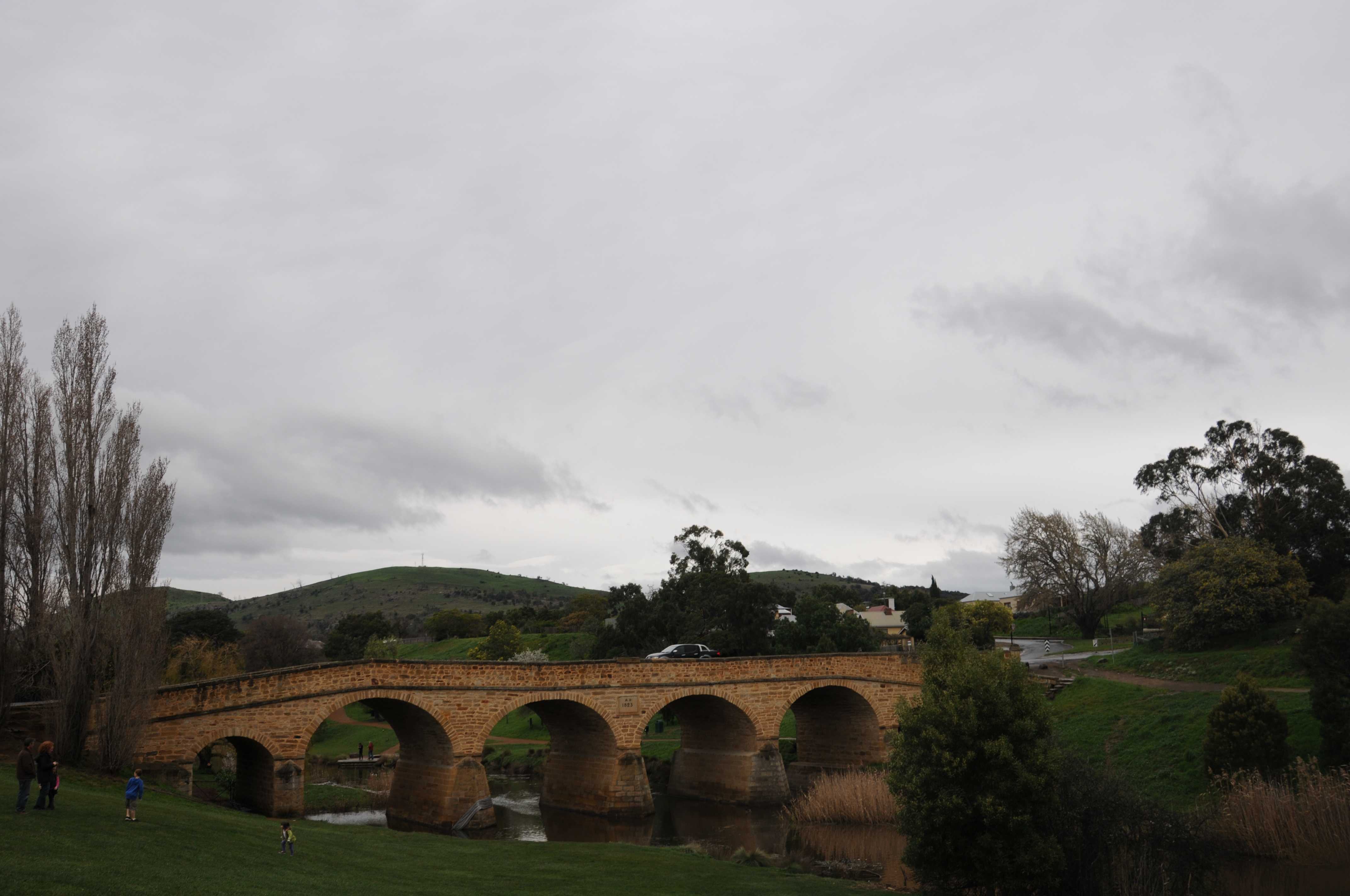
In this photograph, the sky is covered by a greyish sheet of Altostratus cloud. It is of the fairly uniform appearance often seen with Altostratus, although it is not completely uniform: some form is visible. The layer is sufficiently thick to obscure the Sun, hence it is of the variety opacus. About 25 minutes before the photograph was taken, rain was falling from Nimbostratus; therefore, this Altostratus evolved through thinning and lifting of the Nimbostratus and may be designated Altostratus nimbostratomutatus. Ragged low clouds are frequently seen below Altostratus and may or may not merge with the Altostratus. They form as a result of turbulence in the layers below the main cloud, moistened by evaporation from precipitation. In this image, we can see ragged shreds of Stratus fractus cloud of wet weather and Cumulus fractus, which have formed as the accessory cloud pannus.
Links in the image description will highlight features on the image. Mouse over the features for more detail.
© Michael BruhnRichmond near Hobart, Tasmania, AustraliaLatitude: 42° 44' 4'' SLongitude: 147° 26' 24'' E21 August 2009 1202 (Local Time)Camera direction: towards NCL = 7, CM = 2, CH = /Image P/S code: P.5.9Image I.D.: 5867
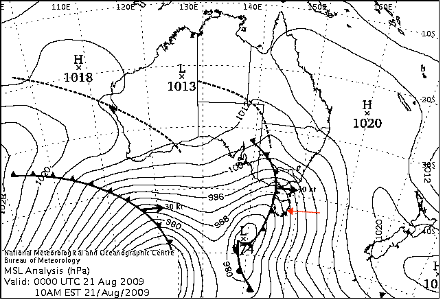
The pressure chart from 0900 hours local time shows a low centre of 974 hPa south-south-west of Tasmania, Australia. The associated cold front and rainband over western Tasmania was moving east towards the location of the photograph (indicated by the red arrow).
© Commonwealth of Australia 2009, Bureau of Meteorology
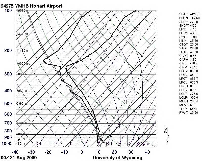
The Hobart Airport, Tasmania, Australia (WMO 94975) sounding from 0000 UTC shows a moist troposphere from the surface to the tropopause. It is particularly moist at medium levels, associated with the nearby cold front.
© University of Wyoming
