Loading...
© George Anderson
Northeast of Paris, France
Latitude: 49° 16' 48'' N
Longitude: 2° 42' 0'' E
17 August 2013 0802 (Local Time)
Camera direction: towards NE
Image P/S code: P.20.0
Image I.D.: 5884
-
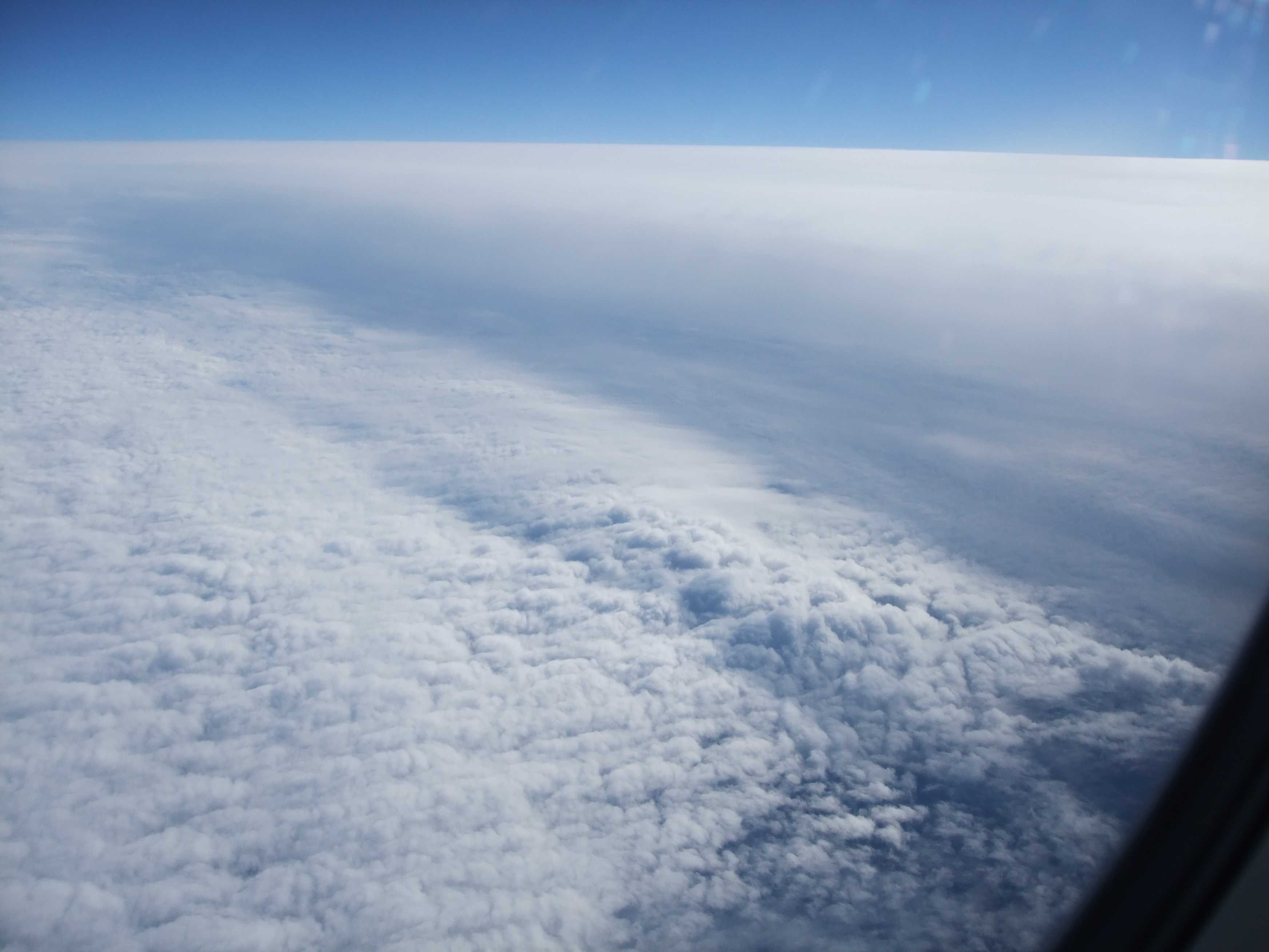
Approaching a weak cold front
Beneath the aircraft flying at about 11 300 m (37 000 ft) is a fairly extensive sheet of low-level convective cloud (Stratocumulus). At the top and right of the image is a “wall” of stratiform cloud associated with a weak cold front, which the aircraft is flying towards.
Links in the image description will highlight features on the image. Mouse over the features for more detail.
© George AndersonNortheast of Paris, FranceLatitude: 49° 16' 48'' NLongitude: 2° 42' 0'' E17 August 2013 0802 (Local Time)Camera direction: towards NEImage P/S code: P.20.0Image I.D.: 5884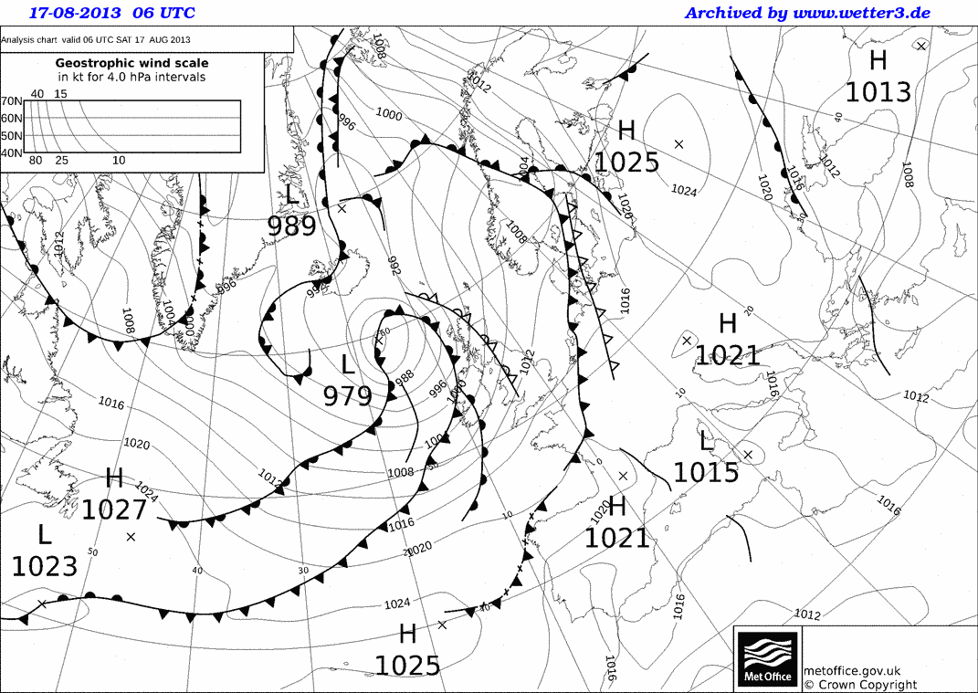
A weak cold front was moving south-eastwards over north-eastern France.
© Crown Copyright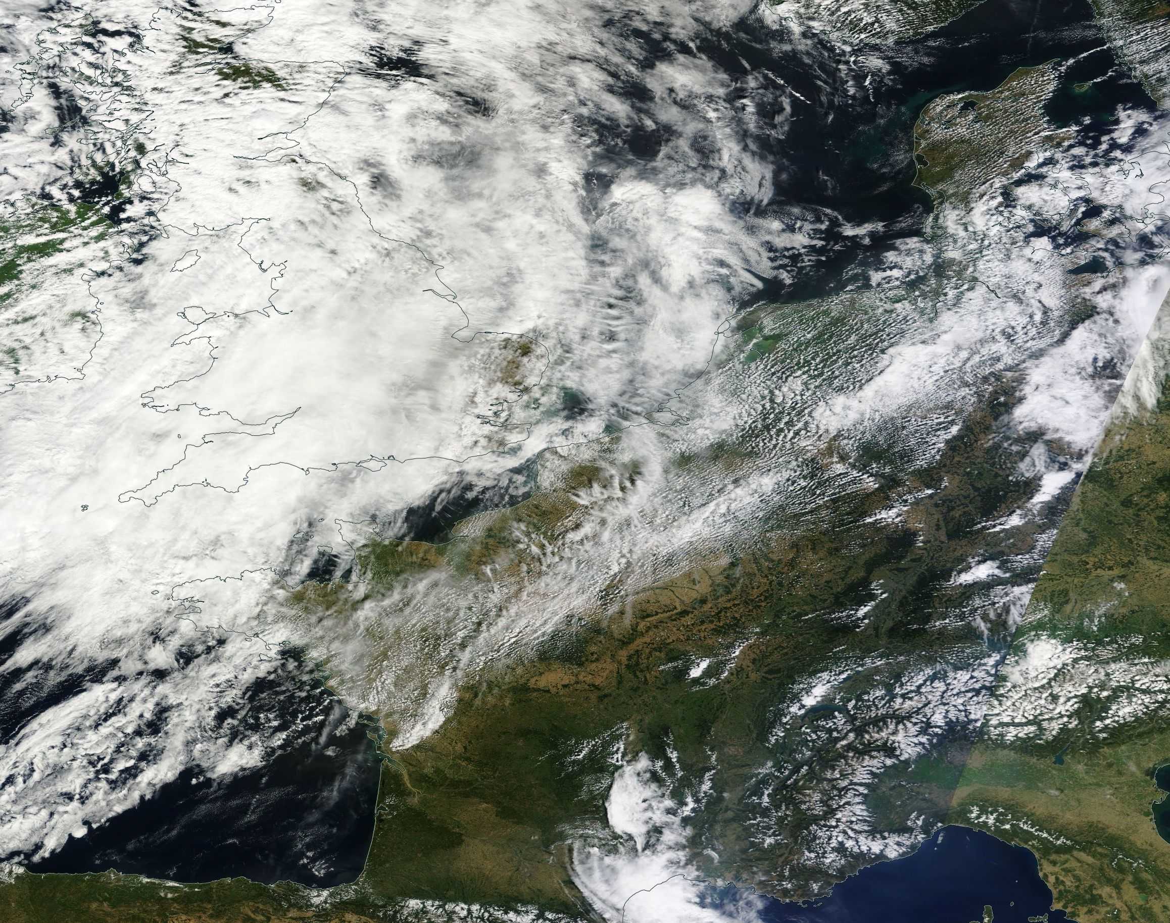
The Terra MODIS satellite image shows a weak frontal trough over north-eastern France.
© Credit NASA