© Dominic Hernandez
West Grove, Pennsylvania, United States of America
Latitude: 39° 49' 20'' N
Longitude: 75° 49' 39'' W
06 July 2015 1558 (Local Time)
Camera direction: towards E
Image P/S code: S.9.3
Image I.D.: 5912
CL = 2, CM = 0, CH = 1
-
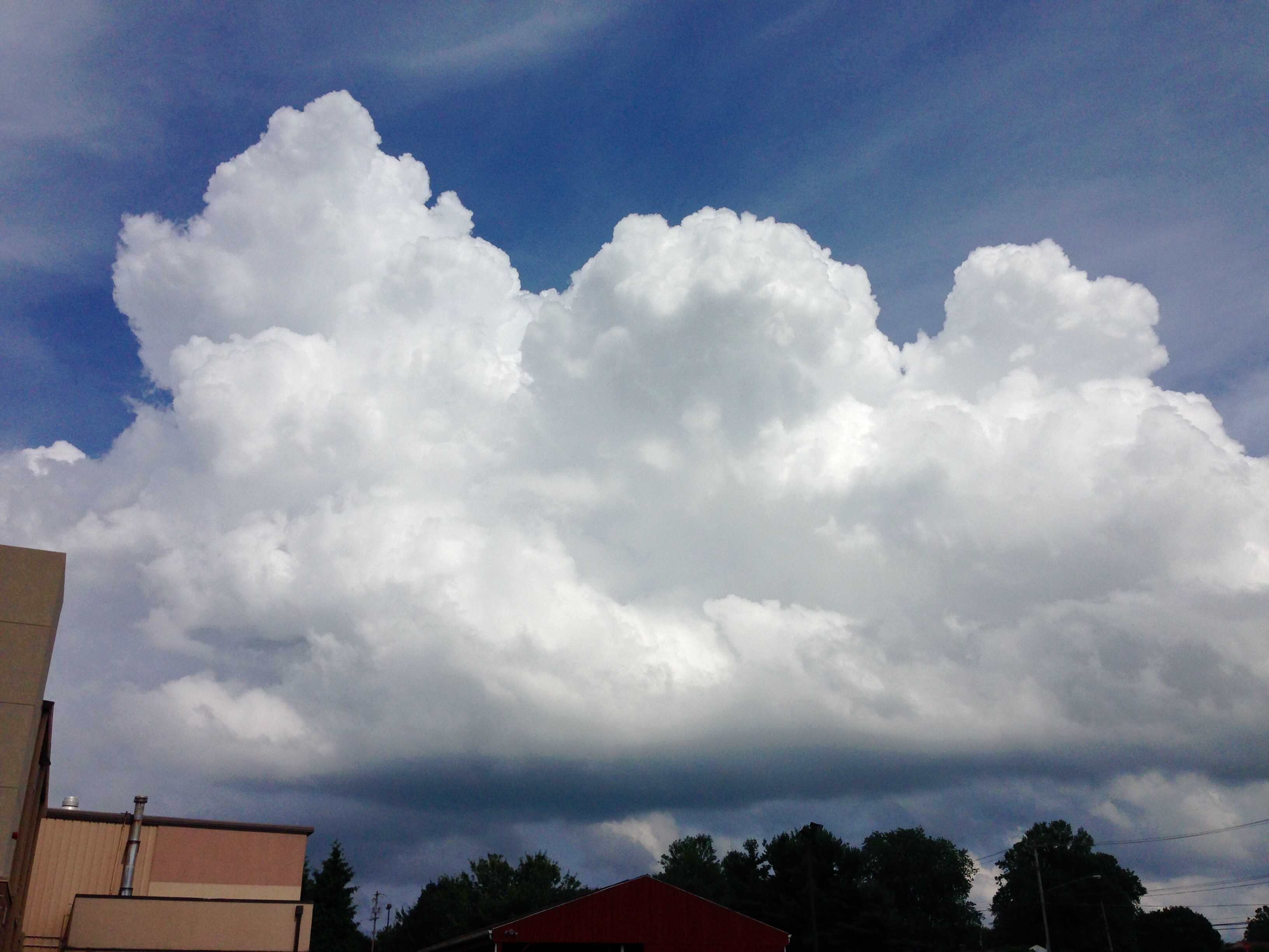
Cumulus congestus
Cumulus are detached clouds, generally dense and with sharp outlines. They develop vertically in the form of rising mounds, domes or towers. The sunlit parts are mostly brilliant white, with a relatively dark and nearly horizontal base. Cumulus congestus, as seen in this image, are strongly sprouting Cumulus clouds of moderate to strong vertical extent (at least 2 to 3 km) with the bulging upper part resembling a cauliflower. These clouds may produce precipitation in the form of showers, and in this instance a thunderstorm was reported in the vicinity shortly after the image was taken. Congestus usually develops from the species mediocris. Cirrus can be seen near the top of the image.
Links in the image description will highlight features on the image. Mouse over the features for more detail.
© Dominic HernandezWest Grove, Pennsylvania, United States of AmericaLatitude: 39° 49' 20'' NLongitude: 75° 49' 39'' W06 July 2015 1558 (Local Time)Camera direction: towards ECL = 2, CM = 0, CH = 1Image P/S code: S.9.3Image I.D.: 5912
The sounding from Sterling, Virginia, USA (WMO 72403), about 160 km upwind of the image location, shows a relatively moist and unstable atmosphere. Instability is most evident between 800 and 500 hPa.
© University of Wyoming