© Jarmo Koistinen
Espoo, Finland
Latitude: 60° 12' 12'' N
Longitude: 24° 38' 39'' E
14 August 2008 1801 (Local Time)
Camera direction: towards N
Image P/S code: P.9.15
Image I.D.: 5961
CL = 2, CM = 0, CH = 0
-
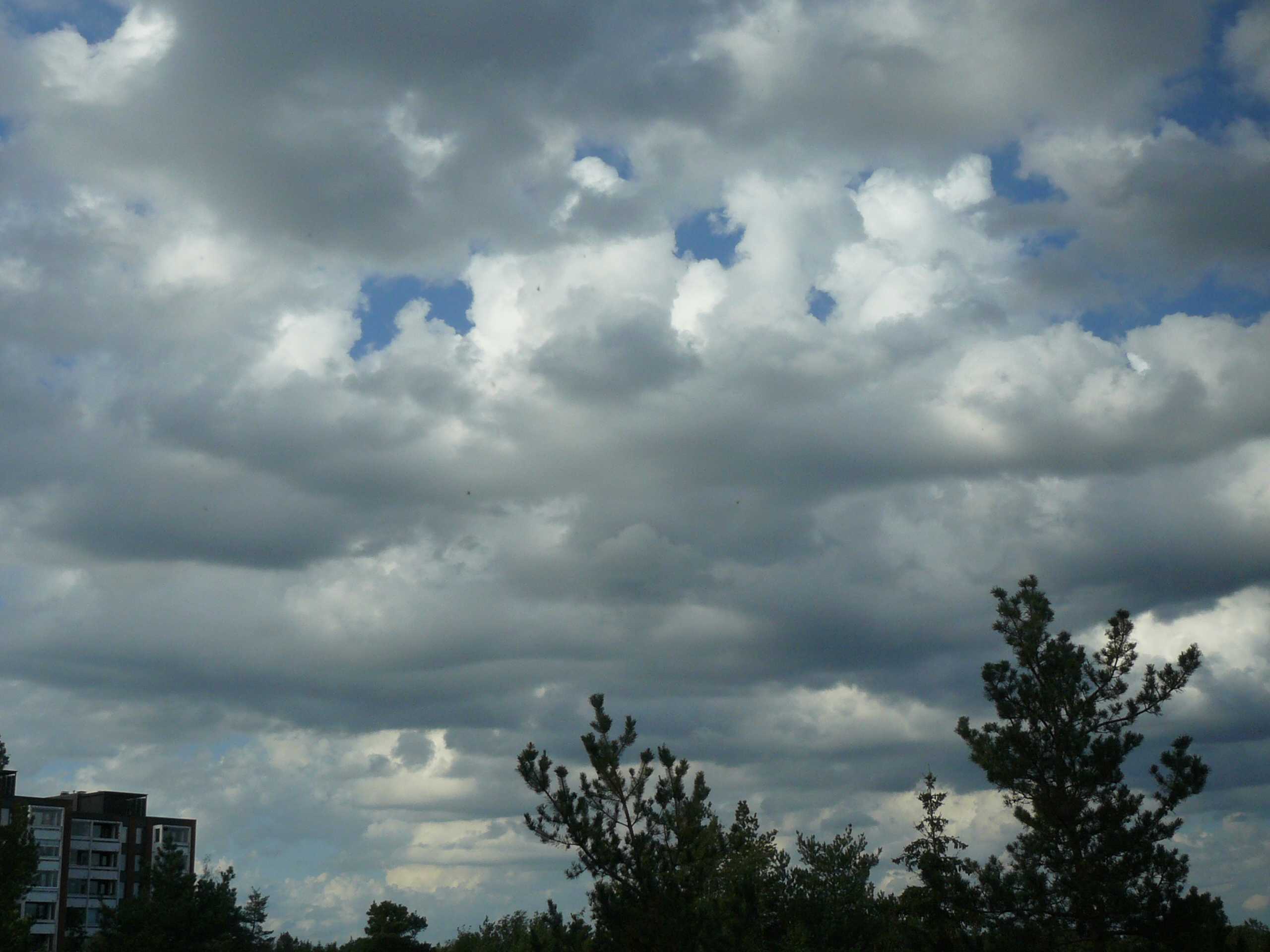
Cumulus congestus stratocumulogenitus
In this image, the clouds exhibit smooth, horizontal and common bases with some dark patches, rather like Stratocumulus. However, cumuliform masses in the form of active convective towers are clearly visible through gaps in the cloud. Careful examination of the top of the towers shows a cauliflower-like appearance in two places (3 and 4). This indicates that the towers are transitioning into Cumulus congestus (which is confirmed by the sounding), but also that they most likely evolved from Stratocumulus and may be designated stratocumulogenitus. There were rain showers in the vicinity before the image was taken. A nearby ceilometer measured the cloud base at a height of 1 300 m.
Links in the image description will highlight features on the image. Mouse over the features for more detail.
© Jarmo KoistinenEspoo, FinlandLatitude: 60° 12' 12'' NLongitude: 24° 38' 39'' E14 August 2008 1801 (Local Time)Camera direction: towards NCL = 2, CM = 0, CH = 0Image P/S code: P.9.15Image I.D.: 5961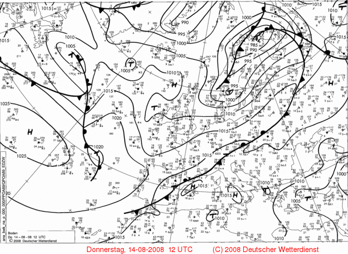
The synoptic chart shows deep low pressure (for the season) of 984 hPa centred over north Finland and a trough extending to south-west Norway. The image site was located in the moderate south-westerly flow of a modified polar maritime air mass on the southern flank of the low.
© Deutscher Wetterdienst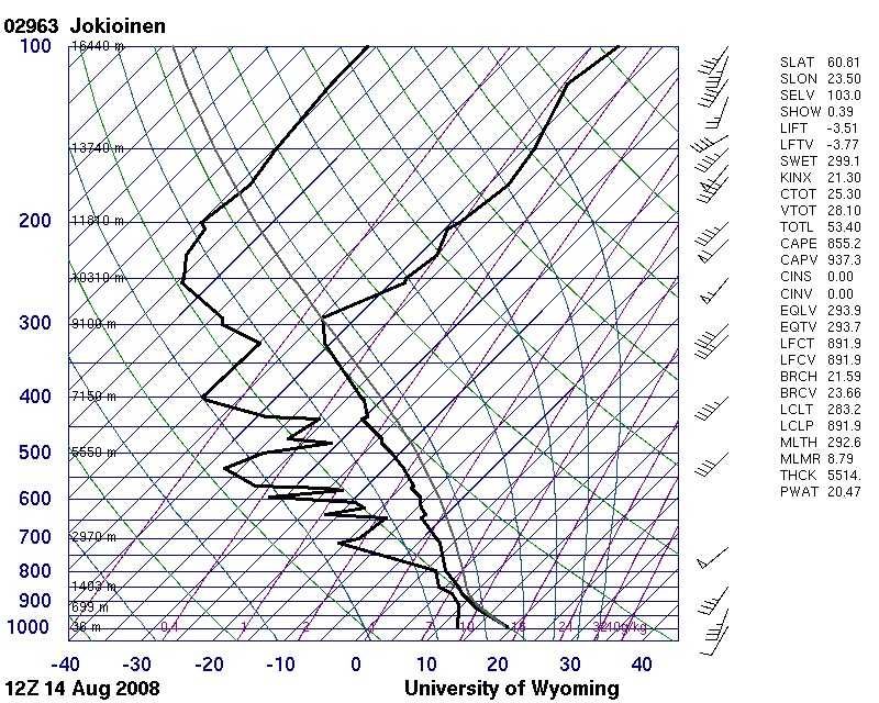
The 1200 UTC Jokioinen, Finland (WMO 02963) sounding, taken in the same air mass, indicates a well-mixed boundary layer in an unstable atmosphere with a relatively high CAPE of 855 J/kg.
© University of Wyoming