© Michael Bruhn
Chelsea, Victoria, Australia
Latitude: 38° 2' 57'' S
Longitude: 145° 7' 30'' E
09 April 2011 1604 (Local Time)
Camera direction: towards WSW
Image P/S code: P.9.10
Image I.D.: 5973
CL = 2, CM = 7, CH = /
-
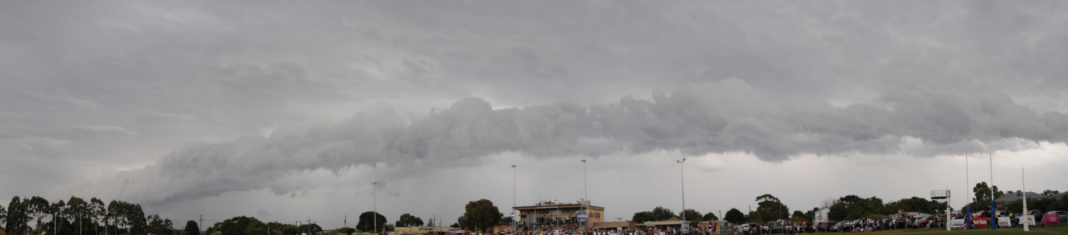
Cumulus congestus praecipitatio arcus pannus
In this panoramic view, the arrival of a cold front has been announced by a gust front on and ahead of a line of Cumulus congestus; several Cumulus congestus tops are clearly visible (5 and 6). Precipitation shafts (supplementary feature precipitatio) can be seen in the distance at 1 and 2. In the foreground is the cloud formed on the gust front. It is a dark, horizontal roll of cloud with more or less tattered edges. This is an arc cloud (supplementary feature arcus), which is situated on the lower front part of the associated cloud. When extensive, arcus can appear as a dark, menacing arch.
Small, sparse and well-separated ragged shreds of the accessory cloud pannus have formed in the moistened layer beneath the rain-bearing Cumulus congestus. The formation process permits the pannus to be identified as Cumulus fractus of wet weather.
Links in the image description will highlight features on the image. Mouse over the features for more detail.
© Michael BruhnChelsea, Victoria, AustraliaLatitude: 38° 2' 57'' SLongitude: 145° 7' 30'' E09 April 2011 1604 (Local Time)Camera direction: towards WSWCL = 2, CM = 7, CH = /Image P/S code: P.9.10Image I.D.: 5973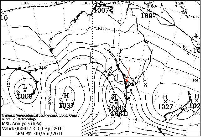
The chart from 1500 hours local time shows low pressure of 1 000 hPa centred south-west of Tasmania, Australia. The associated cold front was approaching the location of the image (red arrow).
© Commonwealth of Australia 2011, Bureau of Meteorology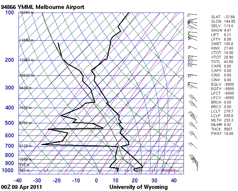
The 0000 UTC sounding from Melbourne Airport, Victoria, Australia (WMO 94866), taken some hours before the photograph, shows an unstable atmosphere favourable for convective development.
© University of Wyoming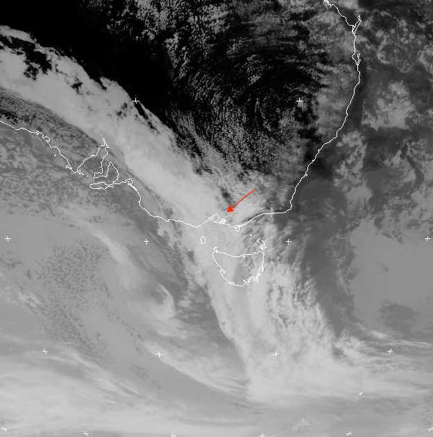
The MTSAT channel 4 infrared image shows that extensive wide frontal cloud has moved over the bayside suburbs of Melbourne, Victoria, Australia.
© Commonwealth of Australia 2011, Bureau of Meteorology / Japan Meteorological Agency