© Michael Bruhn
Mordialloc VIC 3195, Australia
Latitude: 38° 0' 40'' S
Longitude: 145° 5' 3'' E
04 July 2015 1507 (Local Time)
Camera direction: towards SE
Image P/S code: P.5.2
Image I.D.: 5981
CL = 0, CM = 2, CH = /
-
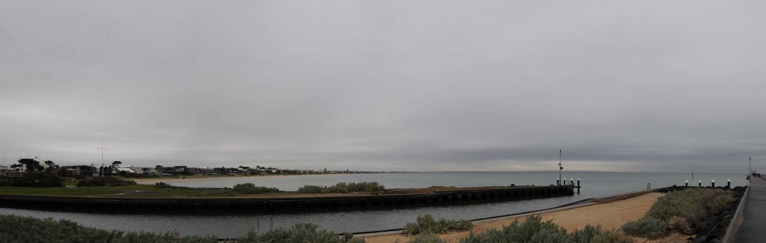
Altostratus opacus praecipitatio
The photo shows a light to mid grey, almost overcast layer of Altostratus, sufficiently thick enough in most parts to mask the Sun. It is not Nimbostratus, as the light grey areas would reveal the position of the Sun and Nimbostratus is featureless. This layer has wave patterns, indicating the variety undulatus.
Light rain can be seen to the south-south-west and virga or light rain can be seem to the south-east. The dark, horizontal band from the south-east through to the south-south-west is the melting level where ice crystals in the cloud are melting.
Links in the image description will highlight features on the image. Mouse over the features for more detail.
© Michael BruhnMordialloc VIC 3195, AustraliaLatitude: 38° 0' 40'' SLongitude: 145° 5' 3'' E04 July 2015 1507 (Local Time)Camera direction: towards SECL = 0, CM = 2, CH = /Image P/S code: P.5.2Image I.D.: 5981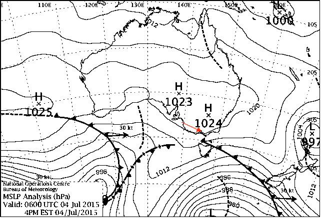
Subtropical ridge to the north and a weak cold front to the south
© Commonwealth of Australia 2015, Bureau of Meteorology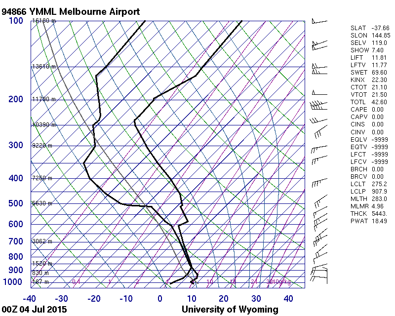
Almost saturated layer from 876 to 608 hPa – this cloud top confirms the cloud is not cirrostratusmutatus and the cold front is weak.
© University of Wyoming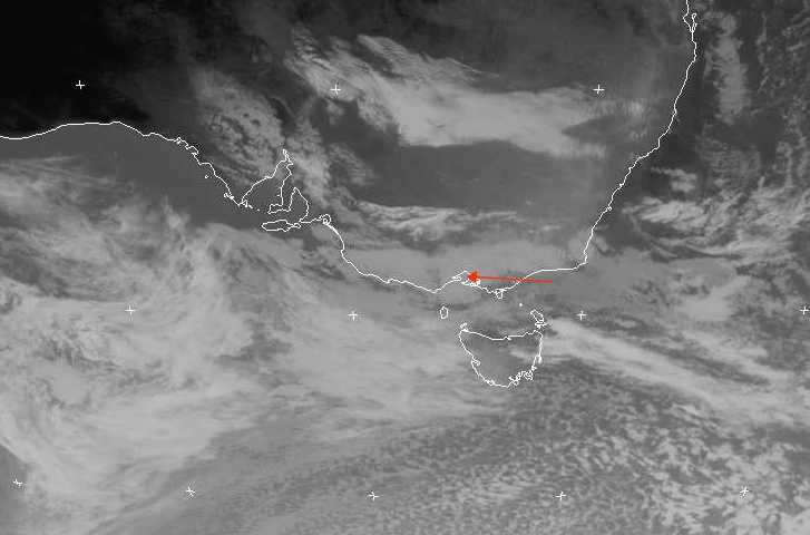
The EUMETSAT infrared channel 4 (10.3 to 11.3 μm) image shows the Altostratus has not transformed from Cirrostratus; it is confined to the middle levels. The weak cold front can be seen to the north-east of Tasmania, Australia.
© EUMETSAT, 2015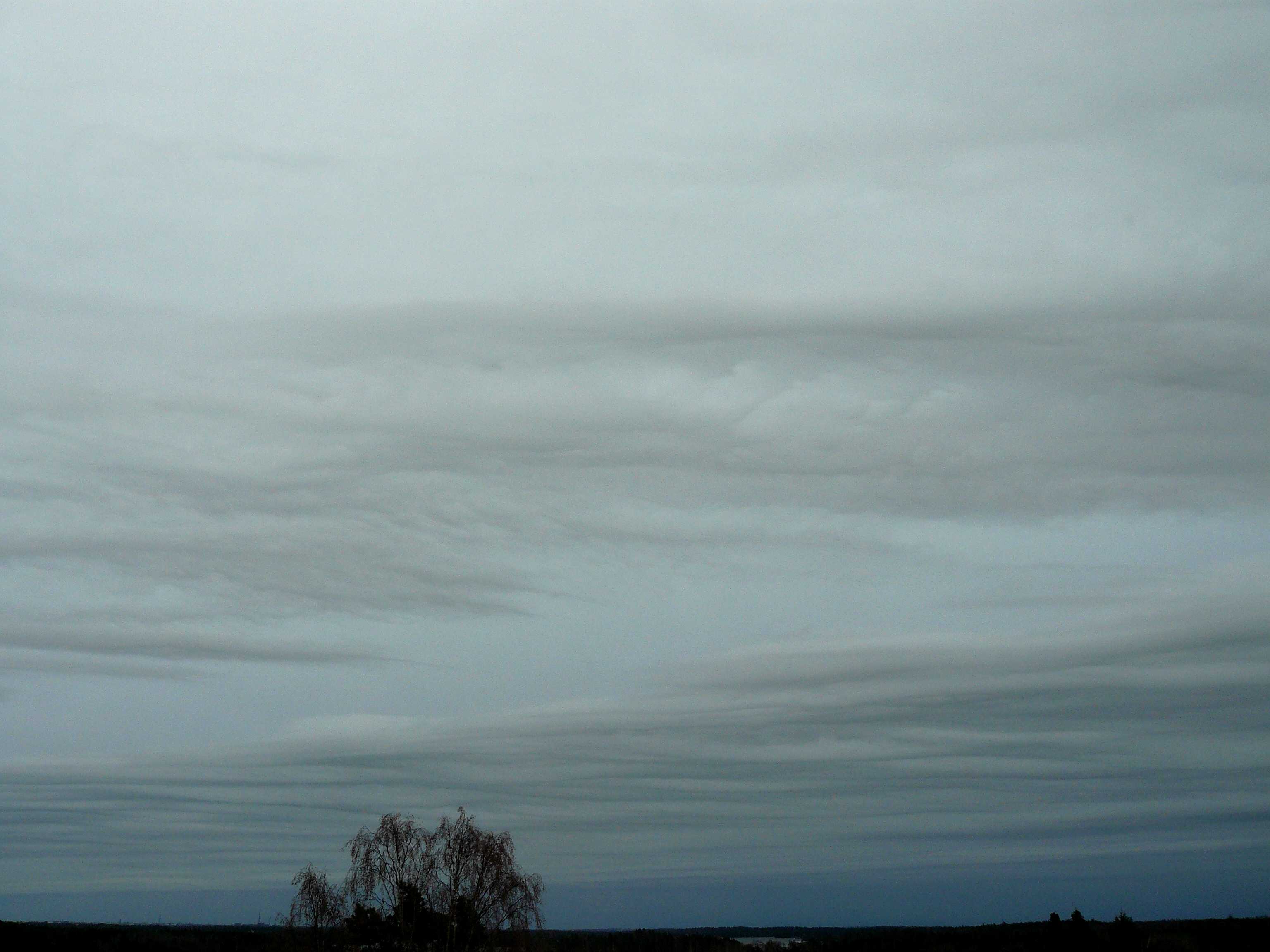
Altostratus opacus and Stratocumulus stratiformis undulatus
The image shows a patch of Stratocumulus close to the camera and a sheet of Stratocumulus toward the horizon. The patch is too small to determine its degree of transparency; the sheet appears marginal between tranlucent and opacus and was identified as opacus. The Stratocumulus has merged elements arranged in nearly parallel lines; this is the variety undulatus. The base of the Stratocumulus was measured at 900 m. Through the gaps of the Stratocumulus can be seen a uniformly grey extensive layer of Altostratus opacus. On the horizon is the leading edge of widespread precipitation ahead of a warm front. Radar showed this leading edge at a distance of 30 km or more; that is, beyond the visual horizon at ground level.
Nimbostratus praecipitatio with continuous rain was observed an hour later.
Links in the image description will highlight features on the image. Mouse over the features for more detail.
© Jarmo KoistinenEspoo, FinlandLatitude: 60° 0' 0'' NLongitude: 25° 0' 0'' E16 April 2012 1952 (Local Time)Camera direction: towards ECL = 5, CM = 2, CH = /Image P/S code: S.5.2 1Image I.D.: 3706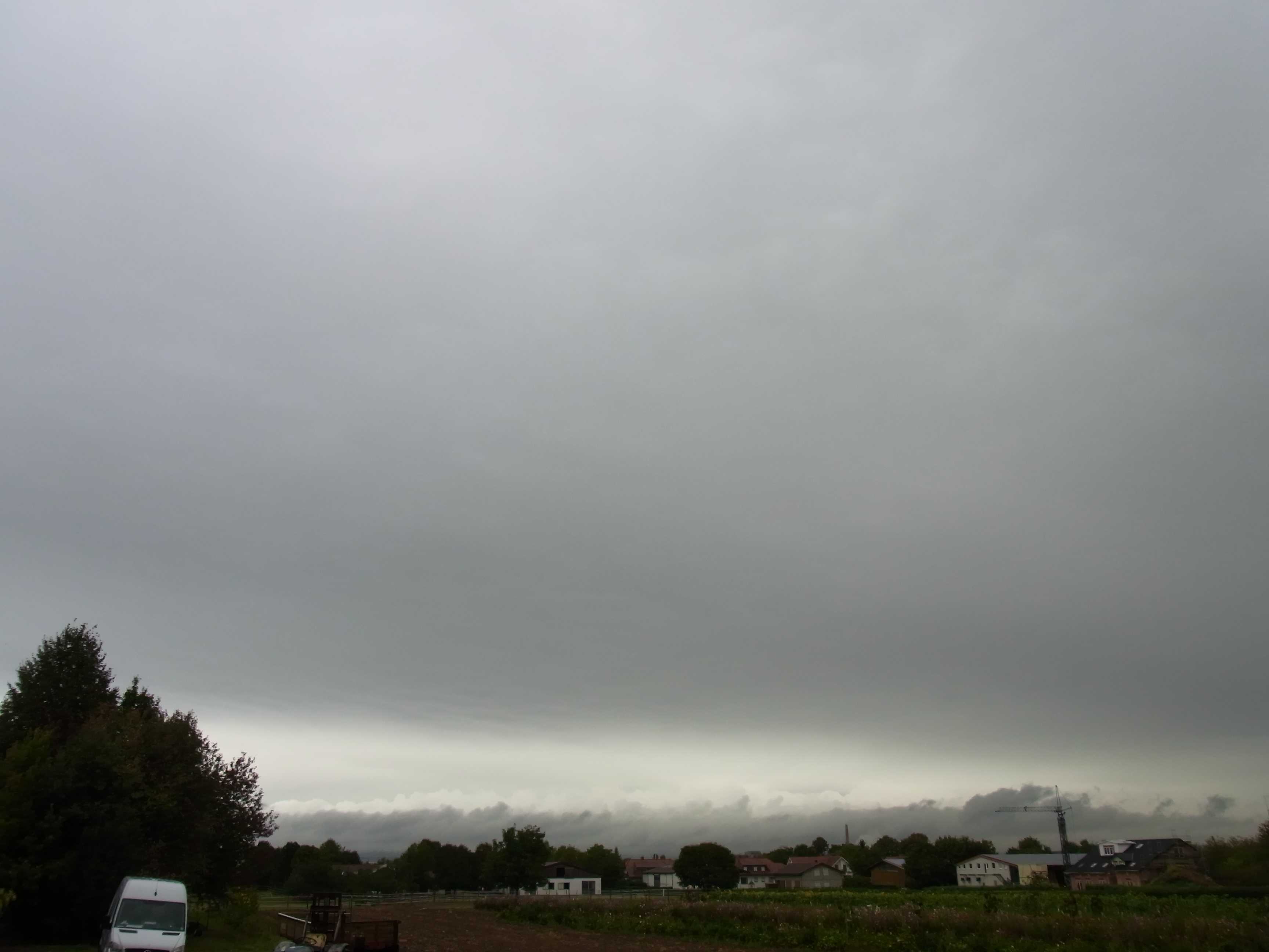
Altostratus opacus praecipitatio and Cumulus
Altostratus opacus covered the sky, from which light to moderate continuous rain was falling. The overcast layer had been Nimbostratus but could not be identified as such at the time of the photo as the Sun was not completely masked by the cloud layer on the horizon. This is evident from the amount of light that is being transmitted through the cloud layer: it is sufficient to illuminate the tops of the northernmost line of Cumulus of the species congestus. In front of this illuminated line of congestus is a line of Cumulus fractus and mediocris; this line is in the shadow of the first line. The thinning in the rain-bearing cloud marks the rear edge of the frontal cloud band and the Cumulus are developing in colder air behind this band.
Links in the image description will highlight features on the image. Mouse over the features for more detail.
© Martin GuddMainz, GermanyLatitude: 49° 58' 27'' NLongitude: 8° 13' 56'' E25 September 2012 1112 (Local Time)Camera direction: towards NWCL = 2, CM = 2, CH = /Image P/S code: P.5.6Image I.D.: 3780