© Frank Le Blancq
Vėžaičiai, Lithuania
Latitude: 55° 43' 9'' N
Longitude: 21° 26' 21'' E
18 July 2016 1755 (Local Time)
Camera direction: towards NNE
Image P/S code: P.9.5
Image I.D.: 6056
CL = 2, CM = 0, CH = 1
-
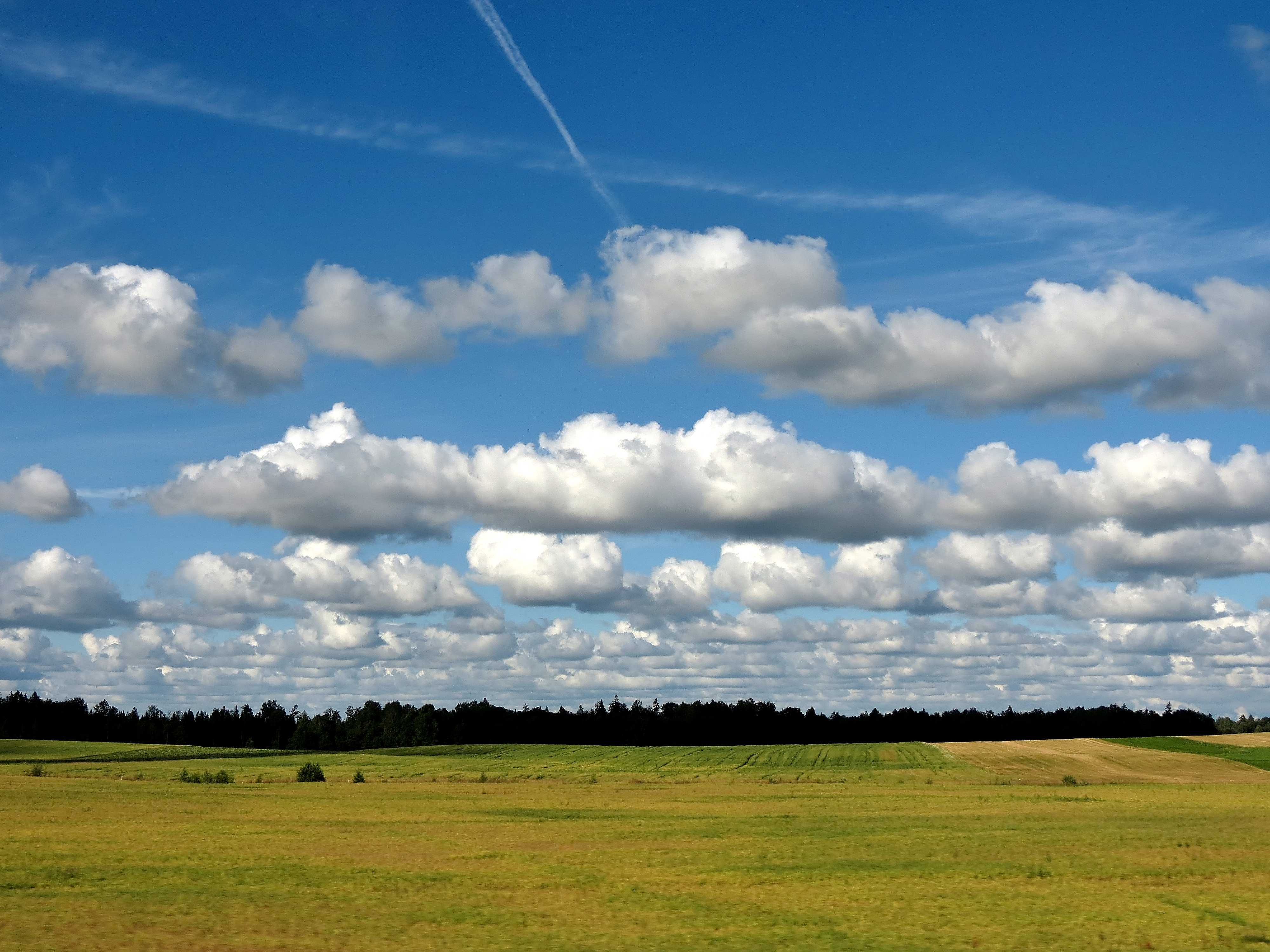
Cumulus mediocris radiatus
The image shows typical detached Cumulus clouds. The upper, sunlit parts are bright white, while the bases are relatively dark and nearly horizontal. The clouds show modest vertical development with small protuberances and sproutings at their tops, indicating the species mediocris. Of particular interest, the clouds are arranged in bands or lines nearly parallel to the wind direction, commonly called cloud streets, which identify them as the variety radiatus. Due to perspective, when viewed along the lines, they appear to converge towards a point on the horizon. Two aircraft condensation trails, Cirrus homogenitus, are visible at the top of the image.
Links in the image description will highlight features on the image. Mouse over the features for more detail.
© Frank Le BlancqVėžaičiai, LithuaniaLatitude: 55° 43' 9'' NLongitude: 21° 26' 21'' E18 July 2016 1755 (Local Time)Camera direction: towards NNECL = 2, CM = 0, CH = 1Image P/S code: P.9.5Image I.D.: 6056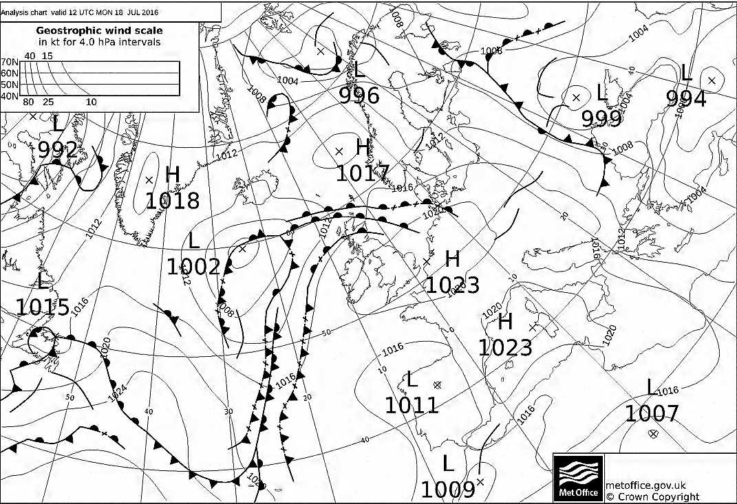
The synoptic chart at 1200 UTC shows low pressure of 999 hPa over Ukraine and weak high pressure of 1 017 hPa west of Norway. The Baltic States are covered by a weak north-west flow behind a cold front.
© Crown Copyright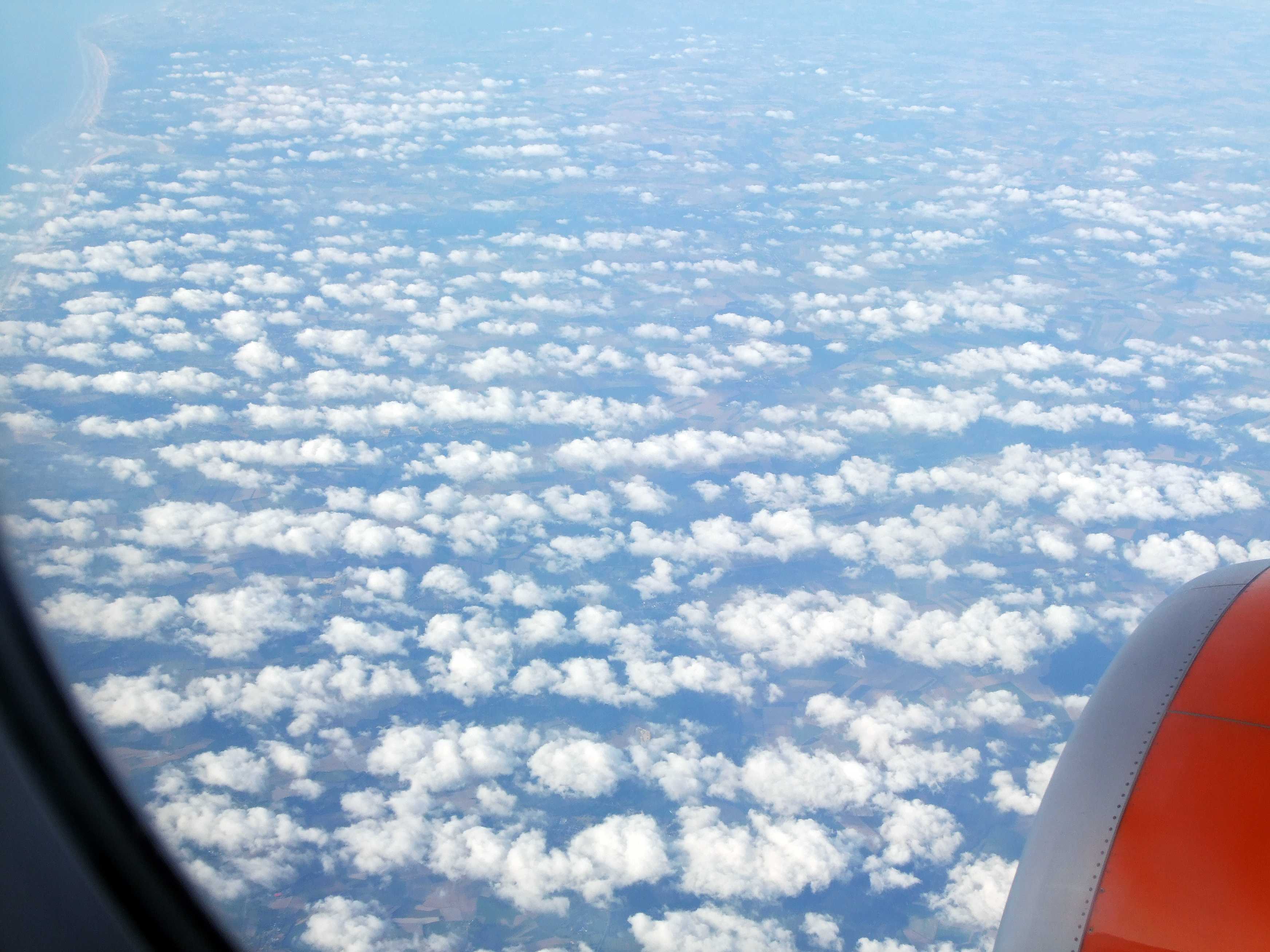
Cumulus mediocris radiatus
Cumulus mediocris cloud over northern France, viewed from an aircraft on descent towards London Gatwick Airport, England, UK. The view is looking north-north-east along the English Channel coast, which can be seen in the top left of the picture. The air flow at cloud height is from the north-west, from left to right across the image, and the clouds are aligned in lines or streets at 1, 2 and 3, making this the variety radiatus.
Links in the image description will highlight features on the image. Mouse over the features for more detail.
© George Andersonnorthern FranceLatitude: 50° 22' 15'' NLongitude: 1° 39' 40'' E02 September 2013 1855 (Local Time)Camera direction: towards NImage P/S code: S.9.5Image I.D.: 5140