© Matthew Clark
大不列颠及北爱尔兰联合王国德文郡Salcombe Regis
纬度: 50° 40' 58'' N
经度: 3° 11' 56'' W
24 March 2015 1700 (当地时间)
摄像机方向:朝向东
图像P/S代码: P.9.9
图像I.D.: 3875
CL = 2, CM = 0, CH = 0
-
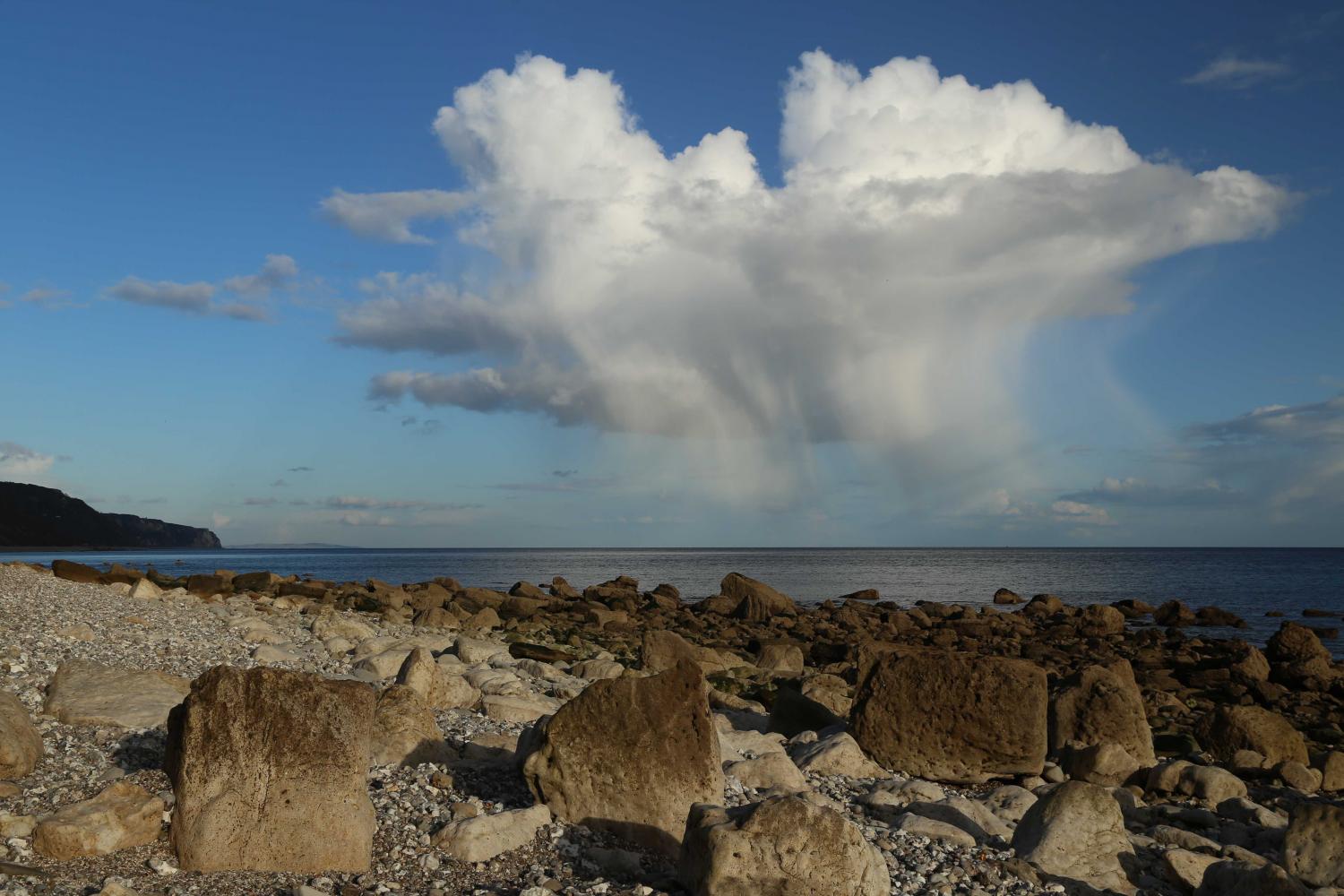
伴有降水的浓积云
这个发展中积云的图像显示出了浓云云种的各种特征。它具有相当大的垂直范围,通常有清晰的轮廓 ,主要是明亮的白色阳光照射部分 。凸起的上面部分类似于花椰菜,而底部相对较暗且几乎是水平的(但在该示例中一部分比较模糊)。浓积云可能会产生降水,这是一种降水性附加特征,在这里看到轻微阵雨和雪粒落到地面。冻结层约为900米,逐渐减少的降水井可能是由于地表附近的降水融化,而最低1500米处的干燥空气促进了云底下的蒸发。在主云的侧翼可以看到5 和6 处的层积云,还能在其他地方看到一些孤立的云块。也可以看到反曙暮辉 。
图像描述中的链接将突出显示图像上的特征。将鼠标悬停在特征上以获取更多详细内容。
© Matthew Clark大不列颠及北爱尔兰联合王国德文郡Salcombe Regis纬度: 50° 40' 58'' N经度: 3° 11' 56'' W24 March 2015 1700 (当地时间)摄像机方向:朝向东CL = 2, CM = 0, CH = 0图像P/S代码: P.9.9图像I.D.: 3875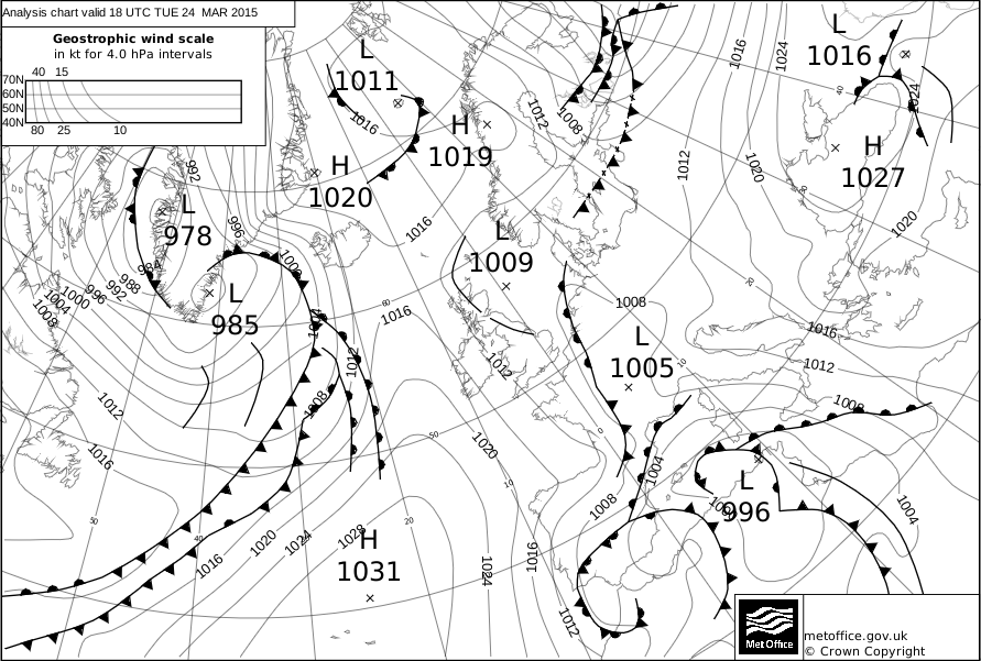
在UTC时间1800点,一股较为轻微的向北气候笼罩着英格兰西南部(照片拍摄地点),其处于东大西洋的高压脊和欧洲大陆的浅层洼地之间。
© 皇家版权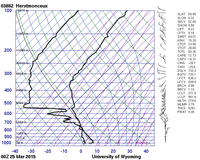
英国英格兰赫斯特蒙苏(WMO 03882)1200点(UTC)探测显示到大约4500处的大气都是有条件的不稳定。在最低1500米处的空气相对干燥,这可能有助于云底下方的降水蒸发。不稳定层的特征是轻微到中等的向北气流以及较弱的垂直风切变。
© 怀俄明大学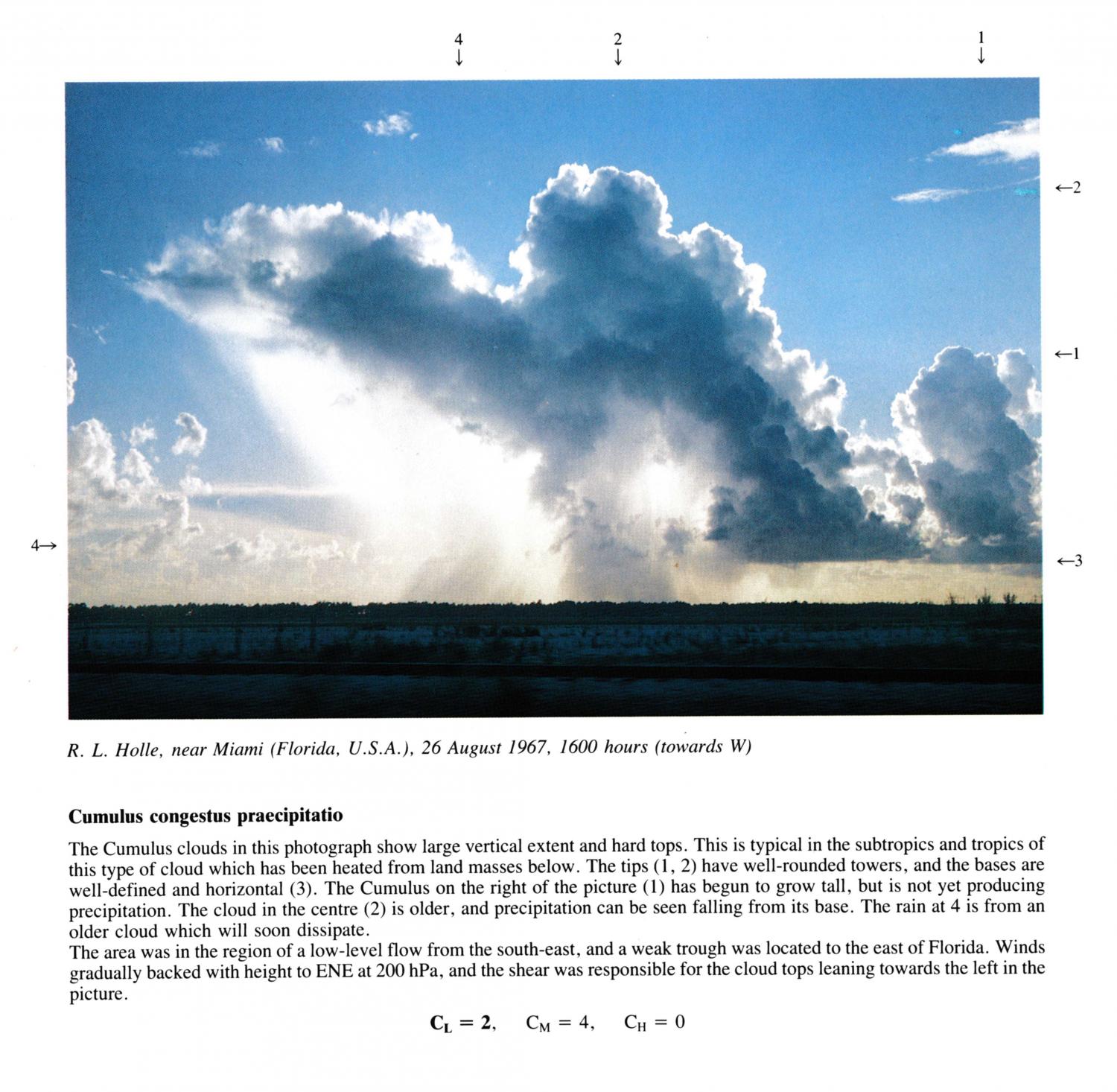
Cumulus congestus praecipitatio
The Cumulus clouds in this photograph show large vertical extent and hard tops. This is typical in the subtropics and tropics of this type of cloud which has been heated from land masses below. The tips 1 and 2 have well-rounded towers, and the bases are well-defined and horizontal. The Cumulus on the right of the picture has begun to grow tall, but is not yet producing precipitation. The cloud in the centre is older, and precipitation can be seen falling from its base. The rain at 6 is from an older cloud which will soon dissipate. .
The area was in the region of a low-level flow from the south-east, and a weak trough was located to the east of Florida. Winds gradually backed with height to ENE at 200 hPa, and the shear was responsible for the cloud tops leaning towards the left in the picture.
图像描述中的链接将突出显示图像上的特征。将鼠标悬停在特征上以获取更多详细内容。
© R.L. HolleMiami, FL, United States of America纬度: 25° 45' 42'' N经度: 80° 11' 30'' W26 August 1967 1600 (当地时间)摄像机方向:朝向西CL = 2, CM = 4, CH = 0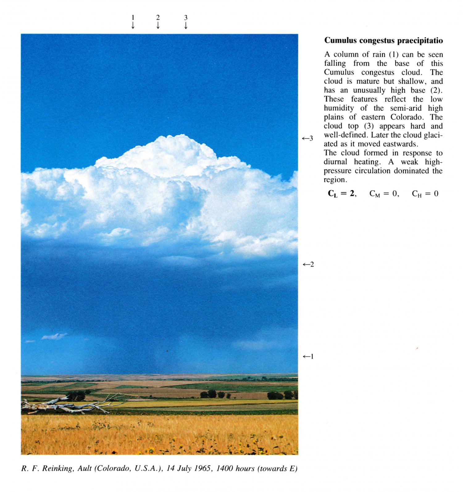
Cumulus congestus praecipitatio
A column of rain can be seen falling from the base of this Cumulus congestus cloud. The cloud is mature but shallow, and has an unusually high base. These features reflect the low humidity of the semi-arid high plains of eastern Colorado. The cloud top appears hard and well-defined. Later the cloud glaciated as it moved eastwards. The cloud formed in response to diurnal heating. A weak high pressure circulation dominated the region.
CL= 2, CM = 0, CH = 0
图像描述中的链接将突出显示图像上的特征。将鼠标悬停在特征上以获取更多详细内容。
© R.F. ReinkingAult, Colorado, United States of America纬度: 40° 34' 57'' N经度: 104° 43' 55'' W14 July 1965 1400 (当地时间)摄像机方向:朝向东CL = 2, CM = 0, CH = 0