© Jarmo Koistinen
芬兰,赫尔辛基
纬度: 60° 0' 0'' N
经度: 25° 0' 0'' E
08 July 2011 1450 (当地时间)
摄像机方向:朝向北
图像P/S代码: P.1.5
图像I.D.: 5505
CL = 2, CM = 0, CH = 3
-
积雨云性密卷云和中展积云
仍为砧状,该积雨云性密卷云是大约45分钟前一个小而孤立的砧状鬃积雨云的余云。
积云,主要为中展云种,可完成云观测。
这是放大的图像。详见附图。
图像描述中的链接将突出显示图像上的特征。将鼠标悬停在特征上以获取更多详细内容。
© Jarmo Koistinen芬兰,赫尔辛基纬度: 60° 0' 0'' N经度: 25° 0' 0'' E08 July 2011 1450 (当地时间)摄像机方向:朝向北CL = 2, CM = 0, CH = 3图像P/S代码: P.1.5图像I.D.: 5505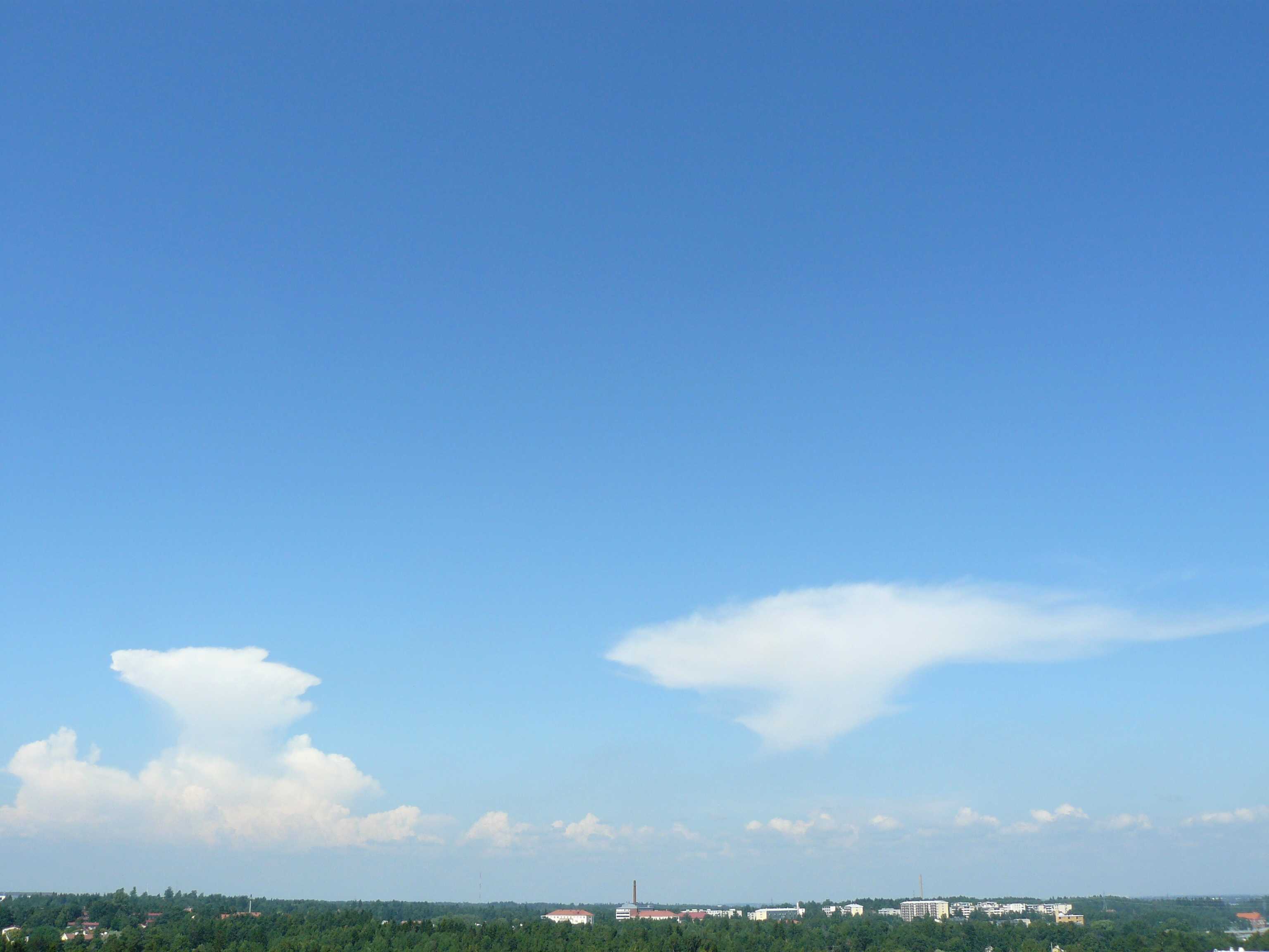
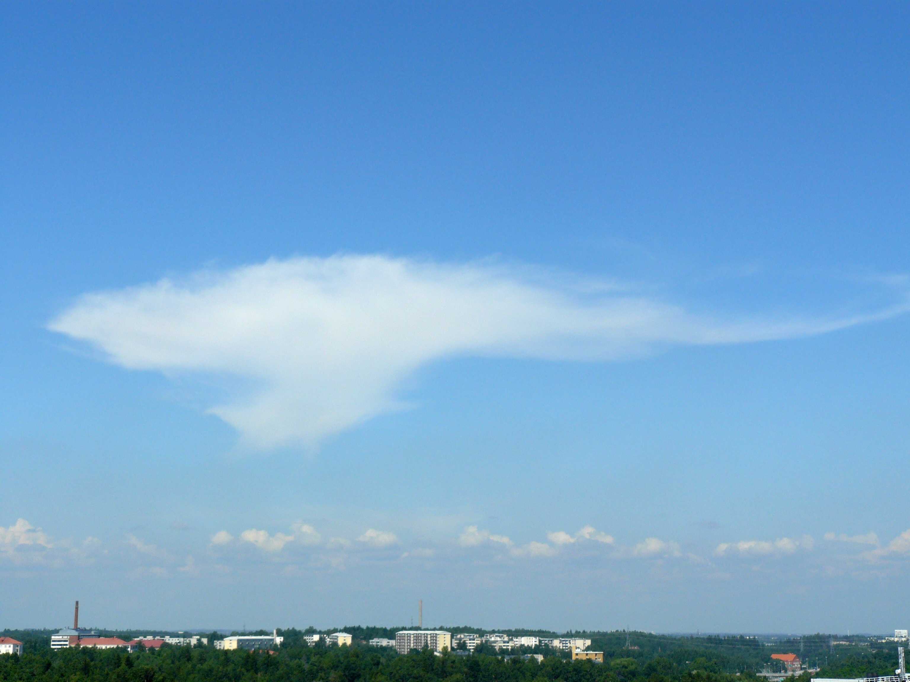
积雨云性密卷云和砧状鬃积雨云
仍为砧形,该积雨云性密卷云是大约45分钟前一个小而孤立的砧状鬃积雨云的余云。在发展的衰退阶段,新的砧状鬃积雨云在左侧地平线约60公里外。在该单体的侧面是浓积云单体或积雨云单体;由于单体距离远且相对较小,无法根据本图做出准确识别。中展云种为主的积云可完成云观测。右侧缩放的单体图像参见附图。
图像描述中的链接将突出显示图像上的特征。将鼠标悬停在特征上以获取更多详细内容。
© Jarmo Koistinen芬兰,赫尔辛基纬度: 60° 0' 0'' N经度: 25° 0' 0'' E08 July 2011 1449 (当地时间)摄像机方向:朝向北CL = 9, CM = 0, CH = 3图像P/S代码: P.1.5图像I.D.: 5506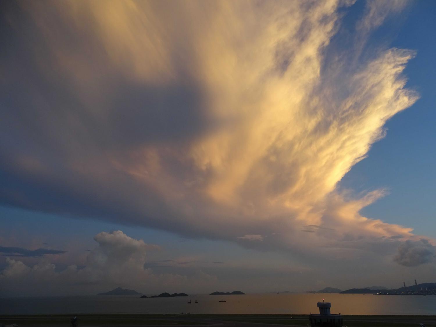
积雨云性密卷云
一股南风气流为香港(中国)附近的广东沿岸带来炎热多雨的天气。密集的云是密卷云,是积雨云的残余部分 - 这可进一步将其定义为人为积雨云性。在地平线上可以看到秃积雨云。
图像描述中的链接将突出显示图像上的特征。将鼠标悬停在特征上以获取更多详细内容。
© Moon Tong Tsang中国香港赤鱲角纬度: 22° 18' 56'' N经度: 113° 55' 21'' E14 June 2015 0536 (当地时间)摄像机方向:朝向北CL = 3, CM = 3, CH = 3图像P/S代码: S.1.5图像I.D.: 4850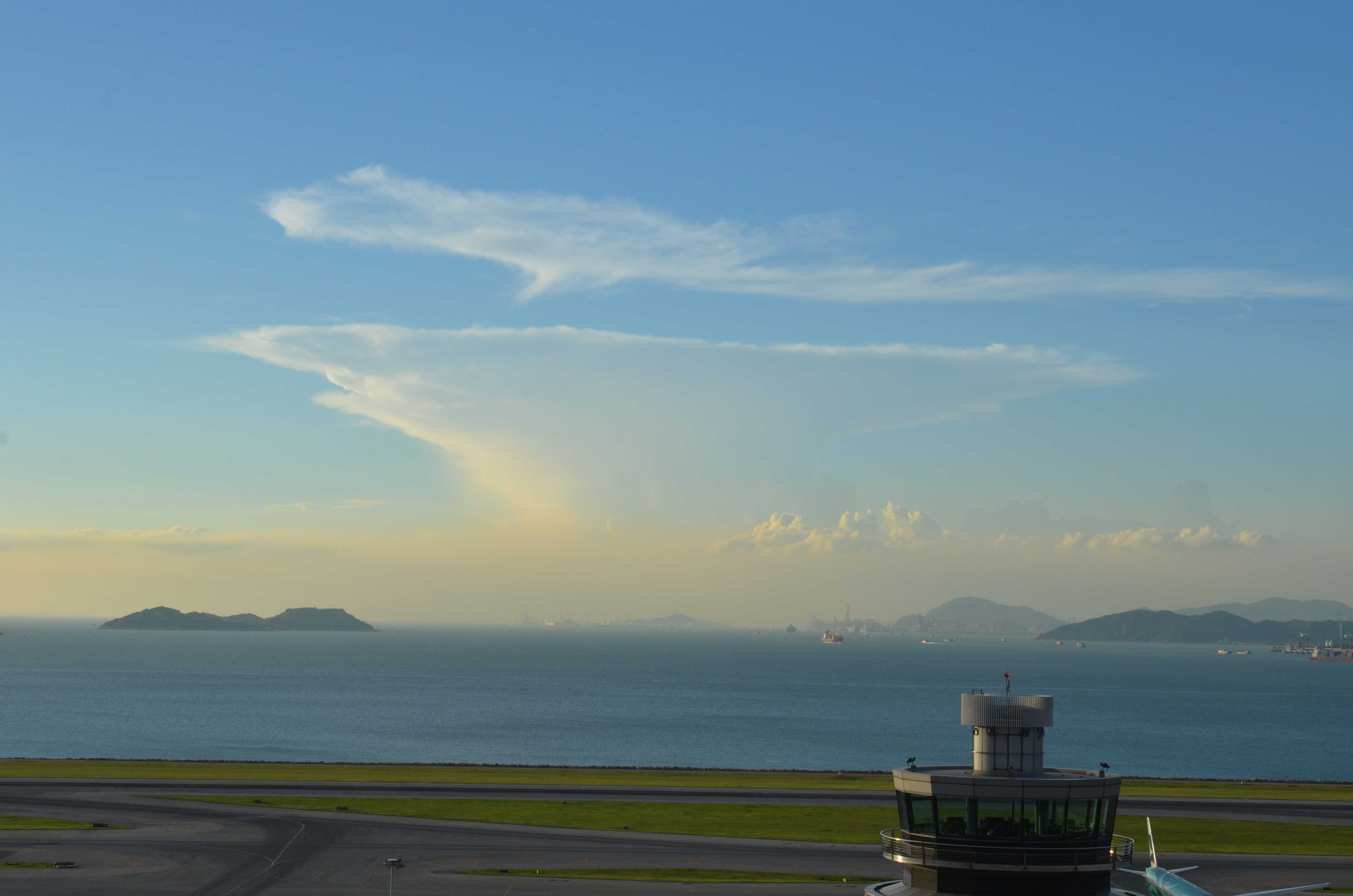
积雨云性密卷云、浓积云和霾
图片上方的云是积雨云性密卷云。它是3小时前在中国香港以南及西南方向100公里发展的一系列雷暴的余云。在这浓密的卷云块之下是另一个典型的积雨云性密卷云。在更靠近香港的第二行形成了这一稠密云块的母积雨云。在第二行云的东侧还可看到正在发展的浓积云。这些云处于落日的阴影中(照片拍摄于日落前36分钟)。更靠近香港的是第三行云,其构成是东侧的中展积云和中间不断增大的浓积云。
霾已被输送并滞留在近海。
图像描述中的链接将突出显示图像上的特征。将鼠标悬停在特征上以获取更多详细内容。
© Tak Leung Ng中国,香港,赤鱲角纬度: 22° 18' 30'' N经度: 113° 55' 5'' E06 August 2013 1824 (当地时间)摄像机方向:朝向西南CL = 2, CM = 0, CH = 3图像P/S代码: S.1.5 2图像I.D.: 5520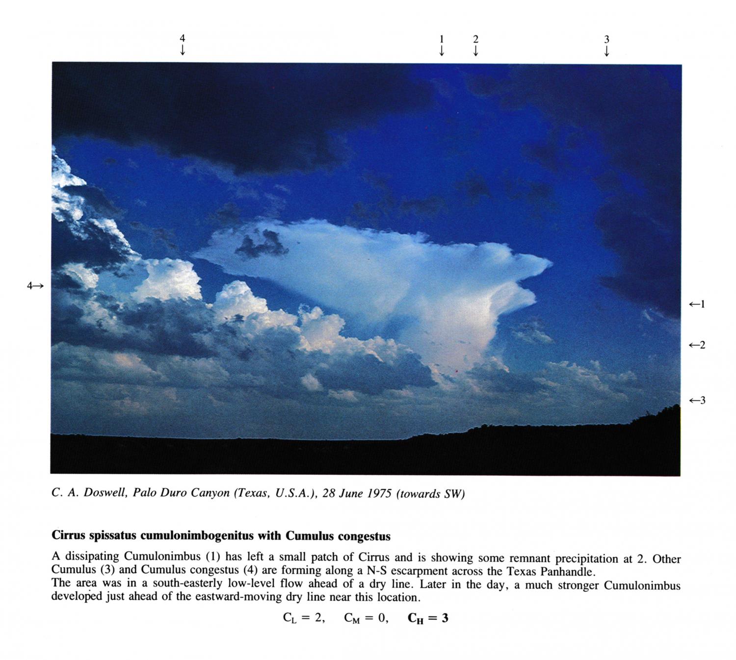
Cirrus spissatus cumulonimbogenitus with Cumulus congestus
(NB. Hour of day estimated)
A dissipating Cumulonimbus has left a small patch of Cirrus and is showing some remnant precipitation at 2. Other Cumulus and Cumulus congestus are forming along a N-S escarpment across the Texas Panhandle. The area was in a south-easterly low-level flow ahead of a dry line. Later in the day, a much stronger Cumulonimbus developed just ahead of the eastward-moving dry line near this location.
图像描述中的链接将突出显示图像上的特征。将鼠标悬停在特征上以获取更多详细内容。
© C.A. DoswellPalo Duro Canyon, Texas, United States of America纬度: 34° 55' 48'' N经度: 101° 39' 0'' W28 June 1975 1700 (当地时间)摄像机方向:朝向西南CL = 2, CM = 0, CH = 3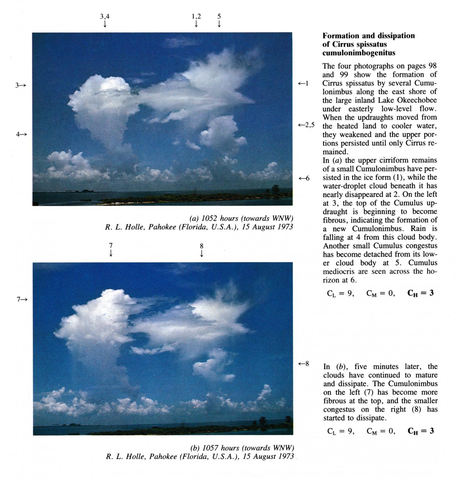
Formation and dissipation of Cirrus spissatus cumulonimbogenitus
The four photographs in PRE.101, PRE.100, PRE.103, PRE.102, show the formation of Cirrus spissatus by several Cumulonimbus along the east shore of the large inland Lake Okeechobee under easterly low-level flow. When the updraughts moved from the heated land to cooler water, they weakened and the upper portions persisted until only Cirrus remained.
In this image, five minutes later (after PRE.101), the clouds have continued to mature and dissipate. The Cumulonimbus on the left has become more fibrous at the top, and the smaller congestus on the right has started to dissipate.
图像描述中的链接将突出显示图像上的特征。将鼠标悬停在特征上以获取更多详细内容。
© R.L. HollePahokee, Florida, United States of America纬度: 26° 49' 12'' N经度: 80° 39' 55'' W15 August 1973 1057 (当地时间)摄像机方向:朝向西西北CL = 9, CM = 0, CH = 3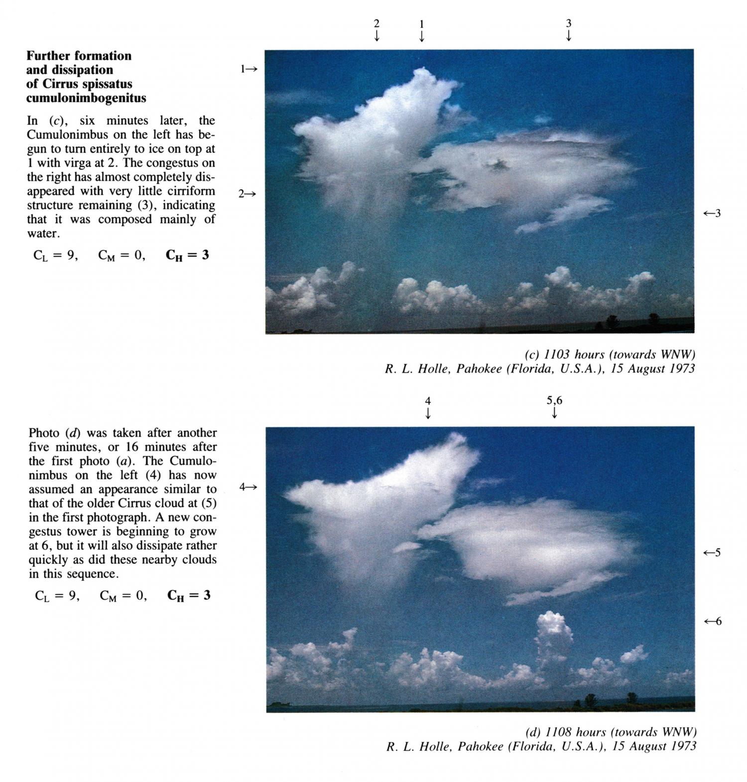
Formation and dissipation of Cirrus spissatus cumulonimbogenitus
The four photographs in PRE.101, PRE.100, PRE.103, PRE.102, show the formation of Cirrus spissatus by several Cumulonimbus along the east shore of the large inland Lake Okeechobee under easterly low-level flow. When the updraughts moved from the heated land to cooler water, they weakened and the upper portions persisted until only Cirrus remained.
This photo was taken after another five minutes, or 16 minutes after the first photo (PRE.101). The Cumulonimbus on the left has now assumed an appearance similar to that of the older Cirrus cloud at 5 in the first photograph. A new congestus tower is beginning to grow at 6, but it will also dissipate rather quickly as did these nearby clouds in this sequence.
图像描述中的链接将突出显示图像上的特征。将鼠标悬停在特征上以获取更多详细内容。
© R.L. HollePahokee, Florida, United States of America纬度: 26° 49' 12'' N经度: 80° 39' 55'' W15 August 1973 1108 (当地时间)摄像机方向:朝向西西北CL = 9, CM = 0, CH = 3