© Michael Bruhn
澳大利亚,阿斯彭代尔花园VIC 3195
纬度: 37° 48' 37'' S
经度: 144° 57' 16'' E
13 January 2007 0827 (当地时间)
摄像机方向:朝向东东北
图像P/S代码: P.1.11
图像I.D.: 5628
CL = 1, CM = 0, CH = 1
-
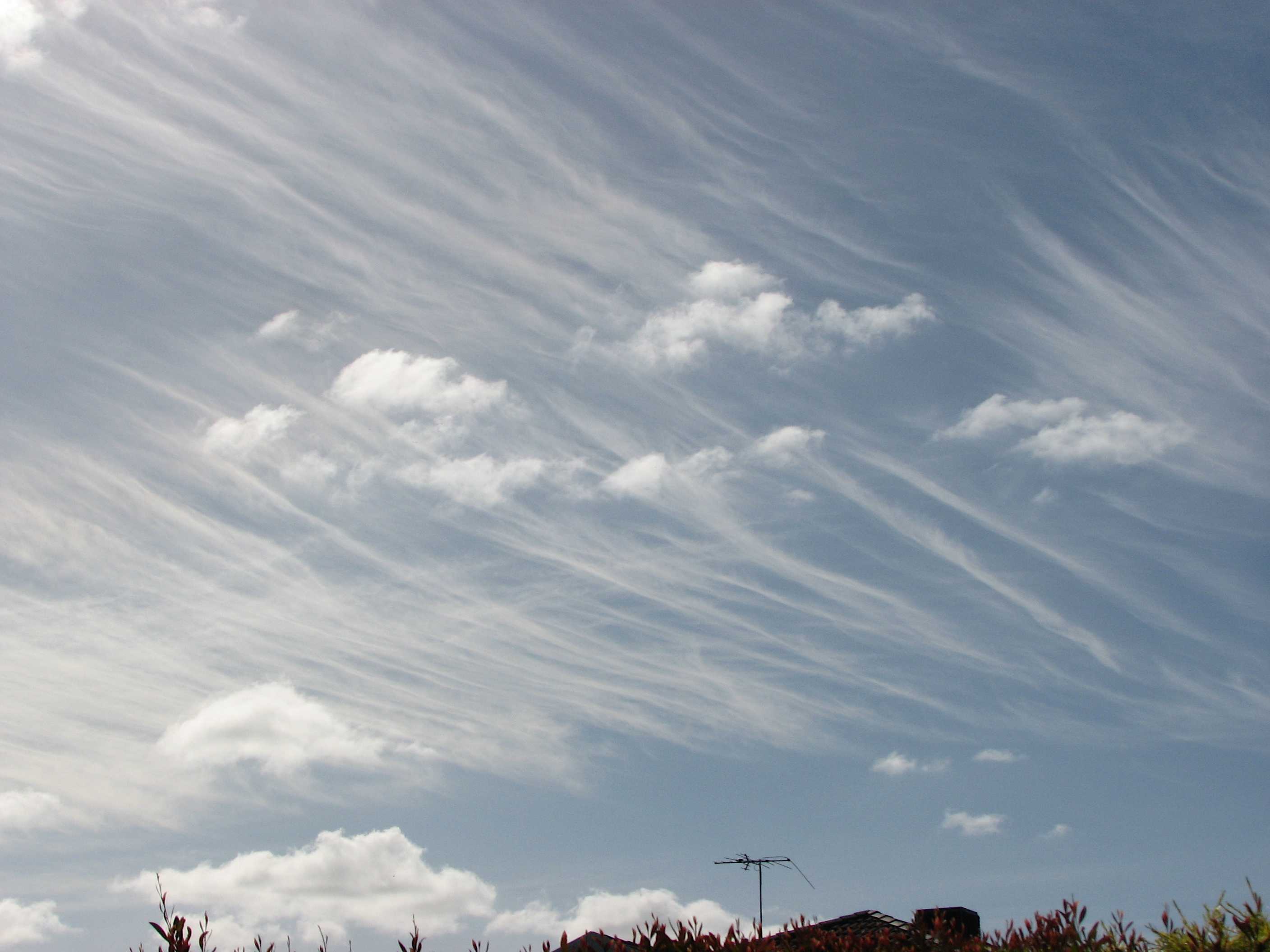
复毛卷云和淡积云及碎积云
这是有两层的毛云种卷云(依据是近乎平直或有些不规则弯曲的丝条)。占主导下层为东西向排列,而上层是南北向排列。天空中还出现了晴天碎积云和淡积云。
图像描述中的链接将突出显示图像上的特征。将鼠标悬停在特征上以获取更多详细内容。
© Michael Bruhn澳大利亚,阿斯彭代尔花园VIC 3195纬度: 37° 48' 37'' S经度: 144° 57' 16'' E13 January 2007 0827 (当地时间)摄像机方向:朝向东东北CL = 1, CM = 0, CH = 1图像P/S代码: P.1.11图像I.D.: 5628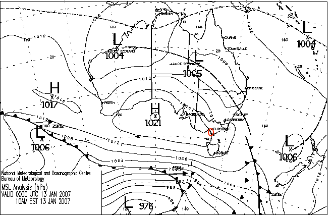
弱脊向东延伸,内陆槽向西北发展,
© 澳大利亚联邦2007,澳大利亚气象局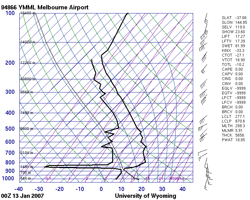
从地表到1200米(879 hPa)下沉逆温为不稳定层,从500 hPa到对流层顶有显著水汽
© 怀俄明大学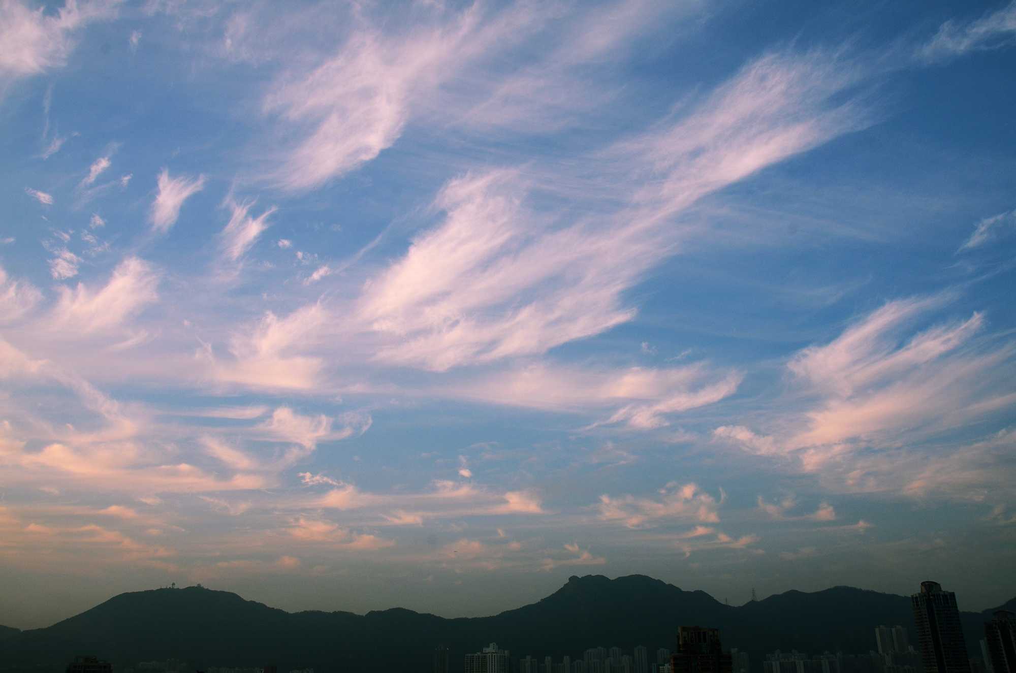
复毛卷云、钩卷云、密卷云和絮状卷云
图中显示出卷云的四个云种和一个云类。按当日的发展顺序,这些云种是:絮状、钩状、毛和密。云类是复云。
圆凸起(积状云顶)可确定1和2为絮状云种。在下一个发展阶段,圆凸起开始消散,并变为云簇;这是钩状云种开始的特征,见此处。在这一阶段后,钩状云簇消散,留下在钩顶终止的逗号 – 异乎寻常的是,图中没有钩卷云这一阶段的明确实例。随后,风使这些钩状变形为不规则弯曲或几乎笔直的丝条(毛云种)。逐渐地,毛状融合成浓密的云块(密云种)。
复云类用于表示在两个不同高度排列的卷云。上层由几乎笔直或略微弯曲的细丝条(毛卷云)构成。
钩云种和毛云种的卷云为主,因此编码为CH = 1。
图像描述中的链接将突出显示图像上的特征。将鼠标悬停在特征上以获取更多详细内容。
© Tze Ching Ho中国,香港,九龙城纬度: 22° 19' 51'' N经度: 114° 11' 31'' E04 March 2016 1815 (当地时间)摄像机方向:朝向北CL = 0, CM = 0, CH = 1图像P/S代码: S.1.11图像I.D.: 5525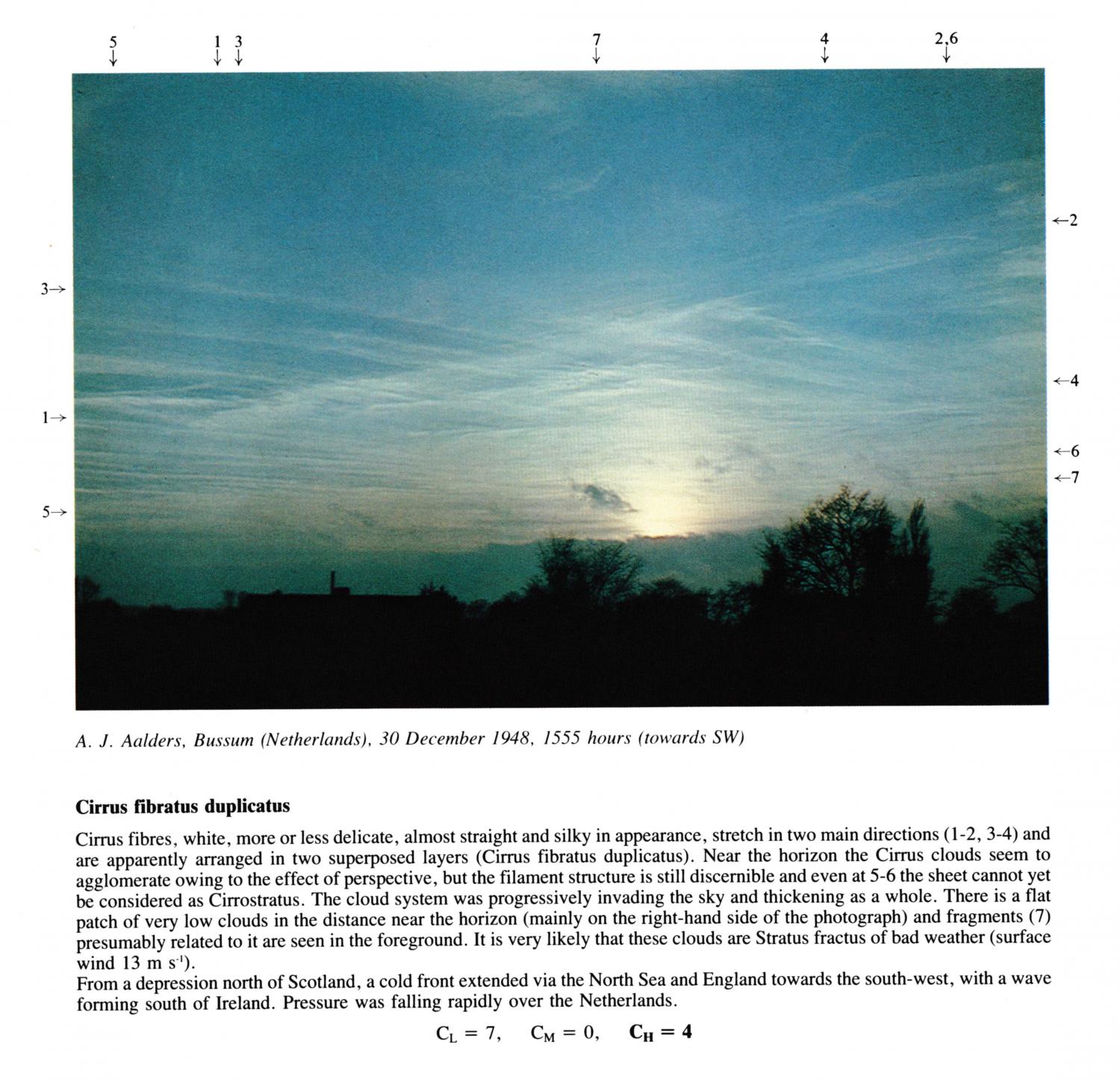
Cirrus fibratus duplicatus
Cirrus fibres, white, more or less delicate, almost straight and silky in appearance, stretch in two main directions(1 - 2, 3 - 4) and are apparently arranged in two superposed layers (Cirrus fibratus duplicatus). Near the horizon the Cirrus clouds seem to agglomerate owing to the effect of perspective, but the filament structure is still discernible and even at 5 - 6 the sheet cannot yet be considered as Cirrostratus. The cloud system was progressively invading the sky and thickening as a whole. There is a flat patch of very low clouds in the distance near the horizon (mainly on the right-hand side of the photograph) and fragments presumably related to it are seen in the foreground. It is very likely that these clouds are Stratus fractus of bad weather (surface wind 13 m s-1).
From a depression north of Scotland, a cold front extended via the North Sea and England towards the south-west, with a wave forming south of Ireland. Pressure was falling rapidly over the Netherlands.
图像描述中的链接将突出显示图像上的特征。将鼠标悬停在特征上以获取更多详细内容。
© A.J. AaldersBussum, Netherlands纬度: 52° 16' 26'' N经度: 5° 9' 59'' E30 December 1948 1555 (当地时间)摄像机方向:朝向西南CL = 7, CM = 0, CH = 4