© Stephen Burt
英国,伯克郡RG7,雷丁附近的斯特拉特菲尔德莫蒂默
纬度: 51° 22' 12'' N
经度: 1° 2' 24'' W
10 July 2010 2040 (当地时间)
摄像机方向:朝向西北
图像P/S代码: P.4.12
图像I.D.: 5925
CL = 0, CM = 8, CH = 0
-

侵入的辐辏状复絮状高积云
这是侵入的高积云双层云带前缘,该云快速增厚及云量增加。
下层的高积云呈深灰色(树的上方),它由积状云簇构成,且大部分云底边界清晰。在这些云的左侧,云底正在消散并破碎。
上层的云层呈中灰色,而最薄的部分发白。这个云层中的云素正合并为长线,似乎正向地平线附近的一个点上汇集。这是辐辏状云类。
图像描述中的链接将突出显示图像上的特征。将鼠标悬停在特征上以获取更多详细内容。
© Stephen Burt英国,伯克郡RG7,雷丁附近的斯特拉特菲尔德莫蒂默纬度: 51° 22' 12'' N经度: 1° 2' 24'' W10 July 2010 2040 (当地时间)摄像机方向:朝向西北CL = 0, CM = 8, CH = 0图像P/S代码: P.4.12图像I.D.: 5925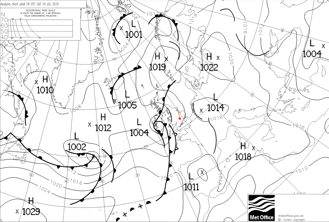
在拍摄这张照片时,浅的开放波低气压在不列颠群岛西部上空发展,极为接近在法国东部上空发展的另一个波。
© 皇家版权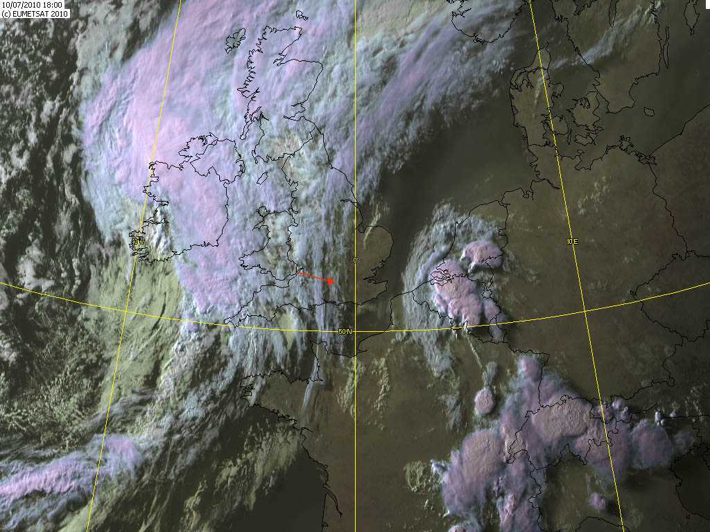
在英国英格兰斯特拉特菲尔德莫蒂默以东地区可看到在高积云之前的卷云。侵入的高积云前在西边约50公里。
© EUMETSAT, 2010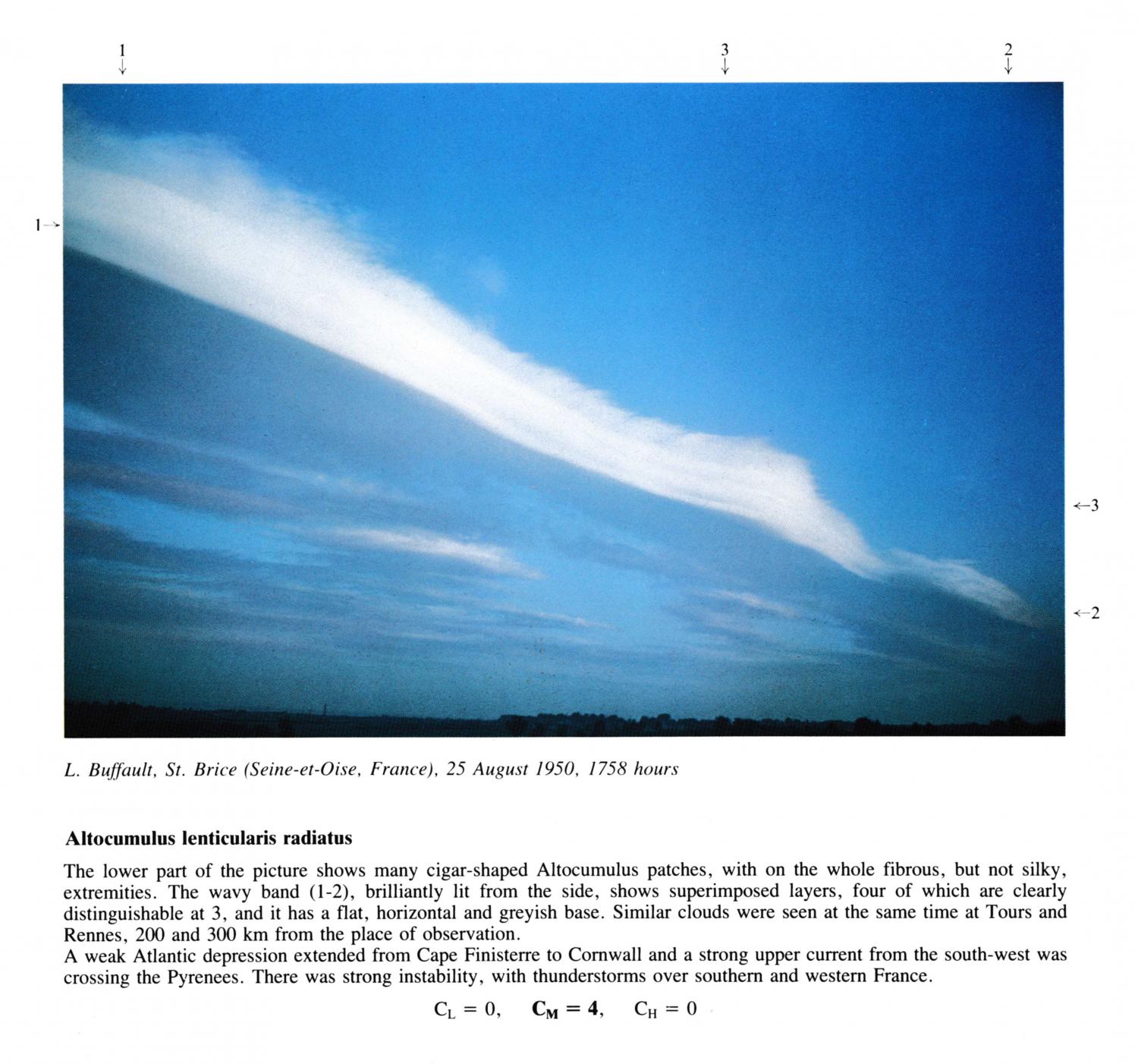
Altocumulus lenticularis radiatus
The lower part of the picture shows many cigar-shaped Altocumulus patches, with on the whole fibrous, but not silky, extremities. The wavy band (1 - 2), brilliantly lit from the side, shows superimposed layers, four of which are clearly distinguishable at 3, and it has a flat, horizontal and greyish base. Similar clouds were seen at the same time at Tours and Rennes, 200 and 300 km from the place of observation. A weak Atlantic depression extended from Cape Finisterre to Cornwall and a strong upper current from the south-west was crossing the Pyrenees. There was strong instability, with thunderstorms over southern and western France.
图像描述中的链接将突出显示图像上的特征。将鼠标悬停在特征上以获取更多详细内容。
© L. BuffaultSaint-Brice-sous-Forêt, Seine-et-Oise, France纬度: 48° 59' 58'' N经度: 2° 21' 22'' E25 August 1950 1758 (当地时间)CL = 0, CM = 4, CH = 0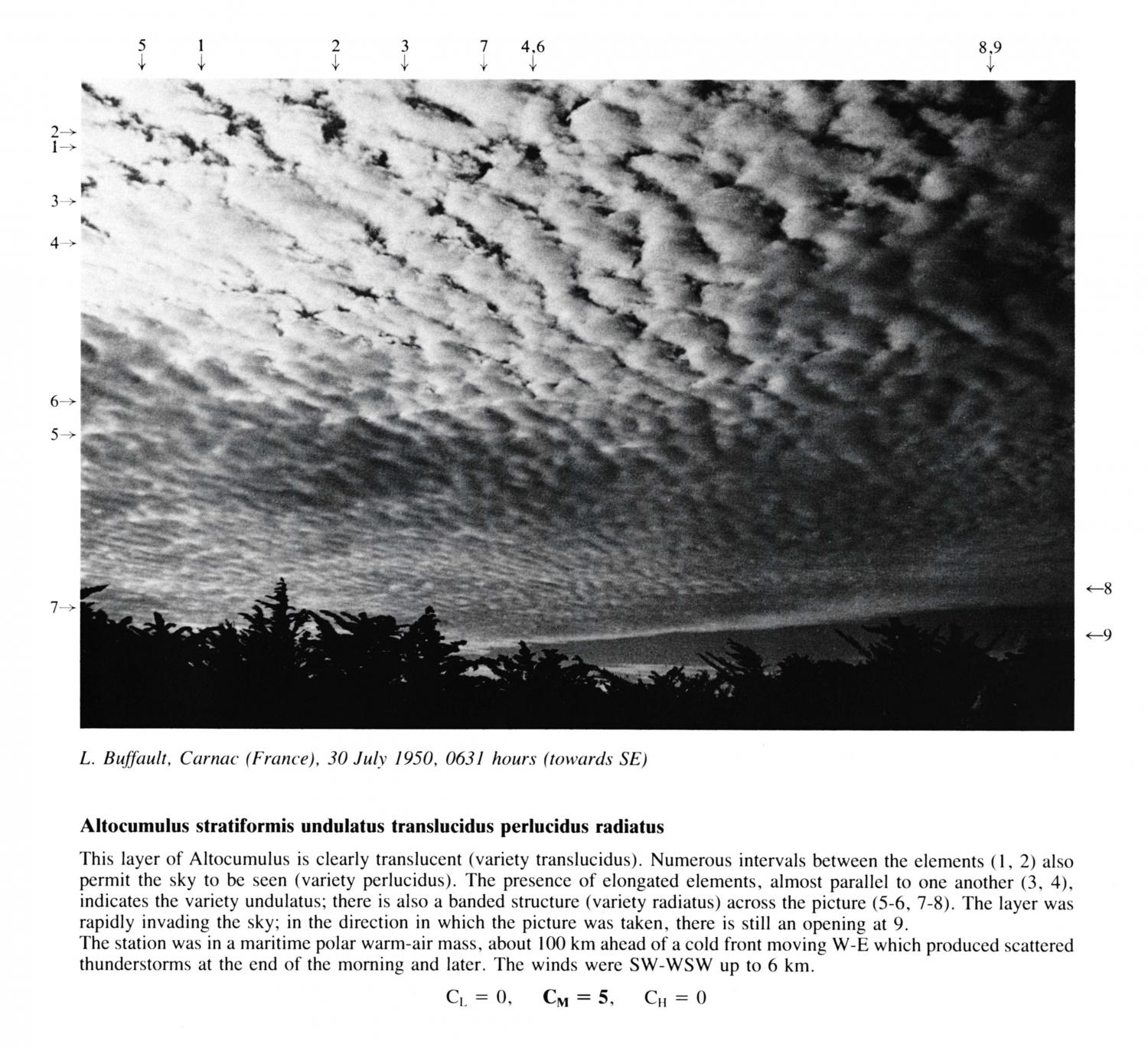
Altocumulus stratiformis undulatus translucidus perlucidus radiatus
This layer of Altocumulus is clearly translucent (variety translucidus). Numerous intervals between the elements 1 and 2 also permit the sky to be seen (variety perlucidus). The presence of elongated elements, almost parallel to one another at 3 and 4, indicates the variety undulatus; there is also a banded structure (variety radiatus) across the picture at 5, 6, 7 and 8. The layer was rapidly invading the sky; in the direction in which the picture was taken, there is still an opening at 9. The station was in a maritime polar warm-air mass, about 100 km ahead of a cold front moving W-E which produced scattered thunderstorms at the end of the morning and later. The winds were SW-WSW up to 6 km.
图像描述中的链接将突出显示图像上的特征。将鼠标悬停在特征上以获取更多详细内容。
© L. BuffaultCarnac, France纬度: 47° 35' 5'' N经度: 3° 4' 40'' W30 July 1950 0631 (当地时间)摄像机方向:朝向北东南CL = 0, CM = 5, CH = 0