© Michael Bruhn
澳大利亚,蒙通VIC 3194
纬度: 37° 58' 56'' S
经度: 145° 4' 15'' E
20 June 2016 1238 (当地时间)
摄像机方向:朝向西
图像P/S代码: P.8.8
图像I.D.: 5957
CL = 7, CM = 2, CH = /
-
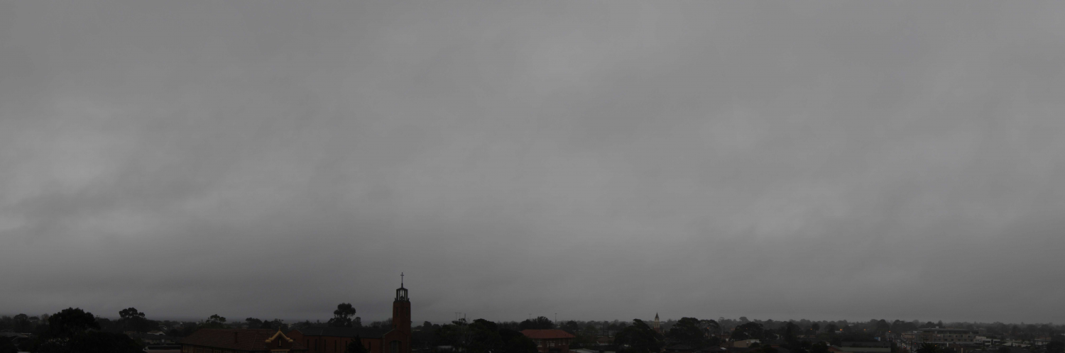
潮湿天气的碎层云
广大而厚重的浅灰色雨层云衬托出潮湿天气碎层云的不规则和破碎的碎片。在有些地方有潮湿天气的碎积云块,其特征是独特的水平云底和更大的垂直厚度。
小雨持续了9个小时。一个小时后,随着雨层云底抬升并向东退去,降雨停止。
图像描述中的链接将突出显示图像上的特征。将鼠标悬停在特征上以获取更多详细内容。
© Michael Bruhn澳大利亚,蒙通VIC 3194纬度: 37° 58' 56'' S经度: 145° 4' 15'' E20 June 2016 1238 (当地时间)摄像机方向:朝向西CL = 7, CM = 2, CH = /图像P/S代码: P.8.8图像I.D.: 5957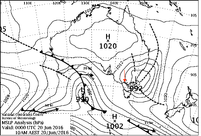
东边的低压系统在加深并向南东南方向移动。该低压系统正在支配着澳大利亚维多利亚州中南部上空潮湿的向岸南东南偏东风。
© 澳大利亚联邦2016,澳大利亚气象局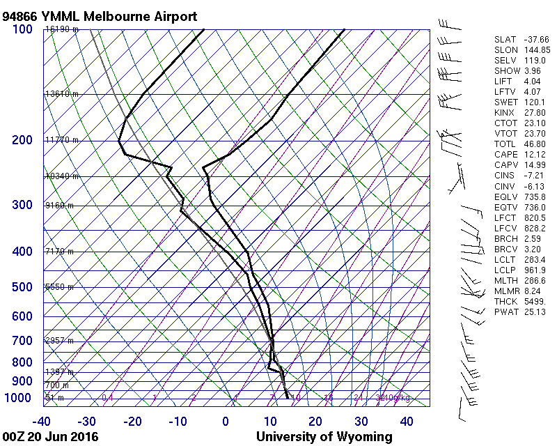
从地面到850 hPa饱和,从850 hPa到236 hPa 的对流层顶非常湿润
© 怀俄明大学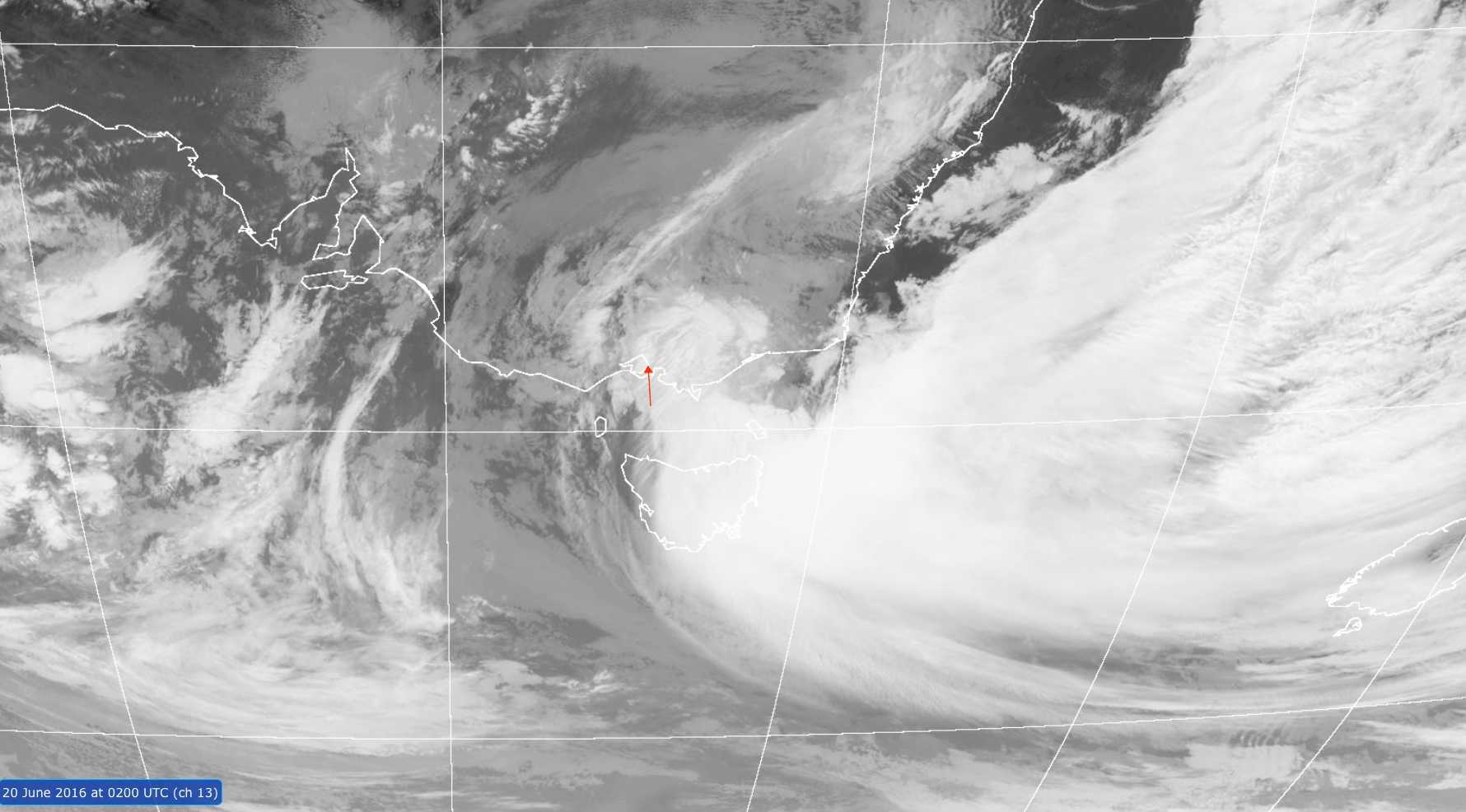
葵花-8卫星13号通道红外图像显示出大片云带环绕着澳大利亚维多利亚东海岸海面的低压系统。墨尔本几乎是在消散云带的西缘。
© 澳大利亚联邦2016,澳大利亚气象局/日本气象厅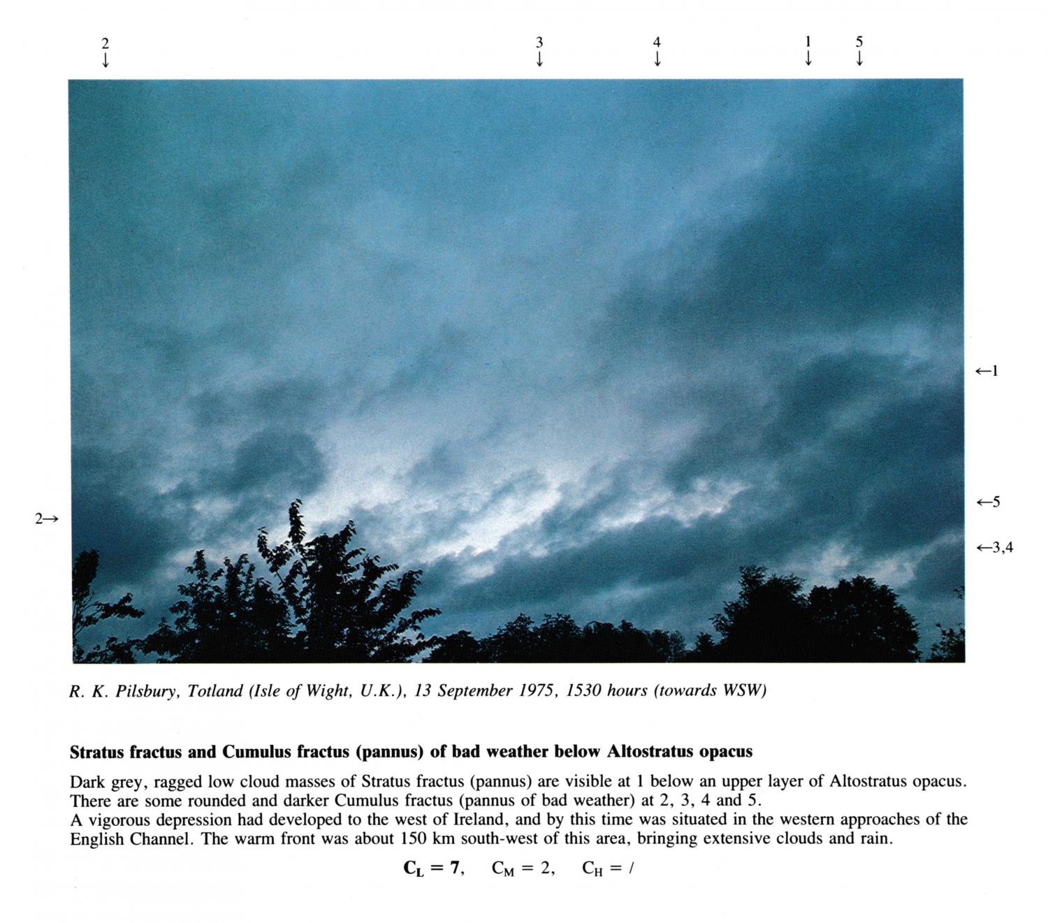
Stratus fractus and Cumulus fractus (pannus) of bad weather below Altostratus opacus
Dark grey, ragged low cloud masses of Stratus fractus (pannus) are visible at 1 below an upper layer of Altostratus opacus.
There are some rounded and darker Cumulus fractus (pannus of bad weather) at 2, 3, 4 and 5.
A vigorous depression had developed to the west of Ireland, and by this time was situated in the western approaches of the
English Channel. The warm front was about 150 km south-west of this area, bringing extensive clouds and rain.
图像描述中的链接将突出显示图像上的特征。将鼠标悬停在特征上以获取更多详细内容。
© R.K. PilsburyTotland, Isle of Wight, United Kingdom of Great Britain and Northern Ireland纬度: 50° 40' 18'' N经度: 1° 32' 51'' W13 September 1975 1530 (当地时间)摄像机方向:朝向西南CL = 7, CM = 2, CH = /