
Altostratus
(Section 2.5.2.5)Altostratus usually occurs between 2 km and 4 km (6 500 ft and 13 000 ft) in polar regions, between 2 km and 7 km (6 500 ft and 23 000 ft) in temperate regions and between 2 km and 8 km (6 500 ft and 25 000 ft) in tropical regions. However, the upper parts of Altostratus may extend beyond the indicated upper limits. Altostratus may range from 1 km to more than 5 km (3 300 ft to more than 16 500 ft) in thickness.
Below the cloud. Viewed from below, the base of Altostratus is nearly flat, and appears diffuse and hazy. This is because rain or snow falls from it, usually without reaching the ground (virga). Some parts of the cloud layer are thin enough that the Sun is weakly visible through them.
Within the cloud. Depending on the part traversed and the position of the aircraft relative to the freezing level (0 °C), particles encountered may be water droplets (supercooled or not), raindrops, ice crystals, snow crystals or snowflakes. Where the cloud consists of ice crystals alone, the particle concentration is usually relatively small.
The airborne observer can distinguish two types of Altostratus, with very different internal structures:
- A homogeneous layer, often with its upper surface reaching great altitudes. Visibility in this layer is usually fair, and the Earth’s surface can be seen through a considerable cloud depth. Halo phenomena may be observed and are often bright.
- Many patches, sheets or layers of water cloud that may be connected by virga or precipitation. The precipitation can obscure the stratified structure, so the Altostratus may appear as a thick single layer with large clear spaces. Therefore, visibility is quite variable within the cloud, and may be less than 100 m in places. At night, the open spaces can easily be seen when the aircraft lights are on. Altocumulus patches are usually present at the top of this Altostratus.
In both types of Altostratus, turbulence is weak and confined to the lower parts, but it may be strong when there is internal convection. Icing is generally light.
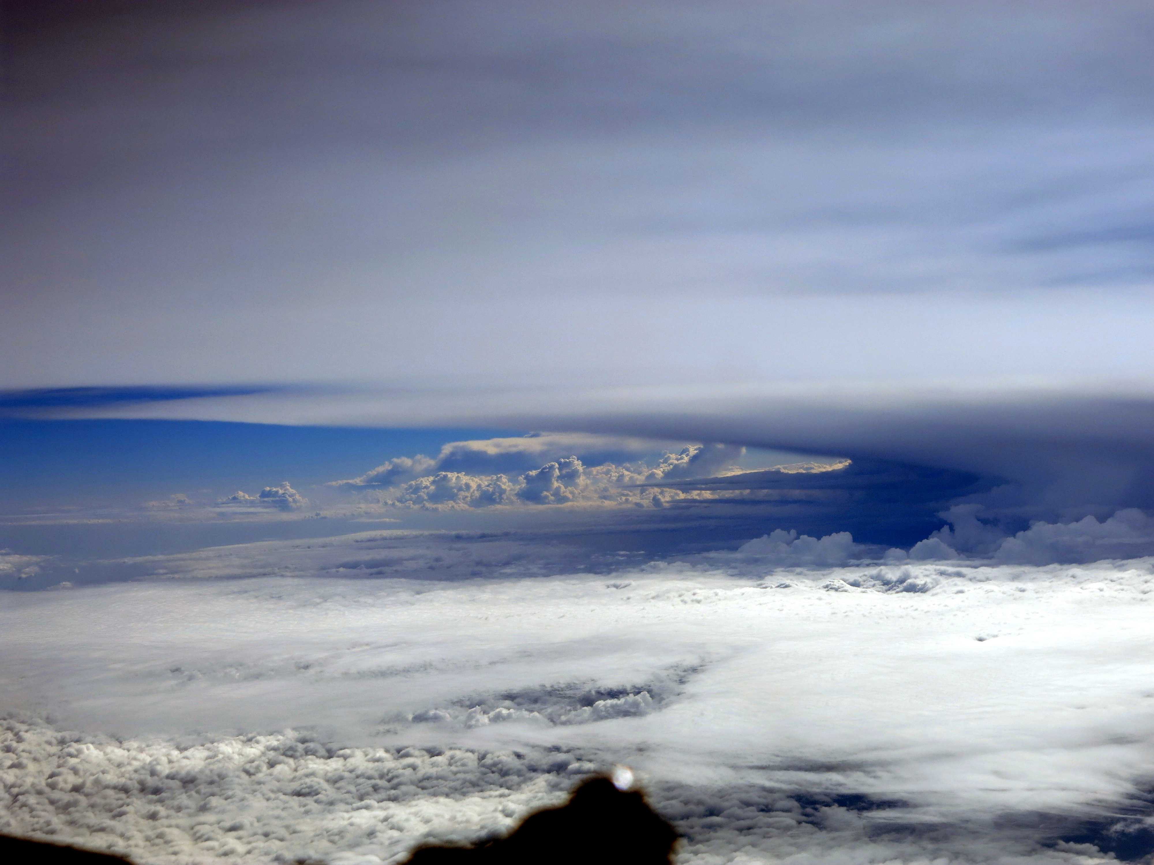
Above the cloud. Viewed from above, the upper surface of the first type of Altostratus is similar to Cirrostratus and the second type resembles Altocumulus. The optical phenomena observed on the upper surface of Altostratus are the same as those observed on Cirrostratus and Altocumulus.
When the air in which Altostratus develops is unstable or becomes unstable, internal convection can produce cumuliform elements that may rise well above the cloud mass and may even develop into Cumulonimbus. When the instability of the air below is sufficient to produce strong convective currents, Cumulus congestus or Cumulonimbus may penetrate through the Altostratus.